Catalog Archive
Auction 154, Lot 262
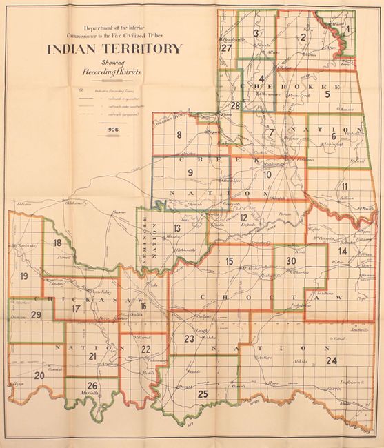
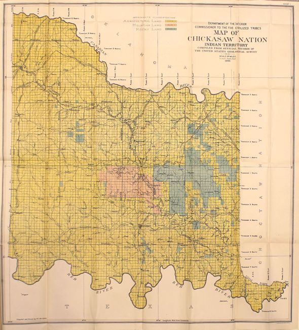
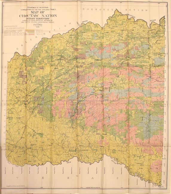
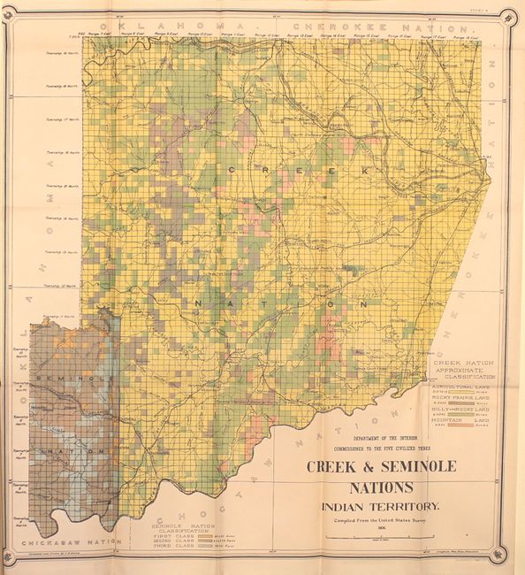
"[Lot of 5 - Indian Territory]", U.S. Department of Interior


1 of 7
Subject: Oklahoma
Period: 1906 (published)
Publication: Laws, Decisions, and Regulations Affecting the Work of the Commissioner to the Five Civilized Tribes, 1893 to 1906...
Color: Printed Color
Size:
6.1 x 9.4 inches
15.5 x 23.9 cm
Download High Resolution Image
(or just click on image to launch the Zoom viewer)
(or just click on image to launch the Zoom viewer)