Catalog Archive
Auction 130, Lot 372

"Carte du Cours du Maragnon ou de la Grande Riviere des Amazones…", Bellin, Jacques Nicolas

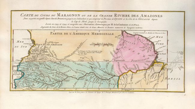
Subject: Northern South America, Amazon

Period: 1773 (published)

Publication: Raynal's Atlas Portatif

Color: Hand Color

Size:
14.5 x 7 inches
36.8 x 17.8 cm
Download High Resolution Image
(or just click on image to launch the Zoom viewer)

This interesting map is usually referred to as "the first scientific map of the Amazon." It shows the expedition in 1743-44 of Charles-Marie La Condamine, a French scientist and explorer. He provided the first scientific account of the Amazon, including notes on how the natives used curare for poison, and introduced rubber trees to Europe.

References: Mercator's World (May/June 1999) pp. 18-25; Portolan (#46 pp. 8-24).

Condition: A+

Nice impression and original color.

Estimate: $140 - $180

Sold for: $100

Closed on 12/2/2009

Archived