Catalog Archive
Auction 130, Lot 180

"Skeleton Map Showing Railroads Completed and in Progress in the United States and their Connection as Proposed with the Harbour of Pensacola…", U.S. Government

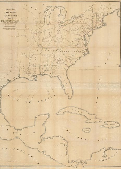
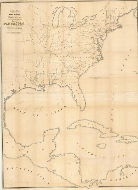
Subject: Eastern United States

Period: 1847-48 (published)

Publication:

Color: Black & White

Size:
36 x 48 inches
91.4 x 121.9 cm
Download High Resolution Image
(or just click on image to launch the Zoom viewer)

Outline map of the eastern half of the United States indicating state boundaries, major cities, and constructed and contemplated railroads. The southern portion of map indicates proposed shipping routes from Pensacola to points in the West Indies and Central America. This is one of the earliest small-scale government maps to show a railroad network.

References:

Condition: B

Issued folding now flattened with tissue reinforced folds.

Estimate: $200 - $250

Sold for: $100

Closed on 12/2/2009

Archived