Catalog Archive
Auction 130, Lot 180
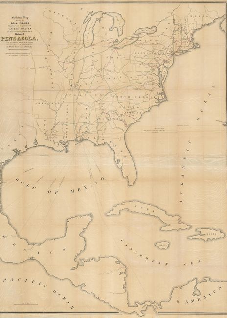
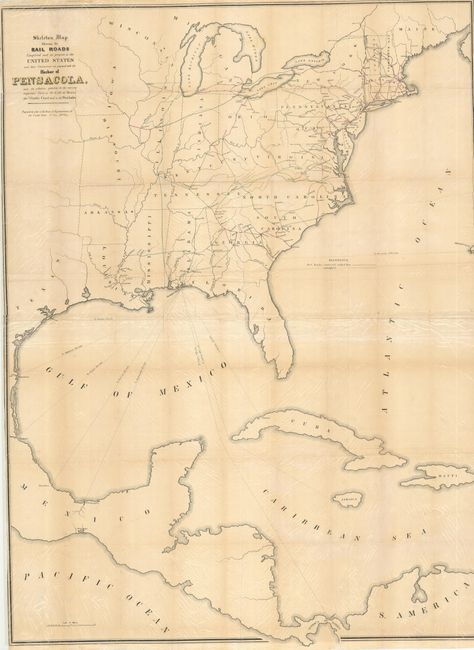
"Skeleton Map Showing Railroads Completed and in Progress in the United States and their Connection as Proposed with the Harbour of Pensacola…", U.S. Government
1 of 2
Subject: Eastern United States
Period: 1847-48 (published)
Publication:
Color: Black & White
Size:
36 x 48 inches
91.4 x 121.9 cm
Download High Resolution Image
(or just click on image to launch the Zoom viewer)
(or just click on image to launch the Zoom viewer)