Catalog Archive
Auction 129, Lot 315
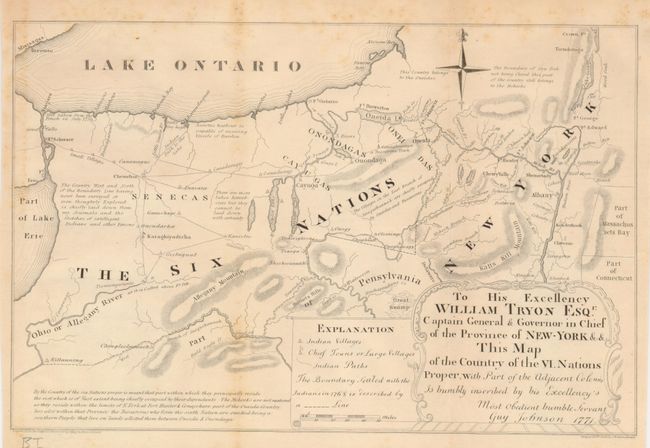
"To His Excellency William Tryon Esqr. Captain General & Governor in Chief of the Province of New York & This Map of the Country of the VI Nations Proper, with Part of the Adjacent Colonies…"
Subject: New York
Period: 1850 (published)
Publication: Documentary History of the State of New York
Color: Black & White
Size:
12 x 8 inches
30.5 x 20.3 cm
Download High Resolution Image
(or just click on image to launch the Zoom viewer)
(or just click on image to launch the Zoom viewer)