Catalog Archive
Auction 129, Lot 315

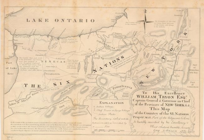
"To His Excellency William Tryon Esqr. Captain General & Governor in Chief of the Province of New York & This Map of the Country of the VI Nations Proper, with Part of the Adjacent Colonies…",
Subject: New York

Period: 1850 (published)

Publication: Documentary History of the State of New York

Color: Black & White

Size:
12 x 8 inches
30.5 x 20.3 cm
Download High Resolution Image
(or just click on image to launch the Zoom viewer)

This is a facsimile copy accomplished in 1850 from a manuscript map originally drawn in 1771 to illustrate the region controlled by the Six Nations. It accompanied a memorandum written by Reverend Charles Inglis who wanted to Christianize the Iroquois. Guy Johnson, the son-in-law of the leading British expert on Indian affairs, lived in the Mohawk Valley and filled the map with considerable information on the Indian villages, paths and boundaries. The original map was destroyed in a fire at the New York State Library. Engraved and printed by J.E. Gavit, Albany.

References:

Condition: B+

Folding as issued with some light foxing along folds.

Estimate: $100 - $150

Sold for: $75

Closed on 9/23/2009

Archived