Subject: Western United States
Period: 1872 (circa)
Publication: New Topographical Atlas of Ohio and the United States
Color: Hand Color
Size:
24.5 x 15 inches
62.2 x 38.1 cm
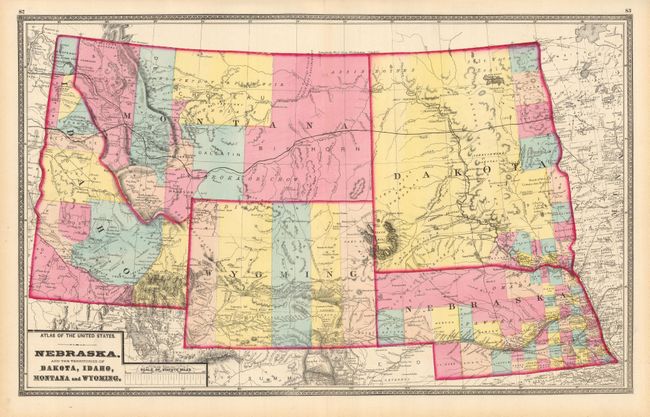
This uncommon map was published in a state atlas by Walling & Gray. The map, centered on the Black Hills, shows the states and territories in great detail with all counties individually hand colored. Dakota is still a single large territory with just a few counties organized along the boundary with Minnesota. Wyoming shows only five counties and the northwest of Nebraska is completely unorganized. The newly created Yellowstone National Park is delineated with a simple block outline in northwestern Wyoming. Details throughout show forts, railroads, wagon roads, springs, watershed and topography in hachure. A beautiful double page stone engraved map.
References:
Condition: A+
Beautiful hand coloring and dark impression. Short centerfold split in lower margin.