Subject: Tobago
Period: 1775 (dated)
Publication: West-India Atlas
Color: Hand Color
Size:
24.5 x 19 inches
62.2 x 48.3 cm
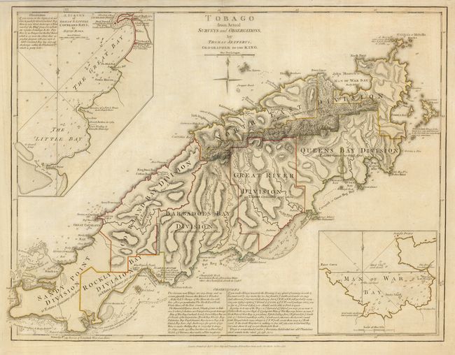
First edition of this classic map of Tobago, issued shortly after the British conquest of the island. The map illustrates the rapid development of sugar plantations; each large division is noted with the number of estates (286 total) and acreages. Only a few small, mountainous portions of the island are Reserved in Wood for Rains. The map depicts the Indian villages, watering places, forts (including a demolished French fort), rocks, shoals, and anchorages with very specific navigational notations. Two large insets depict Great & Little Courland Bays and Man of War Bay.
References: Sellers & Van Ee #2110.
Condition: B+
Lightly toned, with original outline color.