Catalog Archive
Auction 125, Lot 383
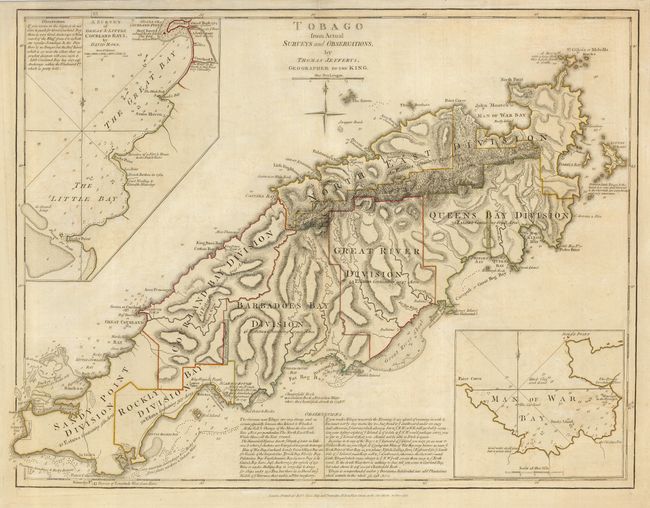
"Tobago from Actual Surveys and Observations", Jefferys, Thomas
Subject: Tobago
Period: 1775 (dated)
Publication: West-India Atlas
Color: Hand Color
Size:
24.5 x 19 inches
62.2 x 48.3 cm
Download High Resolution Image
(or just click on image to launch the Zoom viewer)
(or just click on image to launch the Zoom viewer)