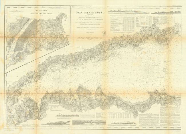
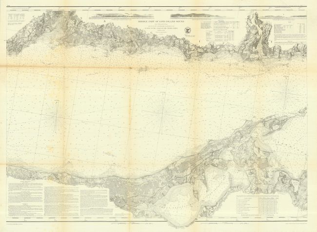
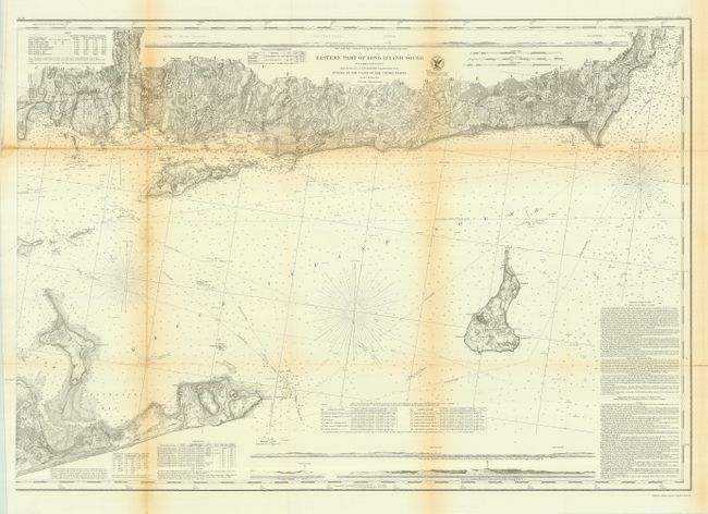
Subject: New York
Period: 1855 (published)
Publication: Annual Report of the Superintendent of the United States Coast Survey
Color: Black & White
Size:
35 x 25 inches
88.9 x 63.5 cm
This set of three matching maps cover the entire island in minute detail. The maps are "Long Island Sound, (Western Sheet)," "Eastern Part of Long Island Sound" and "Middle Part of Long Island." Charts show coastal topography with many depth soundings, harbors, bays, rivers, and inlets. There are sailing directions and navigational notes on dangers, reefs, rocks, shoals, lighthouses, bottoms & current stations. Numerous horizontal landfall approach views and vignettes of lighthouses are presented along the edges. All are from a Trigonometrical Survey under the direction of F.R. Hassler Superintendent of the Survey of the Coast of the United States, second edition 1855. Each approximately the size given above.
References: Phillips (M) p. 363
Condition: B
Issued folding, all now backed with archival tissue. All toned along folds.