Catalog Archive
Auction 116, Lot 293
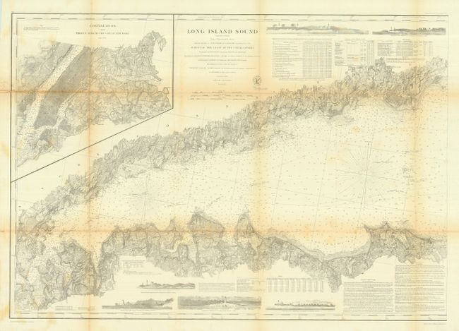
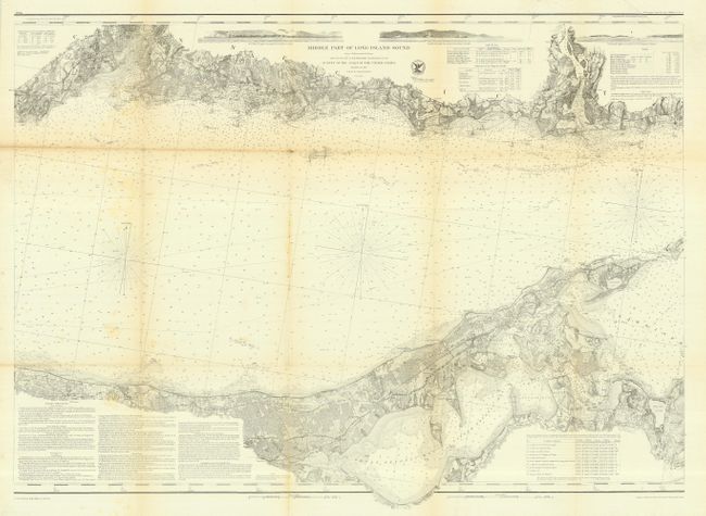
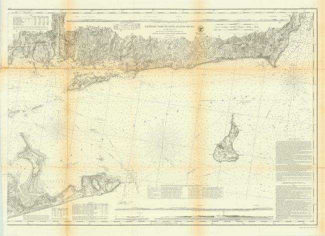
"[Lot of 3 - Long Island Sound]", U.S. Coast Survey
1 of 3
Subject: New York
Period: 1855 (published)
Publication: Annual Report of the Superintendent of the United States Coast Survey
Color: Black & White
Size:
35 x 25 inches
88.9 x 63.5 cm
Download High Resolution Image
(or just click on image to launch the Zoom viewer)
(or just click on image to launch the Zoom viewer)