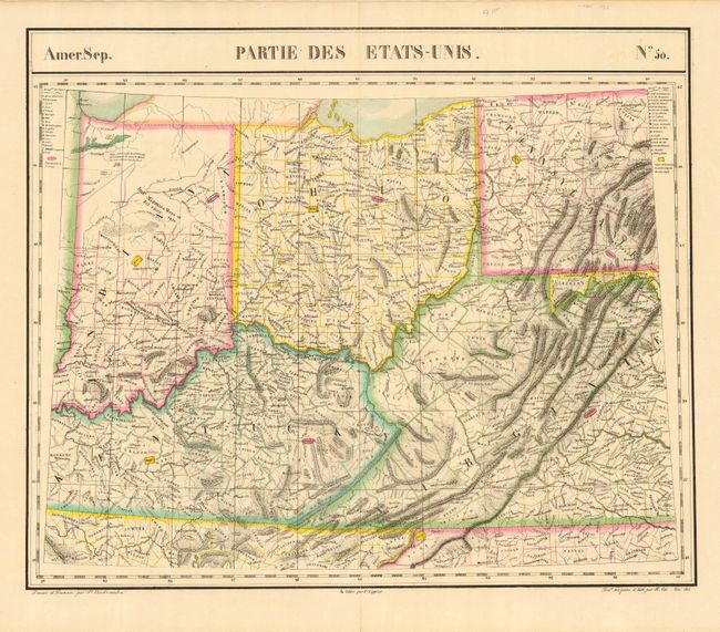
Subject: Central United States
Period: 1827 (published)
Publication: Atlas Universel
Color: Hand Color
Size:
22 x 18.4 inches
55.9 x 46.7 cm
Important map that shows all of Ohio, most of Indiana, much of Kentucky, and the western part of Virginia and Pennsylvania. This was published in the first atlas to present all the maps on the same scale (1: 1,641,836) with each map covering an area of approximately 20 degrees longitude (from Paris) and 6 degrees of latitude. It is also considered to be the first lithographic atlas ever published. There was only one edition, published in 1825-27, and the subscription list shows that 810 copies were sold. A very nice example of a scarce map encapsulated in archival Mylar..
References:
Condition: A
Lovely impression and original hand coloring on a full sheet with very wide margins. A little very light scattered toning and a short split on lower centerfold just to neatline, else fine.