Filtered by Category:Europe & Mediterranean(Show All Categories)
Current Auction
203 lots
Page 1 of 5
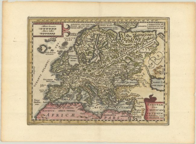
Lot 356
Subject: Europe
Cluver/Jansson
Europam sive Celticam Veterem, sic Describere Conabor Abrahamus Orte, 1676
Size: 7.9 x 6 inches (20.1 x 15.2 cm)
Estimate: $140 - $170
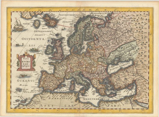
Lot 357
Subject: Europe
Cloppenburg, Johannes
Nova Europae, Descriptio, 1676
Size: 10.2 x 7.4 inches (25.9 x 18.8 cm)
Estimate: $200 - $230
Sold for: $150
Closed on 6/17/2026
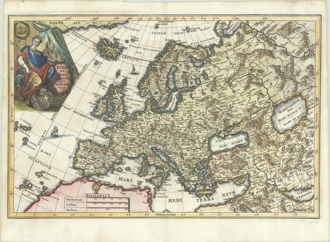
Lot 358
Subject: Europe
Scherer, Heinrich
Europa Orbis Christiani Domina, 1699
Size: 14.1 x 9.2 inches (35.8 x 23.4 cm)
Estimate: $350 - $425
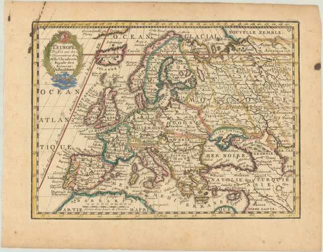
Lot 359
Subject: Europe
Chiquet, Jacques
L'Europe Dressee sur les Observations de Mrs. de l'Academie Royale des Sciences, 1719
Size: 8.9 x 6.6 inches (22.6 x 16.8 cm)
Estimate: $140 - $170
Sold for: $100
Closed on 6/17/2026
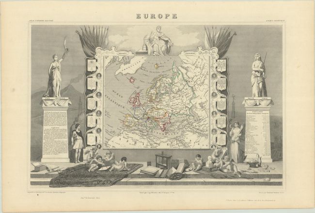
Lot 360
Subject: Europe
Levasseur, Victor
Europe, 1851
Size: 17.4 x 11.4 inches (44.2 x 29 cm)
Estimate: $95 - $120
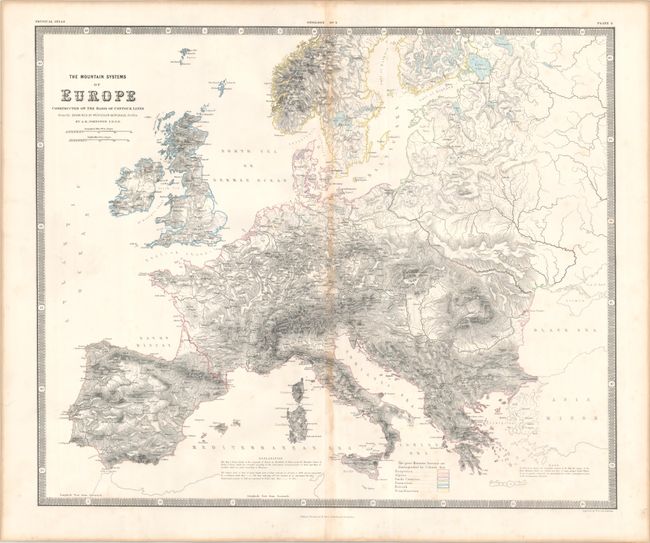
Lot 361
Subject: Europe
Johnston, W. & A.K.
The Mountain Systems of Europe Constructed on the Basis of Contour Lines..., 1856
Size: 23.4 x 19.5 inches (59.4 x 49.5 cm)
Estimate: $120 - $150
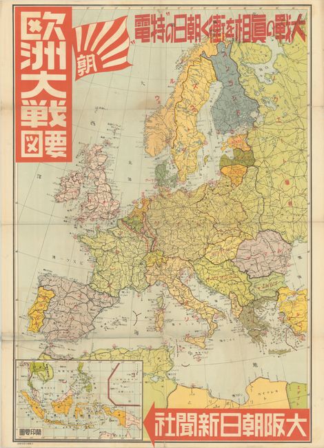
Lot 362
Subject: Europe, World War II
[Japanese Map of the Great War in Europe] Oshu Taisen Yozu, 1939
Size: 28.5 x 42 inches (72.4 x 106.7 cm)
Estimate: $200 - $230
Sold for: $150
Closed on 6/17/2026
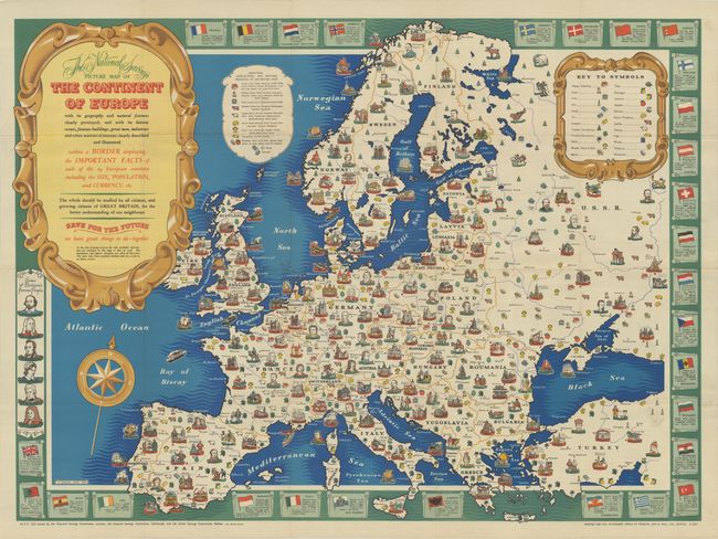
Lot 363
Subject: Europe
The National Savings Picture Map of the Continent of Europe with Its Geography and Natural Features Clearly Portrayed..., 1945
Size: 37.9 x 27.8 inches (96.3 x 70.6 cm)
Estimate: $240 - $300
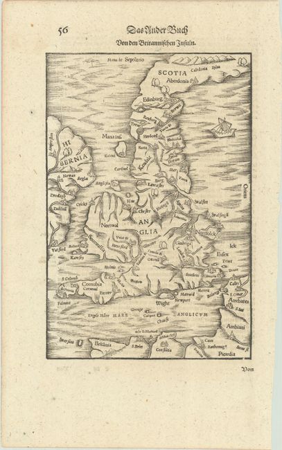
Lot 364
Subject: Britain
Munster, Sebastian
Von den Britannischen Insuln, 1628
Size: 6.7 x 9.9 inches (17 x 25.1 cm)
Estimate: $240 - $300
Sold for: $180
Closed on 6/17/2026
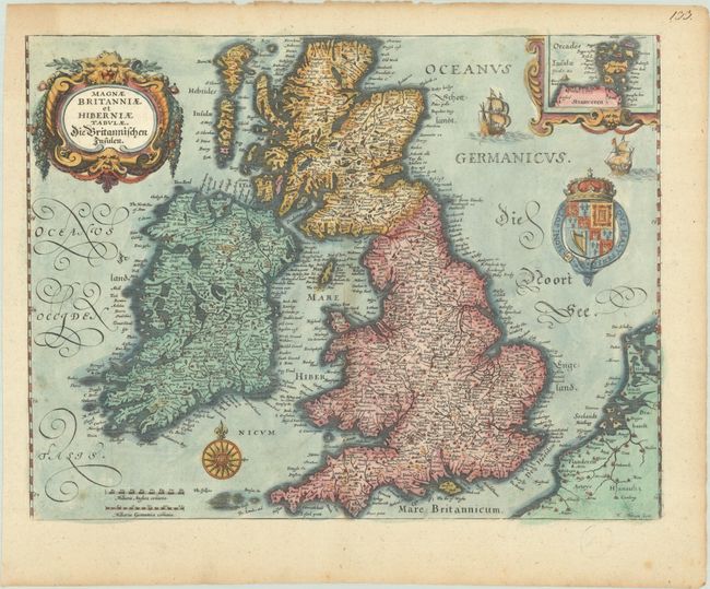
Lot 365
Subject: Britain
Merian, Matthaus
Magnae Britanniae et Hiberniae Tabulae. Die Britannischen Insulen, 1645
Size: 13.9 x 10.6 inches (35.3 x 26.9 cm)
Estimate: $300 - $375
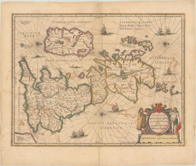
Lot 366
Subject: Britain
Kaerius/Jansson
Insularum Britannicarum Acurata Delineatio ex Geographicis Conatibus Abrahami Ortelii, 1652
Size: 20.2 x 15.5 inches (51.3 x 39.4 cm)
Estimate: $240 - $300
Full Contemporary Color
Sold for: $180
Closed on 6/17/2026
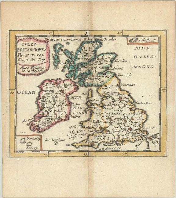
Lot 367
Subject: Britain
Duval, Pierre
Isles Britanniques, 1682
Size: 5 x 4 inches (12.7 x 10.2 cm)
Estimate: $110 - $140
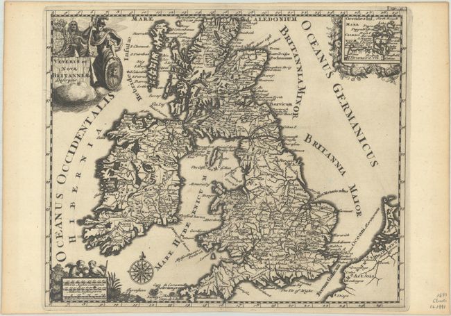
Lot 368
Subject: Britain
Cluver, Philipp
Veteris et Novae Britanniae Descriptio, 1697
Size: 10.2 x 8.4 inches (25.9 x 21.3 cm)
Estimate: $140 - $170
Sold for: $100
Closed on 6/17/2026
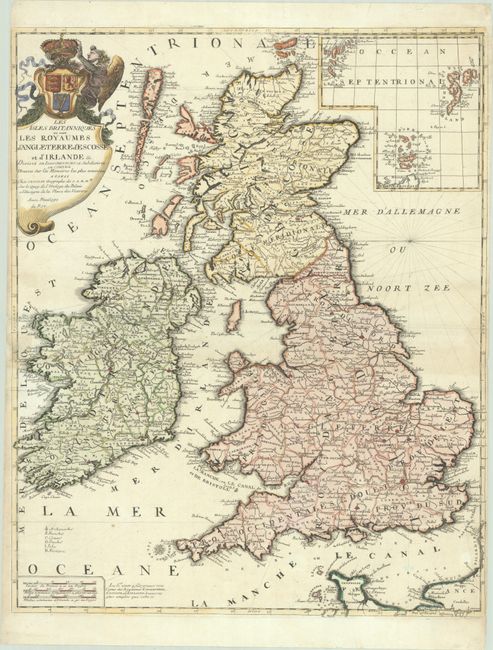
Lot 369
Subject: Britain
Nolin, Jean Batiste
Les Isles Britanniques ou sont les Royaumes d'Angleterre d'Escosse et d'Irlande &c. Divisez en Leurs Provinces et Subdivisez en Comtez..., 1710
Size: 19.2 x 23.6 inches (48.8 x 59.9 cm)
Estimate: $350 - $425
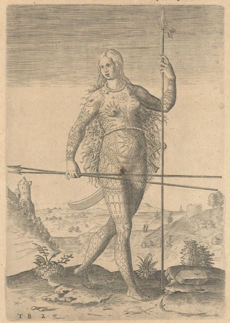
Lot 370
Subject: Britain Natives
Bry, Theodore de
[The True Picture of a Pictish Woman] Das II. Contrafeit Einer Frawen ausz den Picten, 1620
Size: 6.2 x 8.9 inches (15.7 x 22.6 cm)
Estimate: $80 - $100
NO RESERVE
Sold for: $80
Closed on 6/17/2026
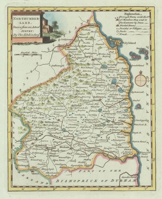
Lot 371
Subject: Northern England
Kitchin, Thomas
[Lot of 2] Northumberland, Drawn from an Actual Survey [and] Westmoreland Drawn from ye Best Authorities and Regulated by Astronl. Observatns, 1749
Size: See Description
Estimate: $100 - $130
Lot 372
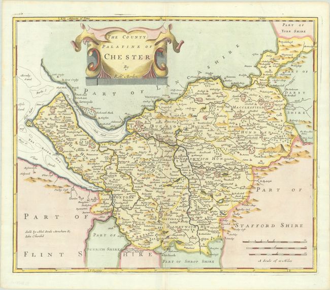
Subject: Northwestern England
Morden, Robert
The County Palatine of Chester, 1695
Size: 16.4 x 13.7 inches (41.7 x 34.8 cm)
Estimate: $150 - $180
Sold for: $110
Closed on 6/17/2026
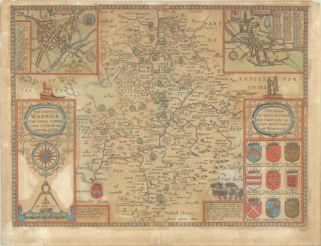
Lot 373
Subject: Central England
Speed, John
The Counti of Warwick the Shire Towne and Citie of Coventre Described, 1610
Size: 20.1 x 15.2 inches (51.1 x 38.6 cm)
Estimate: $375 - $450
William Shakespeare's Birthplace
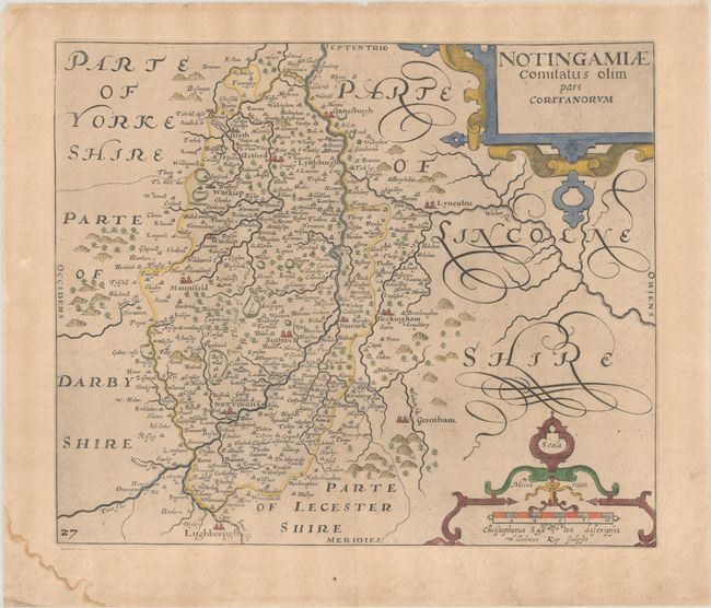
Lot 374
Subject: Central England
Saxton/Kip
Notingamiae Comitatus olim pars Coritanorum, 1637
Size: 12.3 x 10.4 inches (31.2 x 26.4 cm)
Estimate: $90 - $110
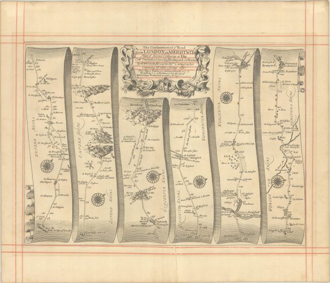
Lot 375
Subject: Central England
Ogilby, John
The Continuation of ye Road from London to Aberistwith Plate ye Second Comencing at Islip Com Oxford & Extending to Bramyard com Hereford, 1675
Size: 17.3 x 12.3 inches (43.9 x 31.2 cm)
Estimate: $160 - $190
Sold for: $120
Closed on 6/17/2026
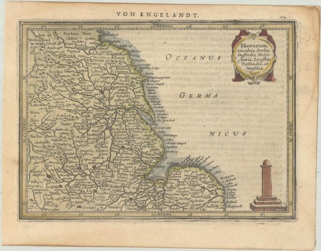
Lot 376
Subject: Eastern England
Mercator/Jansson
Eboracum, Lincolnia, Derbia, Staffordia, Notinghamia, Lecestria, Rutlandia, et Norfolcia, 1631
Size: 8 x 5.8 inches (20.3 x 14.7 cm)
Estimate: $70 - $85
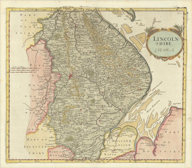
Lot 377
Subject: Eastern England
Morden, Robert
Lincolnshire, 1695
Size: 16.5 x 14.7 inches (41.9 x 37.3 cm)
Estimate: $140 - $170
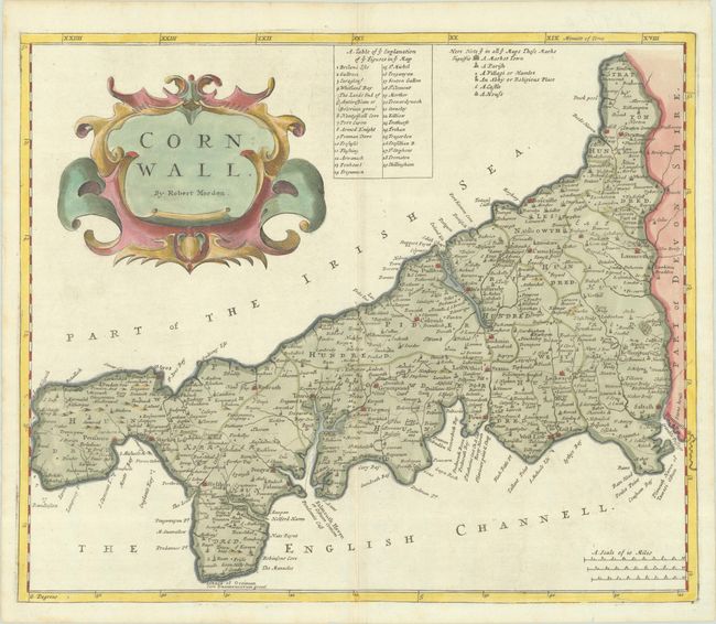
Lot 378
Subject: Southwestern England
Morden, Robert
Cornwall, 1695
Size: 17 x 14.2 inches (43.2 x 36.1 cm)
Estimate: $140 - $170
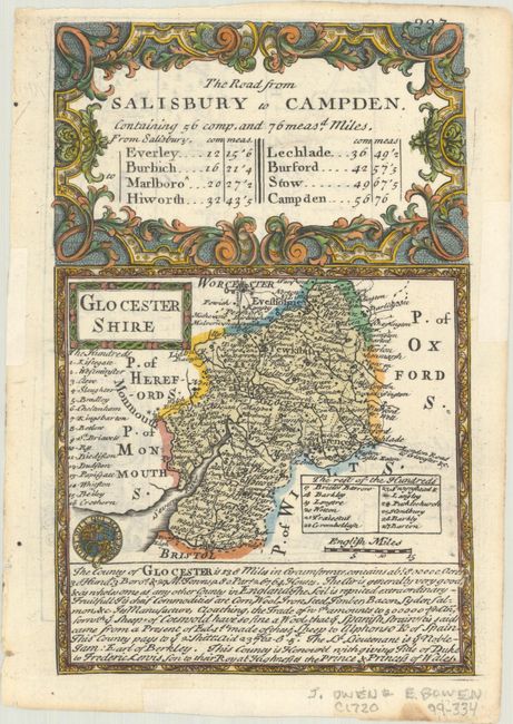
Lot 379
Subject: Southwestern England
Owen & Bowen
The Road from Salisbury to Campden - Glocester Shire, 1720
Size: 4.6 x 7.1 inches (11.7 x 18 cm)
Estimate: $60 - $80
NO RESERVE
Sold for: $40
Closed on 6/17/2026
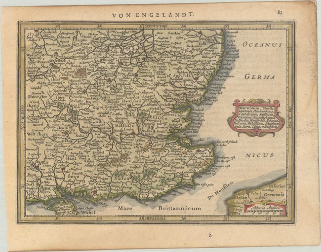
Lot 380
Subject: Southeastern England
Mercator/Jansson
Warwicum, Northhamtonia, Huntingdonia, Cantabrigia, Suffolcia, Oxonium, Buckinghamia, Bedfordia, Hartfordia, Essexia, Berceria, Middelsexia, Southhamtonia, Surria, Catium, et Southsexia, 1631
Size: 8 x 5.9 inches (20.3 x 15 cm)
Estimate: $80 - $95
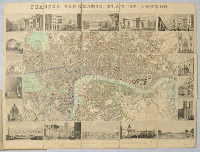
Lot 381
Subject: London, England
Neele, Josiah
Fraser's Panoramic Plan of London, 1831
Size: 22.1 x 14.9 inches (56.1 x 37.8 cm)
Estimate: $750 - $900
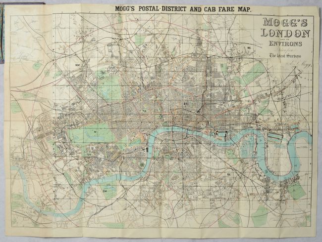
Lot 382
Subject: London, England
Mogg, Edward
Mogg's London and Its Environs Drawn from the Latest Surveys, 1860
Size: 32 x 22.9 inches (81.3 x 58.2 cm)
Estimate: $275 - $350
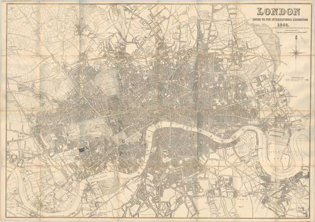
Lot 383
Subject: London, England
Dower, John
London Guide to the International Exposition , 1862
Size: 41.7 x 29.3 inches (105.9 x 74.4 cm)
Estimate: $275 - $350
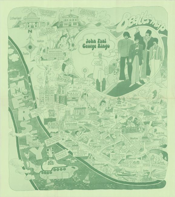
Lot 384
Subject: Liverpool, England
Beatles Map, 1974
Size: 14.6 x 16.8 inches (37.1 x 42.7 cm)
Estimate: $475 - $600
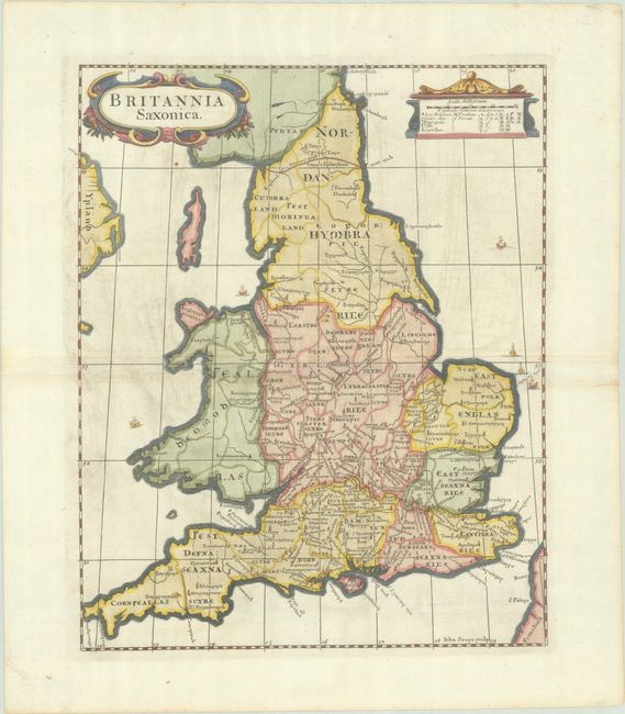
Lot 385
Subject: England & Wales
Morden, Robert
Britannia Saxonica, 1695
Size: 11.7 x 14.5 inches (29.7 x 36.8 cm)
Estimate: $110 - $140
Sold for: $80
Closed on 6/17/2026
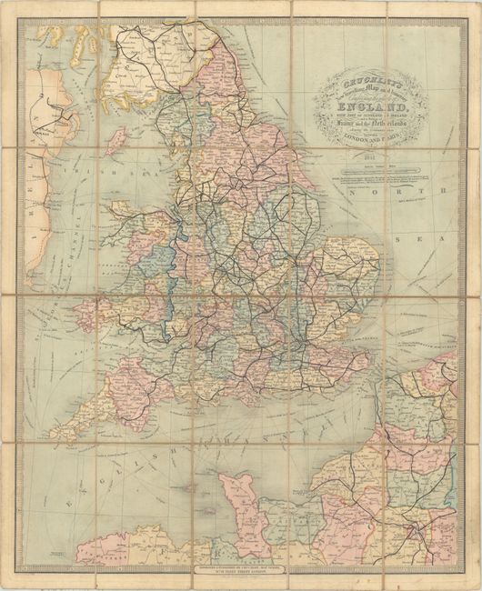
Lot 386
Subject: England & Wales
Cruchley, George Frederick
Cruchley's New Travelling Map and Itinerary Comprising the Whole of England, with Part of Scotland & Ireland and a Portion of France and the Netherlands..., 1841
Size: 20.3 x 25.1 inches (51.6 x 63.8 cm)
Estimate: $100 - $130
NO RESERVE
Sold for: $16
Closed on 6/17/2026
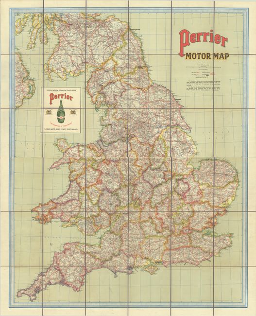
Lot 387
Subject: England & Wales
Philip, George
[On 2 Sheets] Perrier Motor Map, 1910
Size: 43.5 x 27.6 inches (110.5 x 70.1 cm)
Estimate: $200 - $275
Sold for: $150
Closed on 6/17/2026
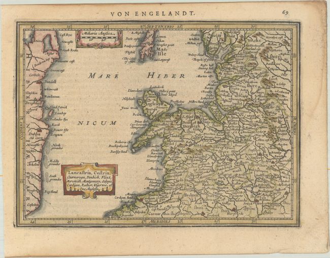
Lot 388
Subject: Western England & Northern Wales
Mercator/Jansson
Lancastria, Cestria, Caernarvan, Denbich, Flint, Merionidh, Montgomery, Salopia, Cardigan, Radnor, Wigornia, et Ins. Anglesey, 1631
Size: 8 x 5.8 inches (20.3 x 14.7 cm)
Estimate: $80 - $95
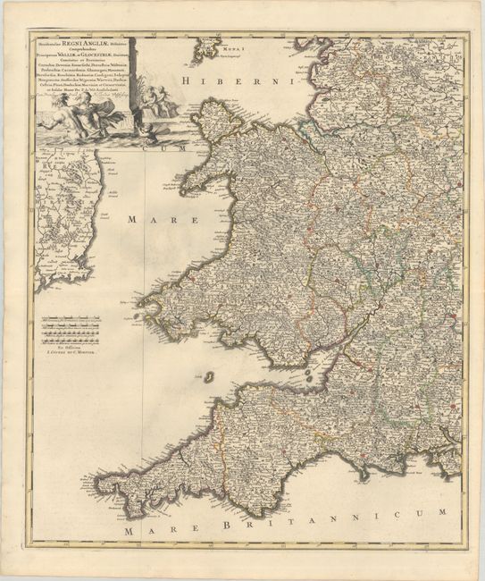
Lot 389
Subject: Western England & Wales
Wit, Frederick de
Occidentalior Regni Angliae Districtus Comprehendens Principatum Walliae et Glocestriae Ducatum Comitatus et Provincias Cornubiae, Devoniae, Somersethi, Dorcestriae..., 1721
Size: 19.4 x 22.6 inches (49.3 x 57.4 cm)
Estimate: $275 - $350
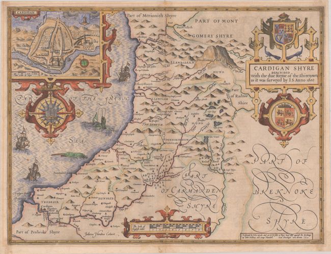
Lot 390
Subject: Western Wales
Speed, John
Cardigan Shyre Described with the Due Forme of the Shire-Town as It Was Surveyed, 1610
Size: 20 x 15 inches (50.8 x 38.1 cm)
Estimate: $350 - $425

Lot 391
Subject: Southwestern Wales
Jansson, Jan
Penbrochia Comitatus et Comitatus Caermardinum, 1646
Size: 20.3 x 15.1 inches (51.6 x 38.4 cm)
Estimate: $180 - $220
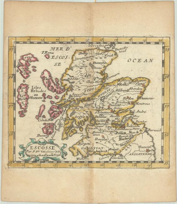
Lot 392
Subject: Scotland
Duval, Pierre
Escosse, 1682
Size: 5 x 4.1 inches (12.7 x 10.4 cm)
Estimate: $110 - $140
Sold for: $90
Closed on 6/17/2026
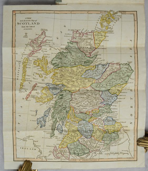
Lot 393
Subject: Scotland
Cooke, Charles
[Map in Book] A New and Accurate Map of Scotland from the Latest Surveys [in] A General Description of Scotland, 1810
Size: 8.6 x 10.6 inches (21.8 x 26.9 cm)
Estimate: $100 - $130
Sold for: $75
Closed on 6/17/2026
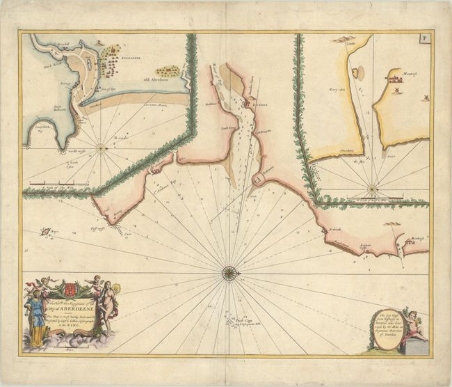
Lot 394
Subject: Eastern Scotland
Collins, Capt. Greenvile
[Approaches to Dundee] To the Honble, the Magistrates of the Citty of Aberdeene..., 1730
Size: 22 x 17.4 inches (55.9 x 44.2 cm)
Estimate: $240 - $300
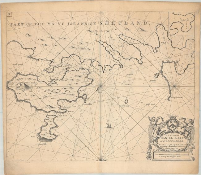
Lot 395
Subject: Shetland Islands
Collins, Capt. Greenvile
[Part of the Maine Island of Shetland] To the Rt. Honorable Daniel Earle of Nottingham..., 1700
Size: 21.8 x 17.3 inches (55.4 x 43.9 cm)
Estimate: $150 - $180
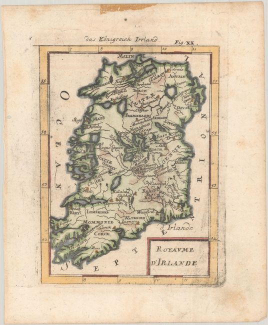
Lot 396
Subject: Ireland
Mallet, Alain Manesson
Royaume d'Irlande, 1685
Size: 4.5 x 6 inches (11.4 x 15.2 cm)
Estimate: $90 - $110
Sold for: $95
Closed on 6/17/2026
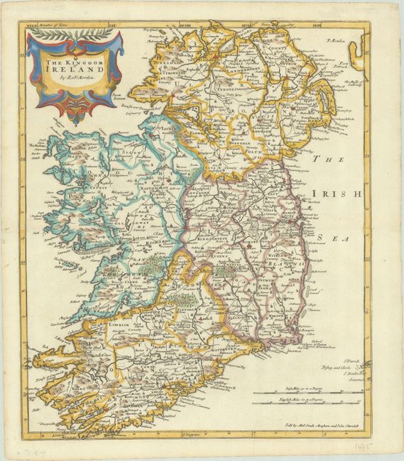
Lot 397
Subject: Ireland
Morden, Robert
The Kingdom of Ireland, 1695
Size: 13.6 x 16.3 inches (34.5 x 41.4 cm)
Estimate: $240 - $300
Sold for: $200
Closed on 6/17/2026
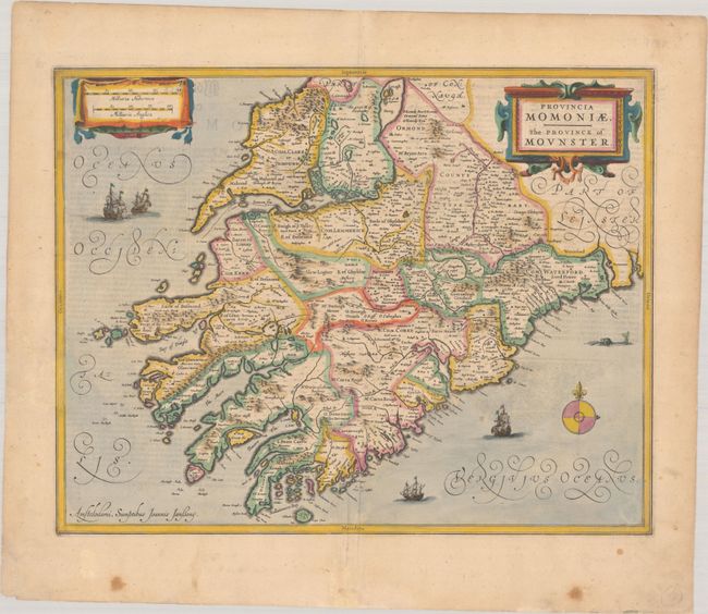
Lot 398
Subject: Southwestern Ireland
Jansson, Jan
Provincia Momoniae. The Province of Mounster, 1636
Size: 19.2 x 15.1 inches (48.8 x 38.4 cm)
Estimate: $300 - $375
Sold for: $220
Closed on 6/17/2026
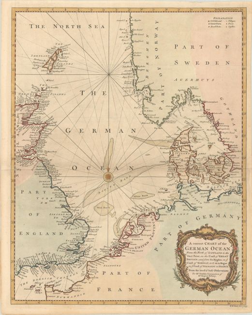
Lot 399
Subject: Northern Europe, North Sea
Seale, Richard William
A Correct Chart of the German Ocean from the North of Scotland to the Start Point, on the Coast of Great Britain; and from So. Bygden on ye Coast of Norway, to C. de la Hogue on ye Coast of Normandy in France..., 1750
Size: 14.9 x 18.7 inches (37.8 x 47.5 cm)
Estimate: $120 - $150
Sold for: $90
Closed on 6/17/2026
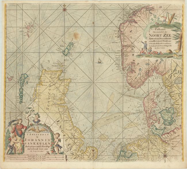
Lot 400
Subject: Northern Europe, North Sea
Keulen, Johannes van
Paskaart van een Gedeelte der Noort Zee Beginnende vande Maas tot Dronte en van Herwits, tot C. Wrath..., 1779
Size: 23 x 20.1 inches (58.4 x 51.1 cm)
Estimate: $550 - $700
Sold for: $400
Closed on 6/17/2026
Lot 401
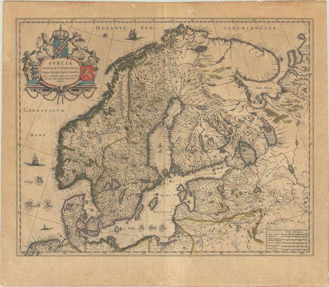
Subject: Scandinavia
Blaeu, (Family)
Suecia, Dania, et Norvegia, Regna Europae Septentrionalia..., 1635
Size: 20.9 x 16.8 inches (53.1 x 42.7 cm)
Estimate: $375 - $450
Sold for: $325
Closed on 6/17/2026
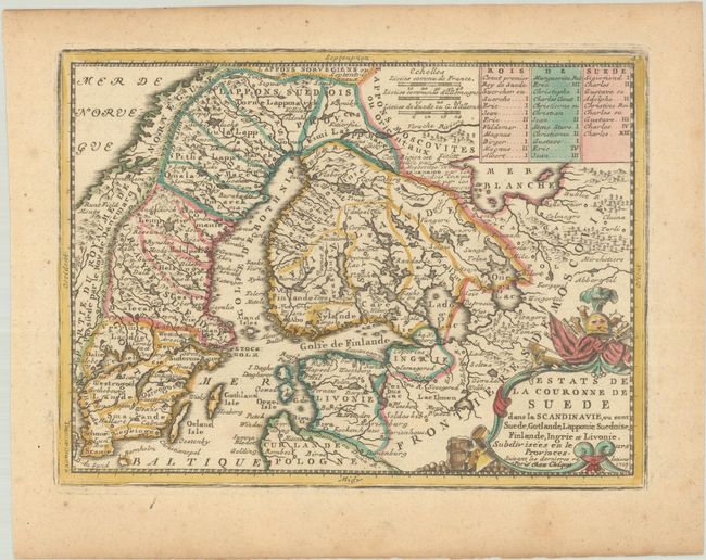
Lot 402
Subject: Scandinavia
Chiquet, Jacques
Estats de la Couronne de Suede dans la Scandinavie, ou sont Suede, Gotlande, Lapponie, Suedoise, Finlande, Ingrie et Livonie..., 1719
Size: 8.8 x 6.6 inches (22.4 x 16.8 cm)
Estimate: $110 - $140
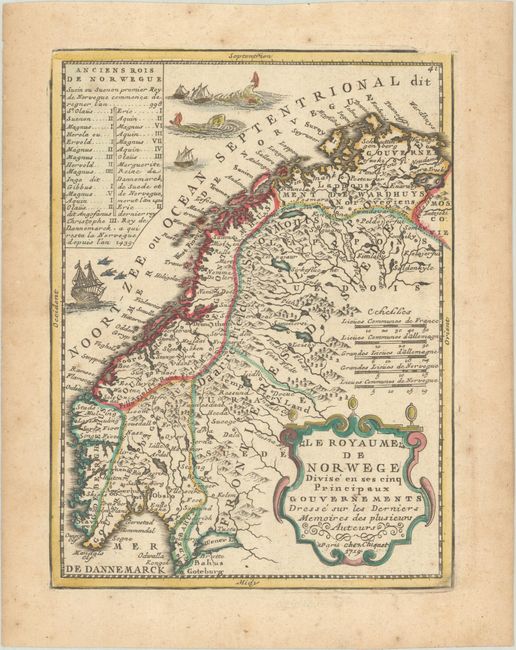
Lot 403
Subject: Norway & Sweden
Chiquet, Jacques
Le Royaume de Norwege Divise en ses Cinq Principaux Gouvernements Dresse sur les Derniers Memoires des Plusieurs Auteurs, 1719
Size: 6.5 x 8.6 inches (16.5 x 21.8 cm)
Estimate: $95 - $120
Sold for: $70
Closed on 6/17/2026
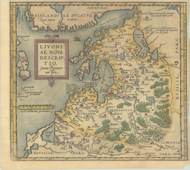
Lot 404
Subject: Baltic, Latvia & Estonia
Ortelius, Abraham
Livoniae Nova Descriptio, Joanne Portantio Auctore, 1584
Size: 9.7 x 8.7 inches (24.6 x 22.1 cm)
Estimate: $80 - $100
NO RESERVE
Sold for: $120
Closed on 6/17/2026
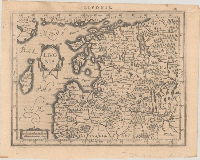
Lot 405
Subject: Baltic, Latvia & Estonia
Mercator/Jansson
Livonia, 1630
Size: 7.5 x 5.8 inches (19.1 x 14.7 cm)
Estimate: $100 - $130
203 lots
Page 1 of 5