Current Live Auction
LIVE AUCTION MARCH 11
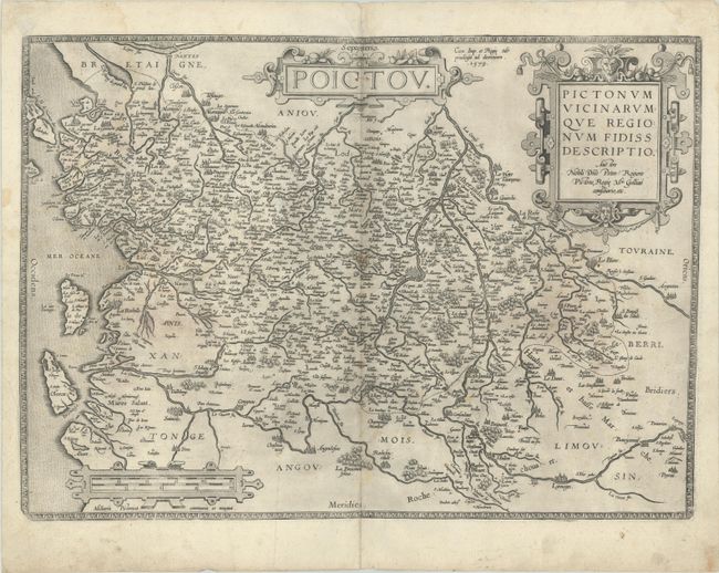
"Poictou - Pictonum Vicinarumque Regionum Fidiss Descriptio Auctore Nobili Dno Petro Rogiero Pictone...", Ortelius, Abraham
Subject: Western France
Period: 1579 (dated)
Publication: Theatrum Orbis Terrarum
Color: Black & White
Size:
19.8 x 14.3 inches
50.3 x 36.3 cm
Download High Resolution Image
(or just click on image to launch the Zoom viewer)
(or just click on image to launch the Zoom viewer)
Beautifully decorated map of the Poitou region of western France between Nantes and Limoges based on a lost original map by Pierre Rogier. Large cities are depicted pictorially, including Nantes, Limoges, La Rochelle, Poitiers, and Saintes. The map is embellished with three strapwork cartouches. Dutch text on verso, published between 1598-1613.
References: Van den Broecke #38.
Condition: B+
A crisp impression on a sheet with the crossed arrows watermark commonly found on Ortelius maps. There is a faint dampstain at upper left, some light foxing, and a pair of wormholes along the upper centerfold.
Estimate: $180 - $220
Current High Bid:
$0
Reserve: Reserve Not Met
Next Bid: $100
Bid Increments
$100 - $249$10
$250 - $499$25
$500 - $999$50
$1,000 - $2,499$100
Terms & Conditions