Showing No Reserve Lots(remove filter)
Showing results for:Auction 173
Catalog Archive
42 lots
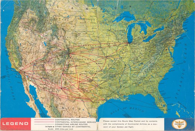
Auction 173, Lot 81
Subject: United States, Flight Maps
[Lot of 3] Welcome Aboard! [and] Air Atlas [and] Delta System Route Map, 1964-89
Size: See Description
Estimate: $50 - $70
NO RESERVE
Sold for: $45
Closed on 6/5/2019
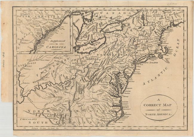
Auction 173, Lot 85
Subject: Eastern United States
A Correct Map of North America, 1812
Size: 11.4 x 8.1 inches (29 x 20.6 cm)
Estimate: $220 - $250
NO RESERVE
Sold for: $55
Closed on 6/5/2019
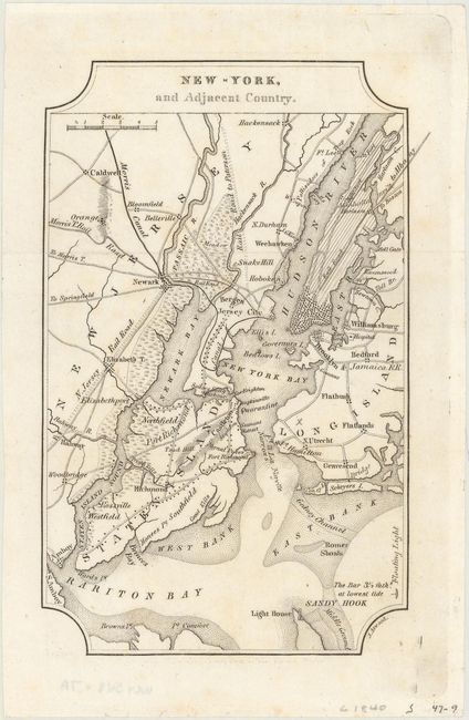
Auction 173, Lot 87
Subject: Eastern United States Cities
Melish, John
[Lot of 7] New-York, and Adjacent Country [and] District of Columbia [and] Boston... [and] Baltimore, Annapolis... [and] Charleston... [and] View of the Country Round the Falls of Niagara [and] Ballston & Saratoga Springs, City of Albany..., 1822
Size: 4 x 6.4 inches (10.2 x 16.3 cm)
Estimate: $300 - $400
NO RESERVE
Sold for: $110
Closed on 6/5/2019
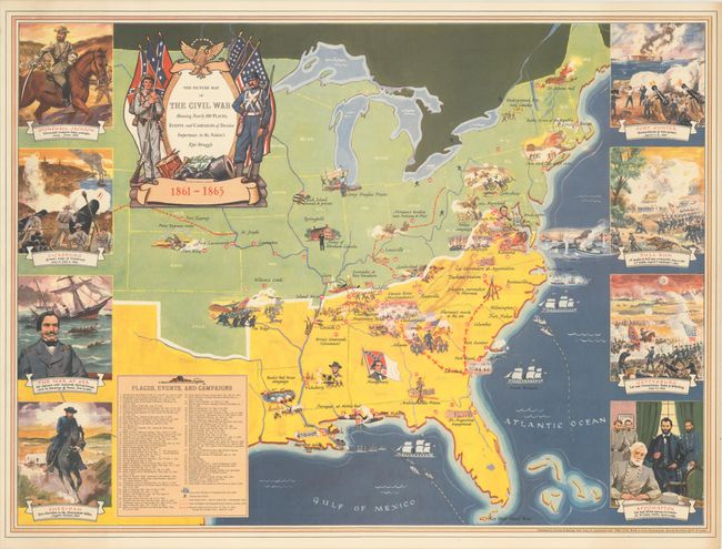
Auction 173, Lot 89
Subject: Eastern United States, Civil War
The Picture Map of the Civil War Showing Nearly 100 Places, Events and Campaigns of Decisive Importance in the Nation's Epic Struggle, 1956
Size: 29.7 x 22 inches (75.4 x 55.9 cm)
Estimate: $160 - $200
NO RESERVE
Sold for: $160
Closed on 6/5/2019
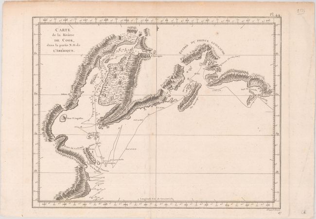
Auction 173, Lot 120
Subject: Southern Alaska
Cook/Benard
Carte de la Riviere de Cook, dans la Partie N.O. de l'Amerique, 1785
Size: 11.9 x 9.3 inches (30.2 x 23.6 cm)
Estimate: $90 - $120
NO RESERVE
Sold for: $8
Closed on 6/5/2019
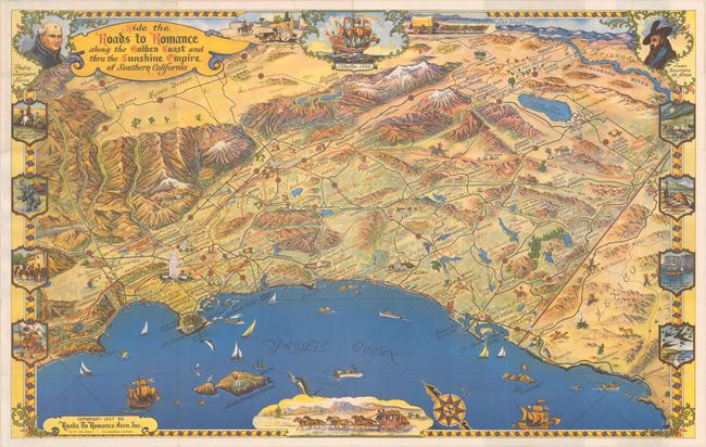
Auction 173, Lot 126
Subject: Southern California
Ride the Roads to Romance Along the Golden Coast and Thru the Sunshine Empire of Southern California, 1957
Size: 33.9 x 21.2 inches (86.1 x 53.8 cm)
Estimate: $200 - $230
NO RESERVE
Sold for: $140
Closed on 6/5/2019
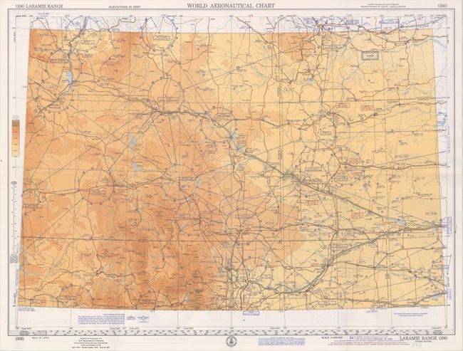
Auction 173, Lot 170
Subject: Wyoming, Flight Maps
U.S. Coast & Geodetic Survey
(306) Laramie Range - World Aeronautical Chart, 1968
Size: 28 x 20.4 inches (71.1 x 51.8 cm)
Estimate: $30 - $50
NO RESERVE
Sold for: $40
Closed on 6/5/2019
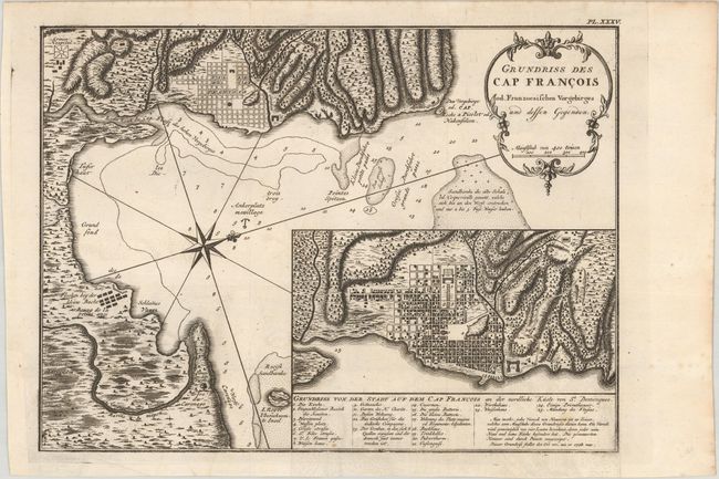
Auction 173, Lot 197
Subject: Cap-Haitien, Haiti
Bellin, Jacques Nicolas
Grundriss des Cap Francois od. Franzoesischen Vorgebirges und Dessen Gegenden, 1760
Size: 12.3 x 9.1 inches (31.2 x 23.1 cm)
Estimate: $80 - $100
NO RESERVE
Sold for: $110
Closed on 6/5/2019
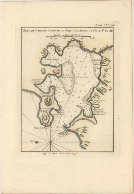
Auction 173, Lot 201
Subject: St. Lucia
Bellin, Jacques Nicolas
Plan du Port du Carenage ou Petit Cul de Sac de l'Isle Se Lucie, 1764
Size: 6.3 x 8.5 inches (16 x 21.6 cm)
Estimate: $40 - $55
NO RESERVE
Sold for: $31
Closed on 6/5/2019
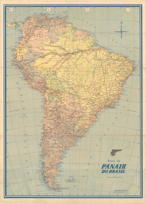
Auction 173, Lot 212
Subject: Brazil, Flight Maps
[Lot of 2] Rotas da Panair do Brasil [and] Mapa de Rotas Varig Routes Map, 1955-70
Size: See Description
Estimate: $55 - $75
NO RESERVE
Sold for: $19
Closed on 6/5/2019
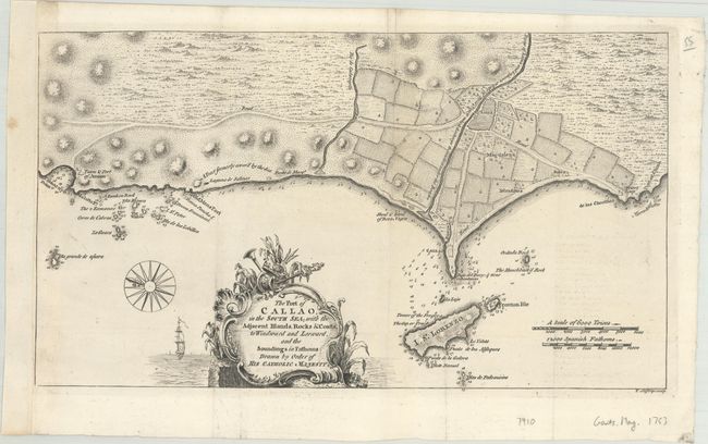
Auction 173, Lot 215
Subject: Lima & Callao, Peru
Jefferys, Thomas
The Port of Callao, in the South Sea; with the Adjacent Islands, Rocks & Coasts, to Windward and Leeward, and the Soundings in Fathoms: Drawn by Order of His Catholic Majesty, 1753
Size: 14.3 x 8.1 inches (36.3 x 20.6 cm)
Estimate: $100 - $130
NO RESERVE
Sold for: $70
Closed on 6/5/2019
Auction 173, Lot 234
Subject: England
Owen & Bowen
[Lot of 4 - Road Maps], 1720
Size: 5.6 x 7.5 inches (14.2 x 19.1 cm)
Estimate: $55 - $75
NO RESERVE
Sold for: $65
Closed on 6/5/2019
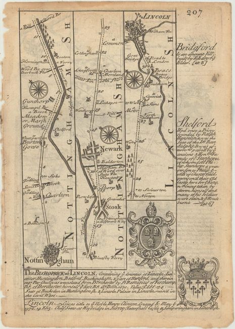
Auction 173, Lot 237
Subject: Central England
Owen & Bowen
[Lot of 3 - Road Maps], 1720
Size: 5.4 x 8 inches (13.7 x 20.3 cm)
Estimate: $50 - $70
NO RESERVE
Sold for: $55
Closed on 6/5/2019
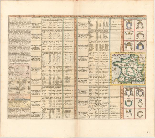
Auction 173, Lot 269
Subject: France
Chatelain, Henry Abraham
Carte du Gouvernement Eclesiastique de France Divise en ses Archeveschez, Eveschez, Archidiaconnez, Archipretrez, Doyennez, et Parroisses, 1719
Size: 17.4 x 13.1 inches (44.2 x 33.3 cm)
Estimate: $70 - $90
NO RESERVE
Sold for: $41
Closed on 6/5/2019
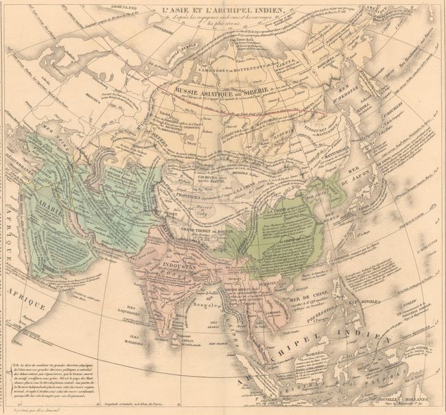
Auction 173, Lot 393
Subject: Asia
Le Sage
L'Asie et l'Archipel Indien, d'Apres les Voyageurs Modernes et les Ouvrages les Plus Recens, 1827
Size: 13.3 x 12.2 inches (33.8 x 31 cm)
Estimate: $80 - $100
NO RESERVE
Sold for: $55
Closed on 6/5/2019
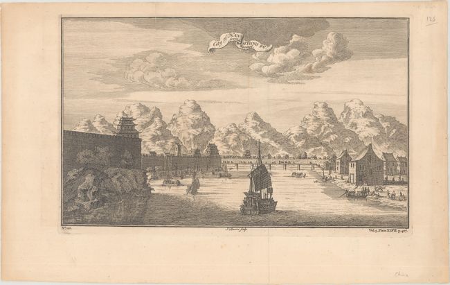
Auction 173, Lot 400
Subject: Nanxiong, China
Basire, James I
City of Nan-Hyong Fu from Nieuhof, 1745
Size: 13.1 x 7.9 inches (33.3 x 20.1 cm)
Estimate: $110 - $140
NO RESERVE
Sold for: $31
Closed on 6/5/2019
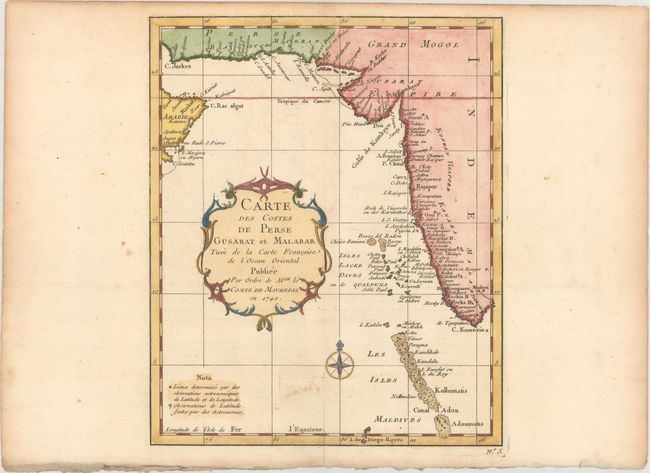
Auction 173, Lot 418
Subject: Southern Pakistan & Western India
Bellin, Jacques Nicolas
Carte des Costes de Perse Gusarat et Malabar Tiree de la Carte Francoise de l'Ocean Oriental, 1740
Size: 7.8 x 9.6 inches (19.8 x 24.4 cm)
Estimate: $110 - $140
NO RESERVE
Sold for: $41
Closed on 6/5/2019
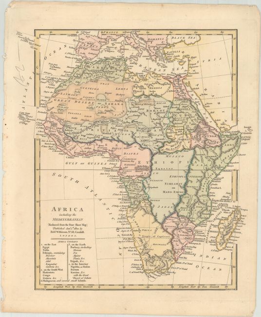
Auction 173, Lot 419
Subject: Africa, Mediterranean
Wilkinson, Robert
Africa Including the Mediterranean (Reduced from the Four Sheet Map), 1800
Size: 10.3 x 11.1 inches (26.2 x 28.2 cm)
Estimate: $100 - $130
NO RESERVE
Sold for: $55
Closed on 6/5/2019
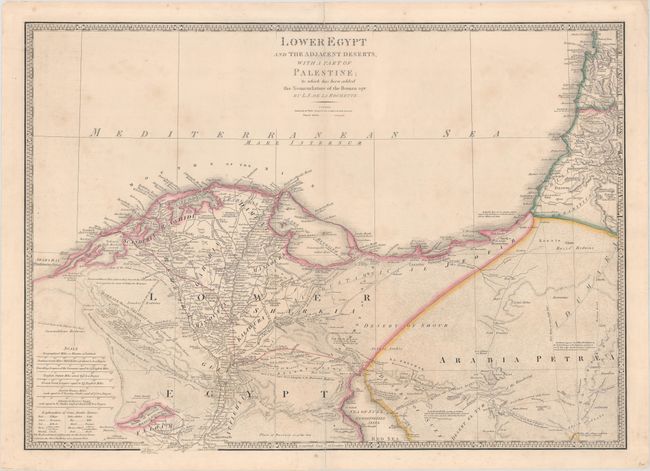
Auction 173, Lot 427
Subject: Egypt
Wyld, James
Lower Egypt and the Adjacent Deserts, with a Part of Palestine; to Which Has Been Added the Nomenclature of the Roman Age, 1851
Size: 29.7 x 21.1 inches (75.4 x 53.6 cm)
Estimate: $140 - $170
NO RESERVE
Sold for: $80
Closed on 6/5/2019
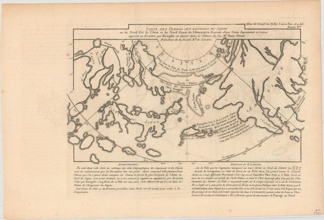
Auction 173, Lot 438
Subject: North Pacific Ocean
Buache, Philip
Carte des Terres aux Environs du Japon ou du Nord-Est de l'Asie et du Nord-Ouest de l'Amerique Extraite d'une Carte Japonnoise..., 1760
Size: 10.5 x 8.2 inches (26.7 x 20.8 cm)
Estimate: $400 - $475
NO RESERVE
Sold for: $85
Closed on 6/5/2019
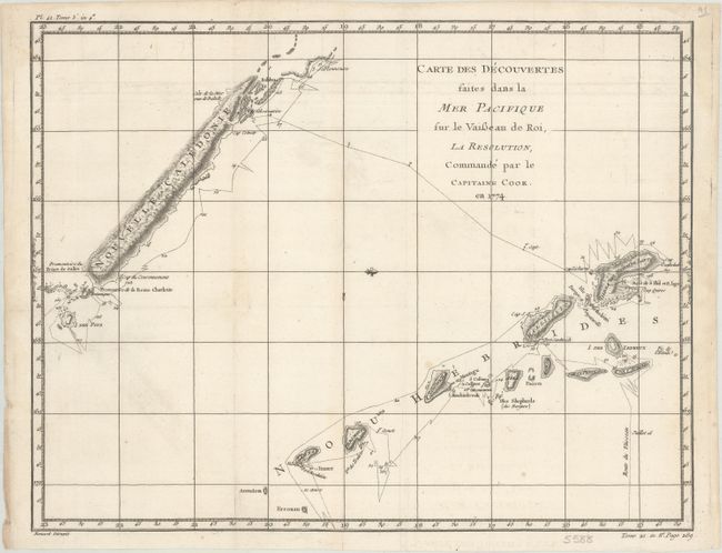
Auction 173, Lot 440
Subject: South Pacific Ocean, New Caledonia & New Hebrides
Cook/Benard
Carte des Decouvertes Faites dans la Mer Pacifique sur le Vaisseau de Roi, la Resolution, Commande par le Capitaine Cook, en 1774, 1778
Size: 18.3 x 14.1 inches (46.5 x 35.8 cm)
Estimate: $110 - $140
NO RESERVE
Sold for: $41
Closed on 6/5/2019
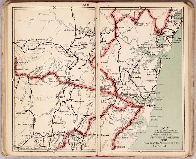
Auction 173, Lot 444
Subject: Australia
N.S.W. Motorists' Road Guide Extending Also to Melbourne and Brisbane..., 1927
Size: 5.3 x 8.7 inches (13.5 x 22.1 cm)
Estimate: $75 - $100
NO RESERVE
Sold for: $210
Closed on 6/5/2019
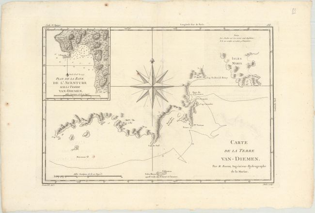
Auction 173, Lot 445
Subject: Southern Tasmania
Bonne, Rigobert
Carte de la Terre Van-Diemen, 1787
Size: 13.7 x 9.2 inches (34.8 x 23.4 cm)
Estimate: $100 - $130
NO RESERVE
Sold for: $80
Closed on 6/5/2019
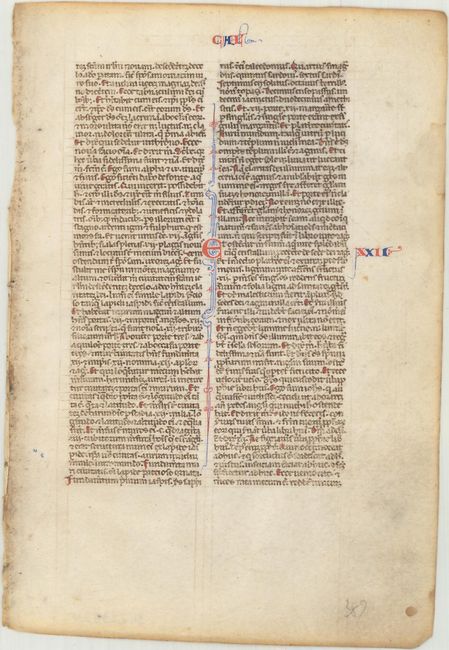
Auction 173, Lot 450
Subject: Medieval Manuscripts
Anon.
[Illuminated Leaf], 1250
Size: 5 x 7.3 inches (12.7 x 18.5 cm)
Estimate: $140 - $170
NO RESERVE
Sold for: $130
Closed on 6/5/2019
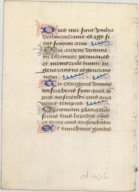
Auction 173, Lot 451
Subject: Medieval Manuscripts
Anon.
[Illuminated Leaf], 1450
Size: 3.8 x 5.2 inches (9.7 x 13.2 cm)
Estimate: $140 - $170
NO RESERVE
Sold for: $85
Closed on 6/5/2019
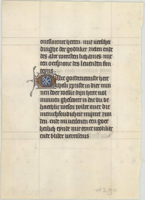
Auction 173, Lot 452
Subject: Medieval Manuscripts
Anon.
[Illuminated Leaf], 1450
Size: 4.8 x 6.6 inches (12.2 x 16.8 cm)
Estimate: $180 - $210
NO RESERVE
Sold for: $80
Closed on 6/5/2019
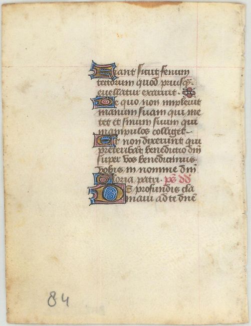
Auction 173, Lot 453
Subject: Medieval Manuscripts
Anon.
[Illuminated Leaf], 1463
Size: 3.1 x 4.1 inches (7.9 x 10.4 cm)
Estimate: $110 - $140
NO RESERVE
Sold for: $80
Closed on 6/5/2019
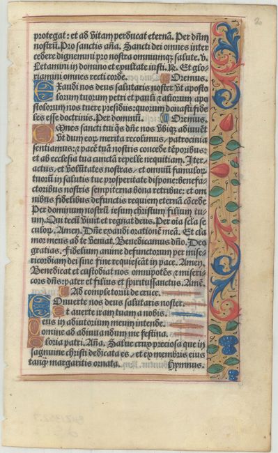
Auction 173, Lot 455
Subject: Early Printing
Anon.
[Illuminated Leaf], 1500
Size: 4.9 x 8 inches (12.4 x 20.3 cm)
Estimate: $200 - $230
NO RESERVE
Sold for: $170
Closed on 6/5/2019
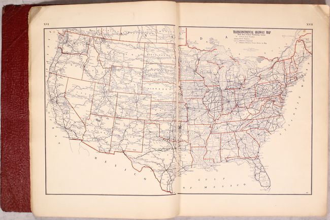
Auction 173, Lot 464
Subject: Atlases, United States
National Map Company
Official Paved Road and Commercial Survey of the United States, 1933
Size: 11.7 x 15 inches (29.7 x 38.1 cm)
Estimate: $100 - $130
NO RESERVE - Early American Road Atlas
Sold for: $100
Closed on 6/5/2019
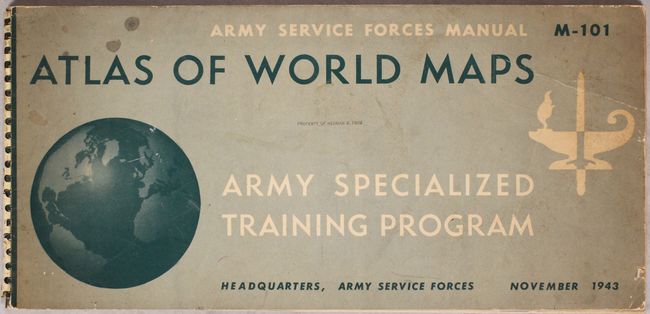
Auction 173, Lot 465
Subject: Atlases
U.S. Army
Atlas of World Maps for the Study of Geography in the Army Specialized Training Program, 1943
Size: 22.3 x 10.5 inches (56.6 x 26.7 cm)
Estimate: $70 - $90
NO RESERVE
Sold for: $21
Closed on 6/5/2019
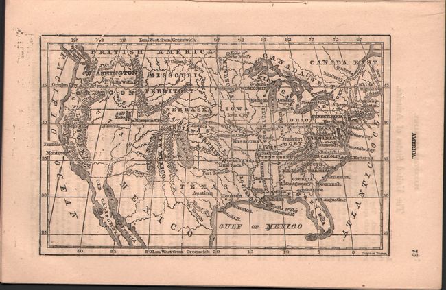
Auction 173, Lot 467
Subject: Geography Books
Cassell, John
Geography and Atlas: Comprising Thirty Engravings and Fifteen Maps. For Home and School Use, 1855
Size: 5.5 x 8.4 inches (14 x 21.3 cm)
Estimate: $50 - $70
NO RESERVE
Sold for: $19
Closed on 6/5/2019
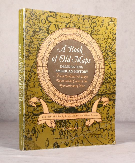
Auction 173, Lot 469
Subject: References, United States
Fite & Freeman
A Book of Old Maps Delineating American History from the Earliest Days Down to the Close of the Revolutionary War, 1969
Size: 11 x 13.8 inches (27.9 x 35.1 cm)
Estimate: $70 - $90
NO RESERVE
Sold for: $60
Closed on 6/5/2019
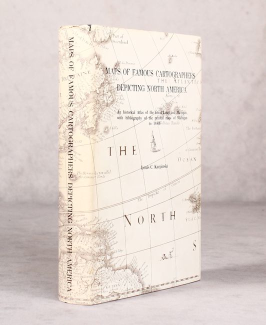
Auction 173, Lot 470
Subject: References, Great Lakes and Michigan
Karpinski, Louis C.
Maps of Famous Cartographers Depicting North America - An Historical Atlas of the Great Lakes and Michigan, with Bibliography of the Printed Maps of Michigan to 1880, 1977
Size: 6.1 x 9.1 inches (15.5 x 23.1 cm)
Estimate: $150 - $180
NO RESERVE
Sold for: $140
Closed on 6/5/2019
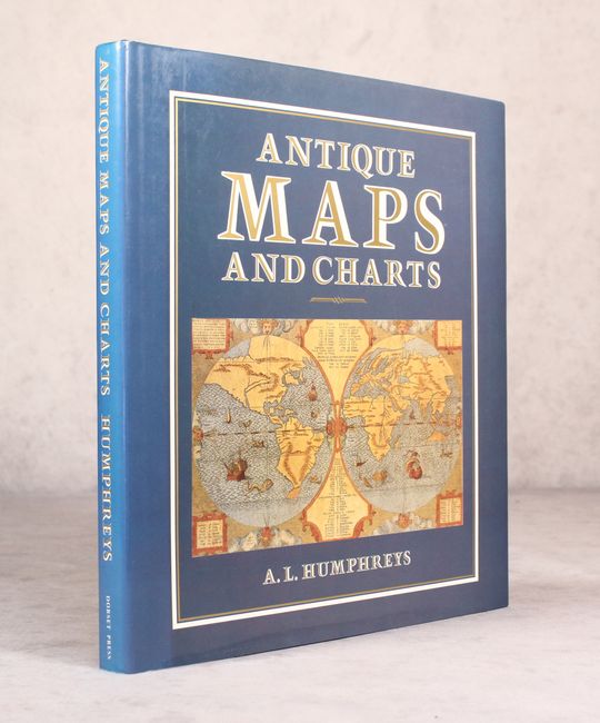
Auction 173, Lot 472
Subject: References
Humphreys, A.L.
Antique Maps and Charts, 1989
Size: 11.3 x 12.1 inches (28.7 x 30.7 cm)
Estimate: $70 - $90
NO RESERVE
Sold for: $17
Closed on 6/5/2019
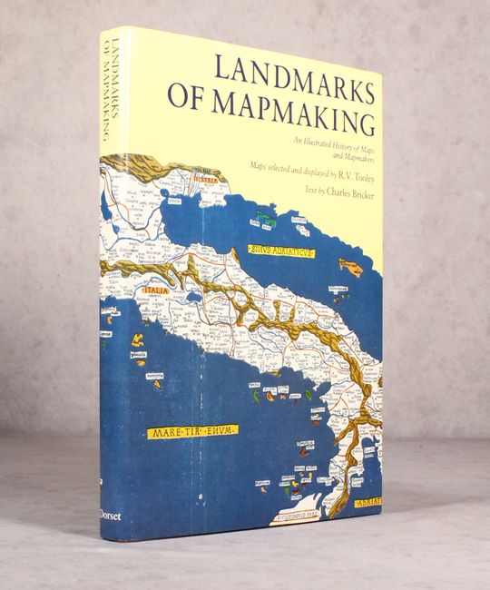
Auction 173, Lot 473
Subject: References
Tooley & Bricker
Landmarks of Mapmaking - An Illustrated Survey of Maps and Mapmaking, 1989
Size: 10.4 x 14.4 inches (26.4 x 36.6 cm)
Estimate: $50 - $70
NO RESERVE
Sold for: $20
Closed on 6/5/2019
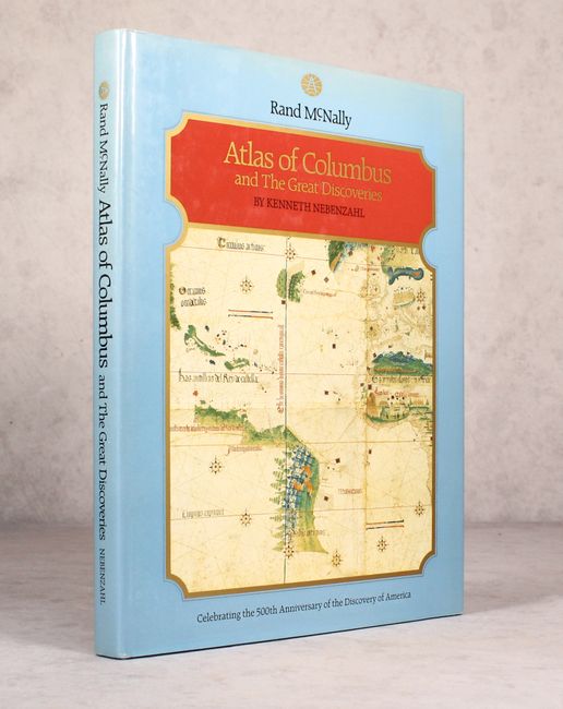
Auction 173, Lot 474
Subject: References
Nebenzahl, Kenneth
Atlas of Columbus and the Great Discoveries, 1990
Size: 11.3 x 14.8 inches (28.7 x 37.6 cm)
Estimate: $25 - $40
NO RESERVE
Sold for: $160
Closed on 6/5/2019
Auction 173, Lot 475
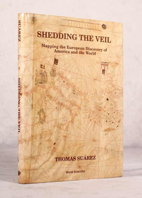
Subject: References
Suarez, Thomas
Shedding the Veil - Mapping the European Discovery of America and the World, 1992
Size: 8.7 x 11.8 inches (22.1 x 30 cm)
Estimate: $90 - $120
NO RESERVE
Sold for: $41
Closed on 6/5/2019
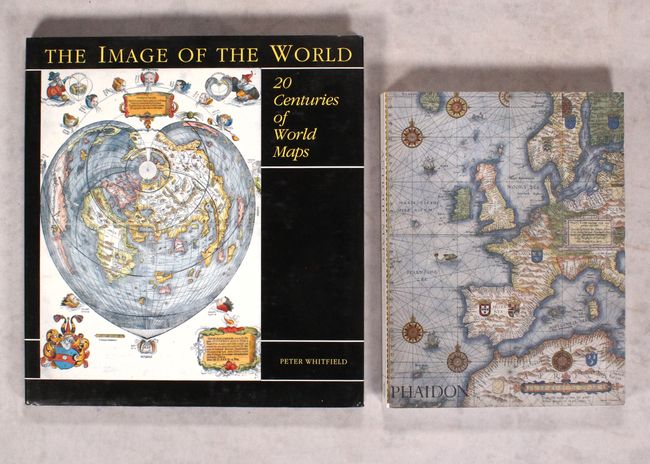
Auction 173, Lot 476
Subject: References
[Lot of 2] Antique Maps [and] The Image of the World - 20 Centuries of World Maps, 1993-94
Size: See Description
Estimate: $55 - $75
NO RESERVE
Sold for: $85
Closed on 6/5/2019
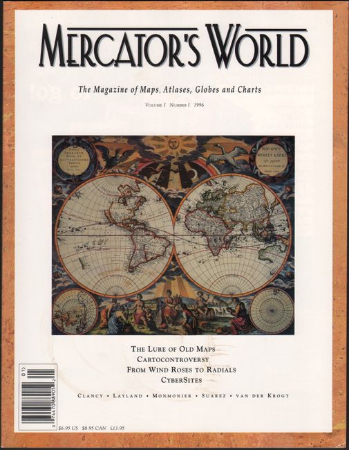
Auction 173, Lot 478
Subject: References
Mercator's World - The Magazine of Maps, Atlases, Globes and Charts Volume I Number I, 1996
Size: 8.4 x 10.9 inches (21.3 x 27.7 cm)
Estimate: $15 - $30
NO RESERVE
Sold for: $2
Closed on 6/5/2019
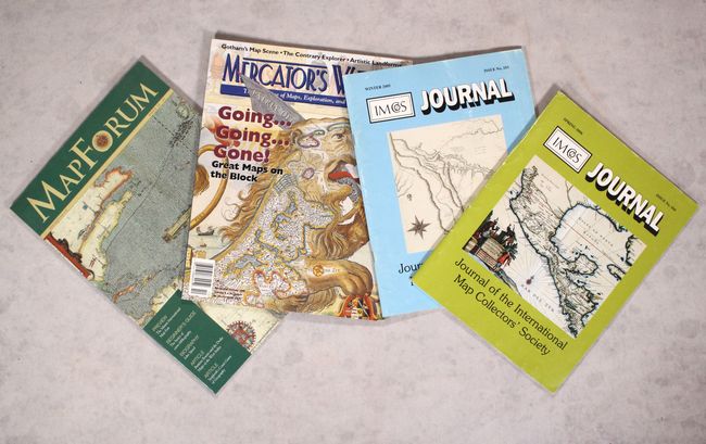
Auction 173, Lot 481
Subject: References
[Lot of 4 - Map Journals], 1999-2007
Size: See Description
Estimate: $25 - $45
NO RESERVE
Sold for: $2
Closed on 6/5/2019
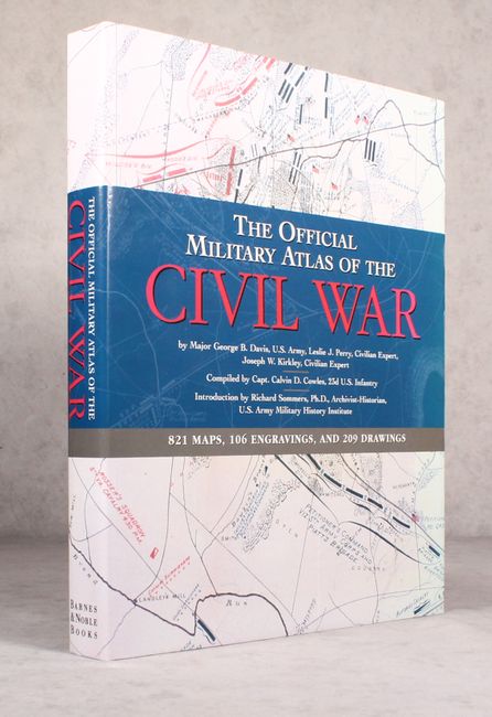
Auction 173, Lot 482
Subject: References, Civil War
The Official Military Atlas of the Civil War, 2003
Size: 13.4 x 16.6 inches (34 x 42.2 cm)
Estimate: $80 - $100
NO RESERVE
Sold for: $230
Closed on 6/5/2019
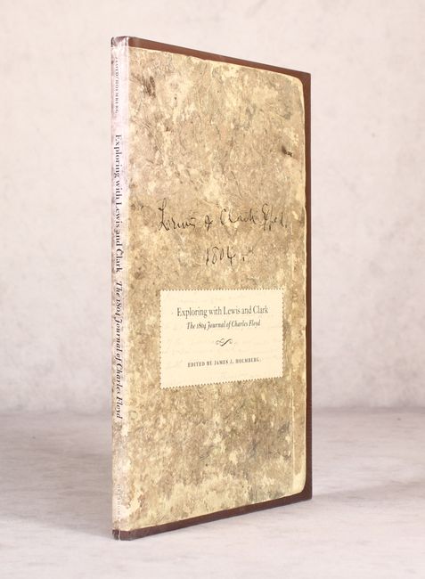
Auction 173, Lot 484
Subject: References, Exploration and Surveys
Exploring with Lewis and Clark - The 1804 Journal of Charles Floyd, 2005
Size: 7.8 x 12.1 inches (19.8 x 30.7 cm)
Estimate: $40 - $55
NO RESERVE
Sold for: $70
Closed on 6/5/2019
42 lots