Subject: Cap-Haitien, Haiti
Period: 1760 (circa)
Publication:
Color: Black & White
Size:
12.3 x 9.1 inches
31.2 x 23.1 cm
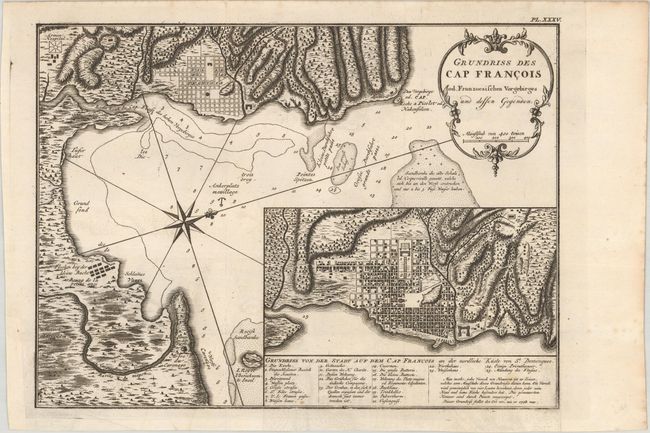
This is the German edition of Bellin's chart of the important port city of Cap-Francois on the island of Saint Domingue, now known as Cap-Haitien, Haiti. Saint Domingue was a French colony established on the island of Hispaniola in 1659, and Cap Francois, established circa 1670, was the capital. The chart details the approach to Cap-Haitien, showing soundings, navigational notes, sand banks, and an anchorage. The city itself is depicted in plan form, and the surrounding coastline is rendered in intricate topographical detail. A compass rose orients north to the top right corner. An inset at bottom right provides a closer view of Cap-Haitien, identifying 25 sites of interest.
References:
Condition: A
A sharp impression on watermarked paper with minor offsetting.