Showing No Reserve Lots(remove filter)
Filtered by Category:United States(Show All Categories)
Showing results for:Auction 91
Catalog Archive
20 lots
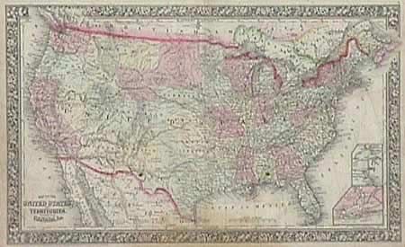
Auction 91, Lot 101
Subject: Canada and United States
Lot of 5 maps, 1860
Size: See Description
Estimate: $100 - $150
Sold for: $170
Closed on 6/14/2000
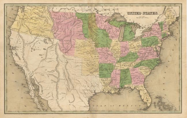
Auction 91, Lot 126
Subject: United States
Lot of 6 maps, 1838-41
Size: See Description
Estimate: $80 - $100
Sold for: $190
Closed on 6/14/2000
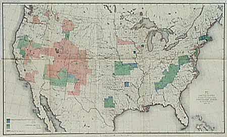
Auction 91, Lot 128
Subject: United States
Map of the United States Showing the Progress of the Topographic Survey during the fiscal year 1887-8, 1888
Size: 28.2 x 17.2 inches (71.6 x 43.7 cm)
Estimate: $50 - $75
Sold for: $60
Closed on 6/14/2000
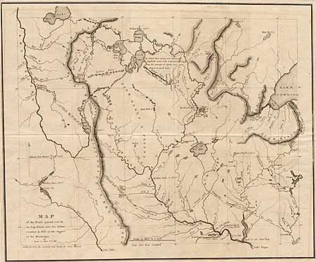
Auction 91, Lot 137
Subject: Central United States
Map of the route passed over by an Expedition into the Indian Country in 1832 to the Source of the Mississippi, 1834
Size: 19 x 15.5 inches (48.3 x 39.4 cm)
Estimate: $275 - $350
Sold for: $400
Closed on 6/14/2000
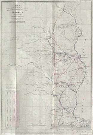
Auction 91, Lot 140
Subject: Central United States
[Pair of maps] - Map Illustrating the plan of the defenses of the Western & North Western Frontier…, 1860
Size: 15 x 21 inches (38.1 x 53.3 cm)
Estimate: $800 - $900
Sold for: $475
Closed on 6/14/2000
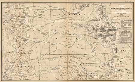
Auction 91, Lot 141
Subject: Central United States
Map of the States of Kansas and Texas and Indian Territory with parts of the Territories of Colorado and New Mexico, 1891-95
Size: 27.5 x 16.5 inches (69.9 x 41.9 cm)
Estimate: $80 - $120
Sold for: $110
Closed on 6/14/2000
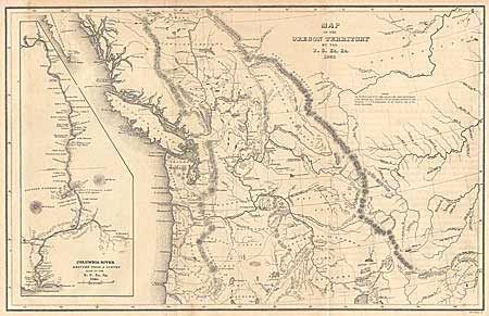
Auction 91, Lot 143
Subject: Northwestern United States
Map of Oregon Territory, 1841
Size: 8.5 x 13 inches (21.6 x 33 cm)
Estimate: $300 - $375
Sold for: $400
Closed on 6/14/2000
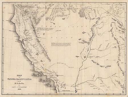
Auction 91, Lot 144
Subject: Western United States
Map of California, 1841
Size: 11.2 x 8.5 inches (28.4 x 21.6 cm)
Estimate: $200 - $240
Sold for: $275
Closed on 6/14/2000
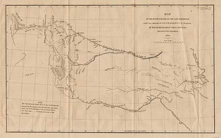
Auction 91, Lot 145
Subject: Western United States
Map of the Route Pursued by the Late Expedition under the command of Co. S.W. Kearny, U.S. 1st Dragoons, 1879
Size: 13 x 7.7 inches (33 x 19.6 cm)
Estimate: $180 - $200
Sold for: $250
Closed on 6/14/2000

Auction 91, Lot 147
Subject: Southwestern United States
Preliminary Map of the Western Portion of the Reconnaissance and Survey for a Pacific Railroad Route near the 35th Par., 1857-8
Size: 48 x 26.2 inches (121.9 x 66.5 cm)
Estimate: $180 - $220
Sold for: $210
Closed on 6/14/2000
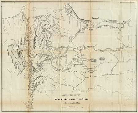
Auction 91, Lot 148
Subject: Western United States
Sketch of the Country between South Pass and the Great Salt Lake, 1860
Size: 21.7 x 17.5 inches (55.1 x 44.5 cm)
Estimate: $100 - $130
Sold for: $55
Closed on 6/14/2000
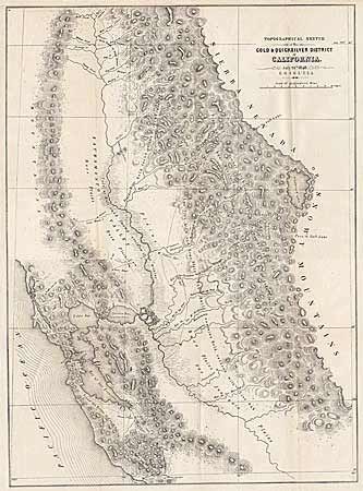
Auction 91, Lot 151
Subject: California
Topographical Sketch of the Gold & Quicksilver District of California, 1848
Size: 15.5 x 21.5 inches (39.4 x 54.6 cm)
Estimate: $450 - $550
Sold for: $650
Closed on 6/14/2000
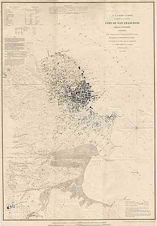
Auction 91, Lot 152
Subject: California
City of San Francisco and its Vicinity, California, 1853
Size: 17.8 x 25.3 inches (45.2 x 64.3 cm)
Estimate: $300 - $375
Sold for: $325
Closed on 6/14/2000
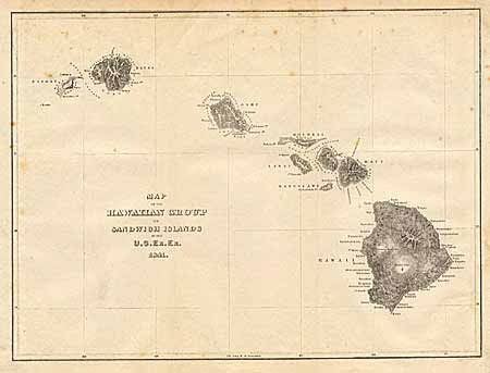
Auction 91, Lot 154
Subject: Hawaii
Map of the Hawaiian Group or Sandwich Islands, 1841
Size: 11 x 8.4 inches (27.9 x 21.3 cm)
Estimate: $200 - $250
Sold for: $110
Closed on 6/14/2000

Auction 91, Lot 170
Subject: Oklahoma
Map of the Former Territorial Limits of the Cherokee "Nation of" Indians… [together with] Map of the Territory Originally Assigned to the Cherokee "Nation of" Indians West of the Mississippi…, 1884
Size: See Description
Estimate: $275 - $350
Sold for: $350
Closed on 6/14/2000
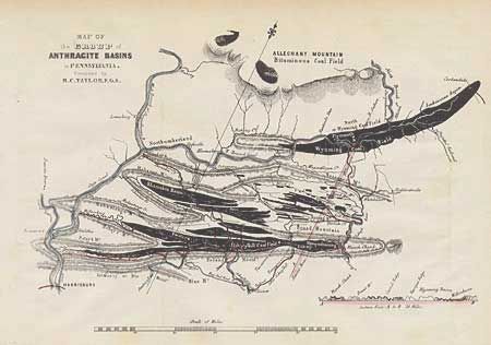
Auction 91, Lot 171
Subject: Pennsylvania
Map of the Group of Anthracite Basins in Pennsylvania, 1855
Size: 11.5 x 8 inches (29.2 x 20.3 cm)
Estimate: $25 - $35
Sold for: $15
Closed on 6/14/2000

Auction 91, Lot 172
Subject: Pennsylvania
Mitchell, S. A.
Plan of Philadelphia, 1860
Size: 12.9 x 10.8 inches (32.8 x 27.4 cm)
Estimate: $60 - $80
Sold for: $60
Closed on 6/14/2000
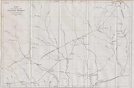
Auction 91, Lot 174
Subject: Texas
Map Showing the Route of the Arkansas Regiment from Shreveport La. to San Antonio de Bexar, Texas, 1846-50
Size: 17.2 x 11.5 inches (43.7 x 29.2 cm)
Estimate: $300 - $350
Sold for: $350
Closed on 6/14/2000
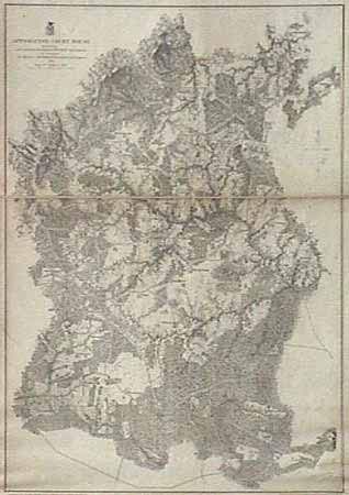
Auction 91, Lot 175
Subject: Virginia
Appomatox Court House, 1867
Size: 22 x 30.5 inches (55.9 x 77.5 cm)
Estimate: $200 - $250
Sold for: $90
Closed on 6/14/2000
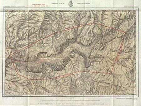
Auction 91, Lot 176
Subject: California
Topographical Map of the Yosemite Valley and Vicinity, 1883
Size: 21.2 x 14.5 inches (53.8 x 36.8 cm)
Estimate: $80 - $100
Sold for: $140
Closed on 6/14/2000
20 lots