Subject: United States
Period: 1838-41 (published)
Publication:
Color:
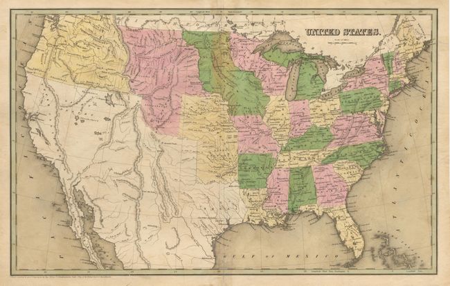
Set of maps from two different Bradford atlases published in 1838 and 1841. Three are approximately 7.5 x 9.7" with only partial coloring: Modes of Traveling; four ancient city plans (Athens, Rome, Jerusalem & Mt. Sinai) on one sheet; and six modern city plans(Paris, Madrid, Brussels, Vienna, London, & Edinburgh) on one sheet. Three are fully hand-colored (11.5 x 14"): Vermont; Massachusetts; and United States. The United States map is a double page map showing the eastern states and western territories; Indian Territory, Iowa, Oregon, and an unnamed region between the Missouri River and the Rocky Mountains. Mexico is in control of California, the present-day Southwest, and Texas. Most with condition problems in margins and a few restorable tears, or minor foxing. Still a nice set of early 19th Century maps.
References:
Condition: C