Catalog Archive
Auction 91, Lot 145

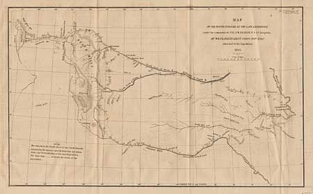
"Map of the Route Pursued by the Late Expedition under the command of Co. S.W. Kearny, U.S. 1st Dragoons",

Subject: Western United States

Period: 1879 (dated)

Publication: HR Doc. #2, 29th Congress, 1st session

Color: Black & White

Size:
13 x 7.7 inches
33 x 19.6 cm
Download High Resolution Image
(or just click on image to launch the Zoom viewer)

Taken from Kearny's report of a summer campaign to the Rocky Mountains. Part of the map is based on Fremont's map of 1843. It covers the region between the Arkansas and Platte Rivers, and extends westward to South Pass and Green River. The dragoons departed Ft. Leavenworth and marched to South Pass via the "Oregon Trail" and returned 99 days later via the Arkansas River route, a distance of 2200 miles over the toughest western terrain. Ref: Wheat [TMW] 495. Faint offsetting.

References:

Condition: A

Estimate: $180 - $200

Sold for: $250

Closed on 6/14/2000

Archived