Showing Featured Lots(remove filter)
Filtered by Category:United States(Show All Categories)
Showing results for:Auction 147
Catalog Archive
17 lots
Auction 147, Lot 111
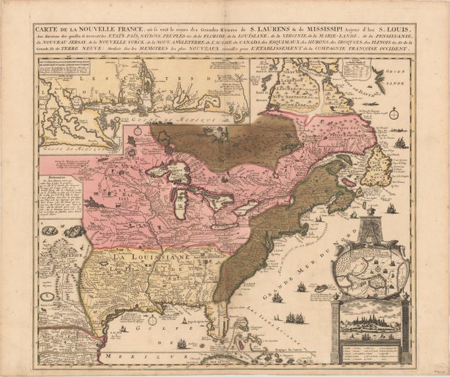
Subject: Colonial Eastern United States & Canada
Fer, Nicolas de
Carte de la Nouvelle France, ou se voit le cours des Grandes Rivieres de S. Laurens & de Mississipi, Aujour d'hui S. Louis…, 1719
Size: 21.7 x 19.6 inches (55.1 x 49.8 cm)
Estimate: $2,300 - $3,000
Striking Map of French Colonial Possessions
Unsold
Closed on 11/20/2013
Auction 147, Lot 122
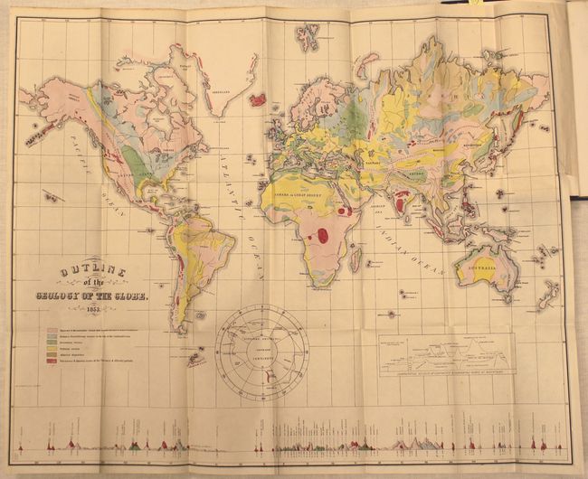
Subject: United States & Canada
Hitchcock, Edward
[Maps with Report] A Geological Map of the United States and Canada [and] Outline of the Geology of the Globe, 1853
Size: See Description
Estimate: $1,000 - $1,300
First Edition of Hitchcock's Important Maps and Report
Sold for: $1,300
Closed on 11/20/2013
Auction 147, Lot 132
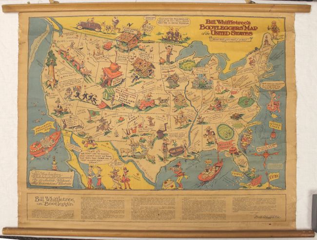
Subject: United States
Bill Whiffletree's Bootlegger's Map of the United States, 1925
Size: 30.1 x 20.3 inches (76.5 x 51.6 cm)
Estimate: $1,000 - $1,200
Sold for: $2,400
Closed on 11/20/2013
Auction 147, Lot 137
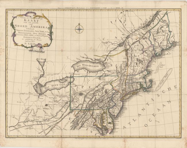
Subject: Colonial Northeastern United States
Kalm, Peter
Nieuwe en Nauwkeurige Kaart van een gedeelte van Noord Amerika, behelzende Nieuw Engeland, New York, Pensylvania, New Jersey, Connecticut, Rhode Island, een Stuk van Virginia, Kanada en Halifax, 1772
Size: 29.9 x 22 inches (75.9 x 55.9 cm)
Estimate: $1,400 - $1,800
Sold for: $750
Closed on 11/20/2013
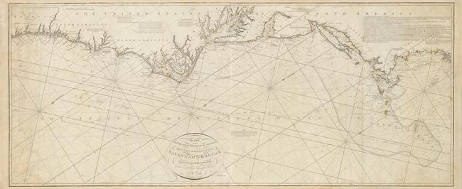
Auction 147, Lot 145
Subject: Eastern United States
Norie, John William
To the Independent Mariners of America, This Chart of their Coast from Savannah to Boston is most Respectfully Dedicated…, 1852
Size: 61 x 25.3 inches (154.9 x 64.3 cm)
Estimate: $2,300 - $2,750
Rare Blue-Back Chart of the East Coast
Unsold
Closed on 11/20/2013
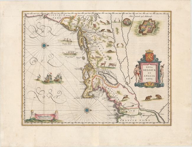
Auction 147, Lot 148
Subject: Colonial New England & Mid-Atlantic
Blaeu, Willem
Nova Belgica et Anglia Nova, 1662
Size: 19.7 x 15.2 inches (50 x 38.6 cm)
Estimate: $3,250 - $4,000
Important Map of Colonial New England and the Mid-Atlantic
Sold for: $2,200
Closed on 11/20/2013
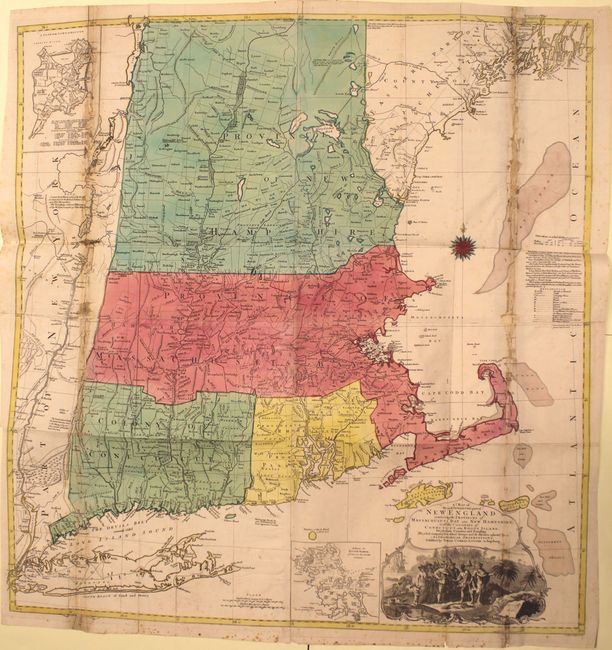
Auction 147, Lot 150
Subject: Colonial New England
Lotter, Tobias Conrad
A Map of the Most Inhabited Part of New England, Containing the Provinces of Massachusets Bay and New Hampshire, with the Colonies of Conecticut and Rhode Island…, 1776
Size: 38 x 40.2 inches (96.5 x 102.1 cm)
Estimate: $3,000 - $4,000
Sold for: $900
Closed on 11/20/2013
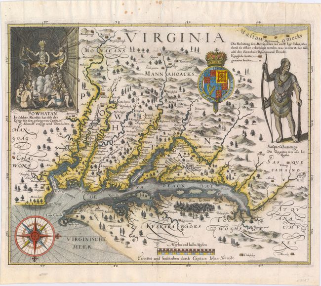
Auction 147, Lot 153
Subject: Colonial Mid-Atlantic
Merian, Matthaus
Virginia - Erforshet und Beschriben durch Capitain Iohan Schmidt, 1627
Size: 14 x 11.3 inches (35.6 x 28.7 cm)
Estimate: $8,000 - $9,500
The Third Derivative of Smith's Map of Virginia
Sold for: $6,000
Closed on 11/20/2013
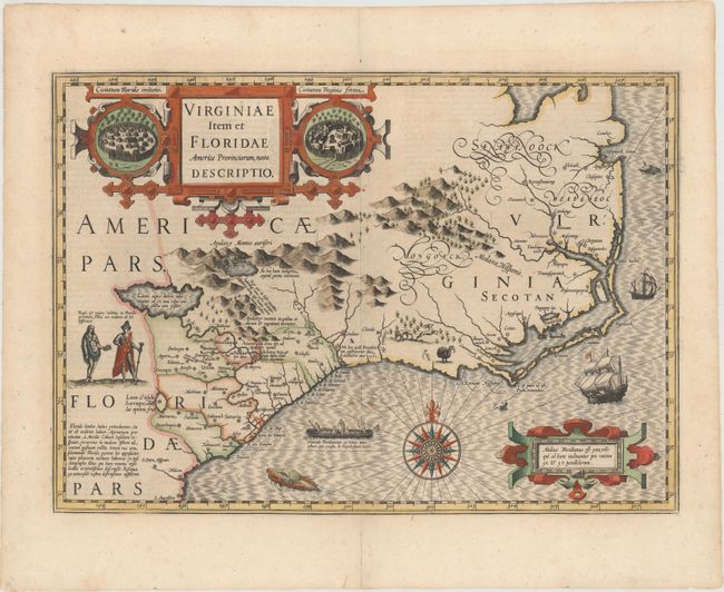
Auction 147, Lot 162
Subject: Colonial Southeast
Hondius, Jodocus
Virginiae Item et Floridae Americae Provinciarum, Nova Descriptio, 1619
Size: 19 x 13.5 inches (48.3 x 34.3 cm)
Estimate: $2,400 - $3,000
A Seminal Map of the Southeast and Early American Cartography
Sold for: $2,750
Closed on 11/20/2013
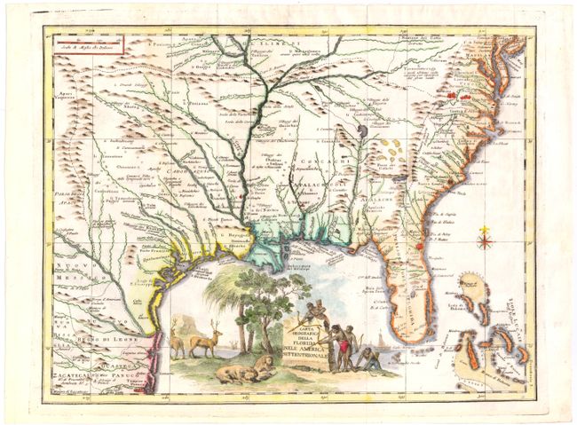
Auction 147, Lot 163
Subject: Colonial Southeast
Albrizzi, Girolamo
Carta Geografica della Florida nell' America Settentrionale, 1740
Size: 16.8 x 12.8 inches (42.7 x 32.5 cm)
Estimate: $1,300 - $1,600
Unsold
Closed on 11/20/2013
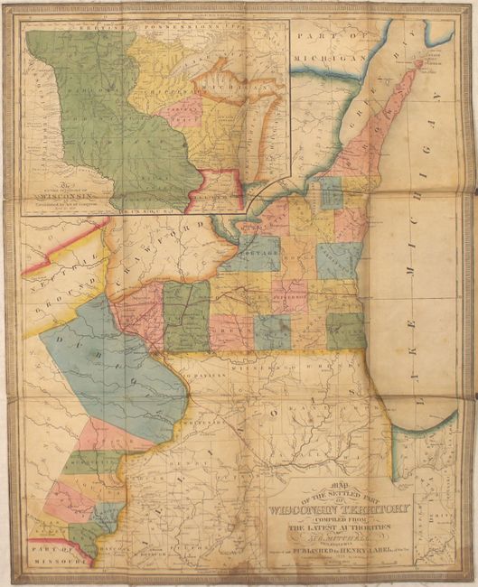
Auction 147, Lot 181
Subject: North Central United States
Mitchell/Young
Map of the Settled Part of Wisconsin Territory Compiled from the Latest Authorities, 1838
Size: 17.6 x 21.8 inches (44.7 x 55.4 cm)
Estimate: $4,000 - $5,000
Very Early and Scarce Map of Wisconsin Territory
Unsold
Closed on 11/20/2013
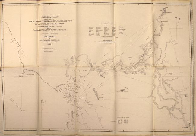
Auction 147, Lot 197
Subject: Northern California
Ringgold, Cadwalader
A Series of Charts with Sailing Directions, Embracing Surveys of the Farallones, Entrance to the Bay of San Francisco ... State of California, 1852
Size: 7.7 x 11.5 inches (19.6 x 29.2 cm)
Estimate: $2,000 - $2,500
Important Coastal Surveys Leading to the Gold Region
Sold for: $1,000
Closed on 11/20/2013
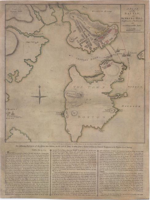
Auction 147, Lot 225
Subject: Boston, Massachusetts
Sayer & Bennett
A Plan of the Battle, on Bunkers Hill. Fought on the 17th of June 1775. By an Officer on the Spot, 1775
Size: 13.7 x 13.6 inches (34.8 x 34.5 cm)
Estimate: $13,000 - $15,000
Rare British Broadside of the Battle of Bunkers Hill
Sold for: $7,000
Closed on 11/20/2013
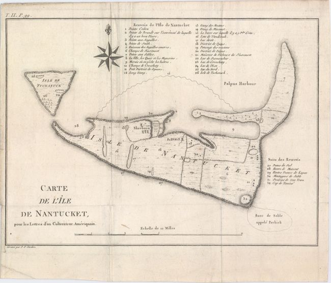
Auction 147, Lot 226
Subject: Nantucket, Massachusetts
Crevecoeur, Michel Guillaume De
Carte de l'Ile de Nantucket, pour les Lettres d’un Cultivateur Ameriquain, 1787
Size: 11 x 8 inches (27.9 x 20.3 cm)
Estimate: $1,400 - $1,700
Sold for: $900
Closed on 11/20/2013
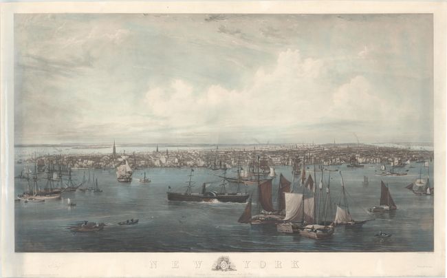
Auction 147, Lot 234
Subject: New York City, New York
New York, 1855
Size: 50.5 x 29 inches (128.3 x 73.7 cm)
Estimate: $4,000 - $5,000
Sold for: $2,550
Closed on 11/20/2013
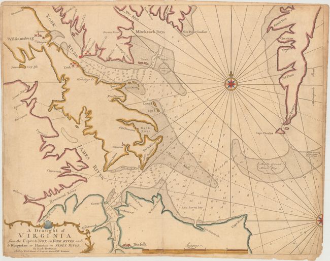
Auction 147, Lot 248
Subject: Chesapeake Bay, Virginia
Mount & Page
A Draught of Virginia from the Capes to York in York River and to Kuiquotan or Hamton in James River, 1751
Size: 23.9 x 18.1 inches (60.7 x 46 cm)
Estimate: $1,200 - $1,500
Unsold
Closed on 11/20/2013
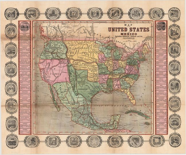
Auction 147, Lot 254
Subject: United States & Mexico
Haven, John
Map of the United States and Mexico Including Oregon, Texas and the Californias, 1846
Size: 15.3 x 14.3 inches (38.9 x 36.3 cm)
Estimate: $1,400 - $1,700
Sold for: $700
Closed on 11/20/2013
17 lots