Subject: Northern California
Period: 1852 (published)
Publication:
Color: Black & White
Size:
7.7 x 11.5 inches
19.6 x 29.2 cm
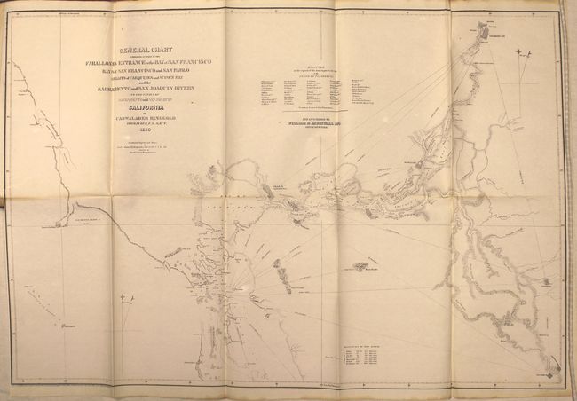
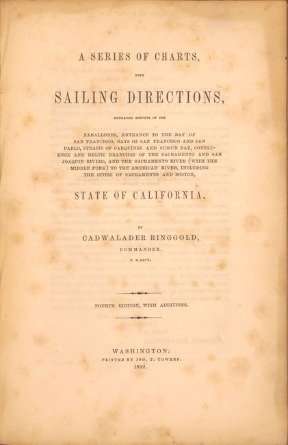
This report and survey of the San Francisco Bay and associated headwaters was compiled by Cadwalader Ringgold, who had a long and distinguished naval career, including commanding the Porpoise in the Wilkes Exploring Expedition from 1838-1842 where he made his first surveys of the northwest coast of America. In 1849 he returned to California where he completed the work that resulted in the present volume, which was precipitated by the flood of emigration to the anchorage of San Francisco and on the unexplored routes leading to the interior.
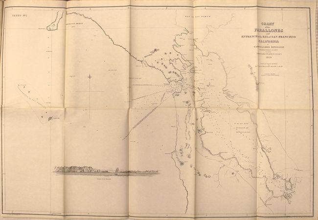
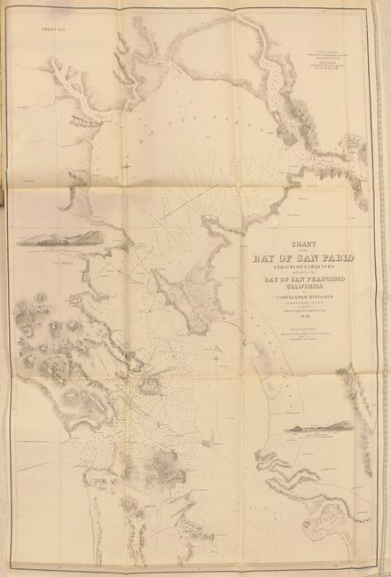
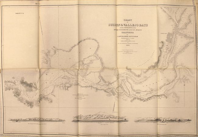
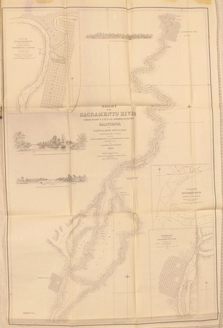
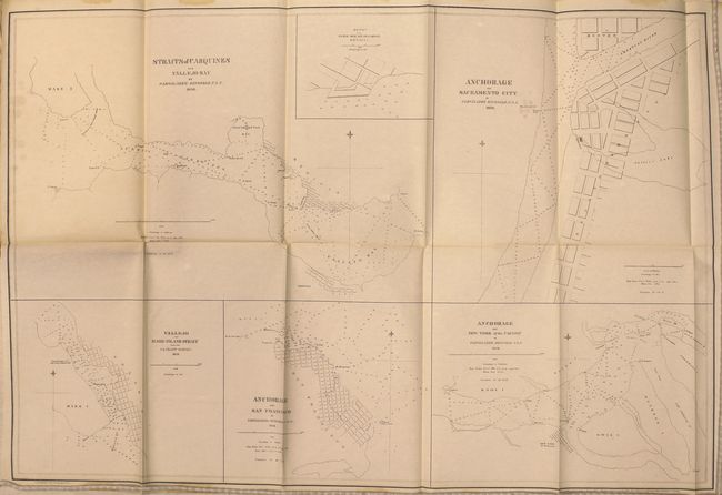
Ringgold's set of maps served as an important pilot guide to the water routes leading to the gold regions. The six folding maps, all approximately 20 x 29 inches, include: a general chart of the San Francisco bay extending inland as far as Sacramento and Boston; detailed maps of some of the smaller harbors; and a chart of the Sacramento River from Suisun City to the American River. The list includes:
1. General Chart Embracing Surveys of the Farallones Entrance to the Bay of San Francisco..
2. Sheet No. 1 - Chart of the Farallones and Entrance to the Bay of San Francisco...
3. Sheet No. 2 - Chart of the Bay of San Pablo...
4. Sheet No. 3 - Chart of the Suisun and Vallejo Bays..
5. Sheet No. 4 - Chart of the Sacramento River from Suisun City to the American River…
6. Straits of Carquines and Vallejo Bay [on sheet with] Vallejo and Mare Island Strait [and] Anchorage off Sacramento City [and] Anchorage off San Francisco [and] Anchorage off New York of the Pacific
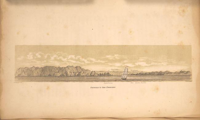
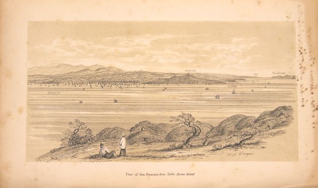
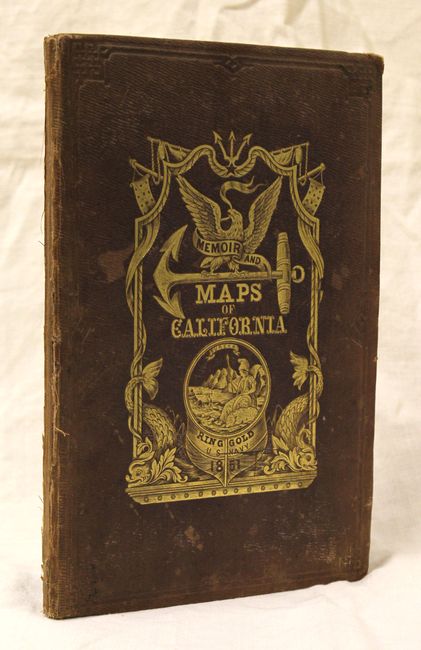
48 pp., 8 plates and 6 large folding maps. Hardbound in brown embossed cloth with gilt title and illustration on front cover.
References: Howes #R303.
Condition: B+
The condition code is for the maps, which are clean and bright with a 2" binding tear at left in each of the maps and very faint toning along a few folds. The text and plates are in good condition ("B") with scattered foxing. The hinges are starting, and the covers are worn, with the back cover partially detached.