Showing Featured Lots(remove filter)
Filtered by Category:United States(Show All Categories)
Showing results for:Auction 141
Catalog Archive
16 lots
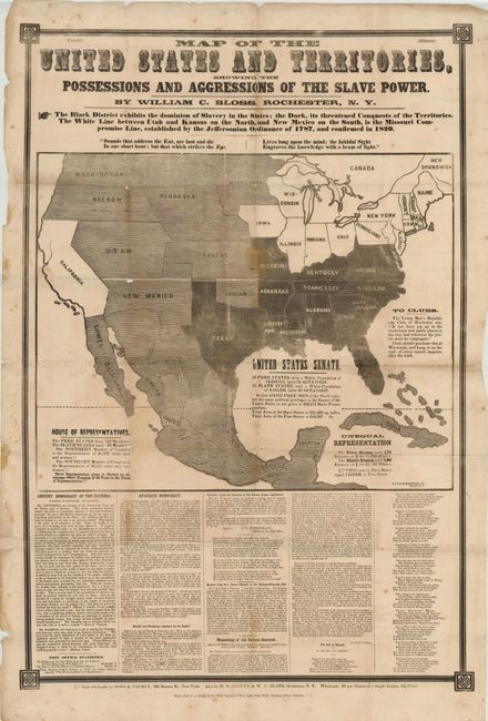
Auction 141, Lot 146
Subject: United States, Civil War
Map of the United States and Territories, Showing the Possessions and Aggressions of the Slave Power, 1856
Size: 26 x 42 inches (66 x 106.7 cm)
Estimate: $2,000 - $4,000
Fascinating and Rare Example of Political Propaganda and Thematic Mapping
Sold for: $4,750
Closed on 9/5/2012
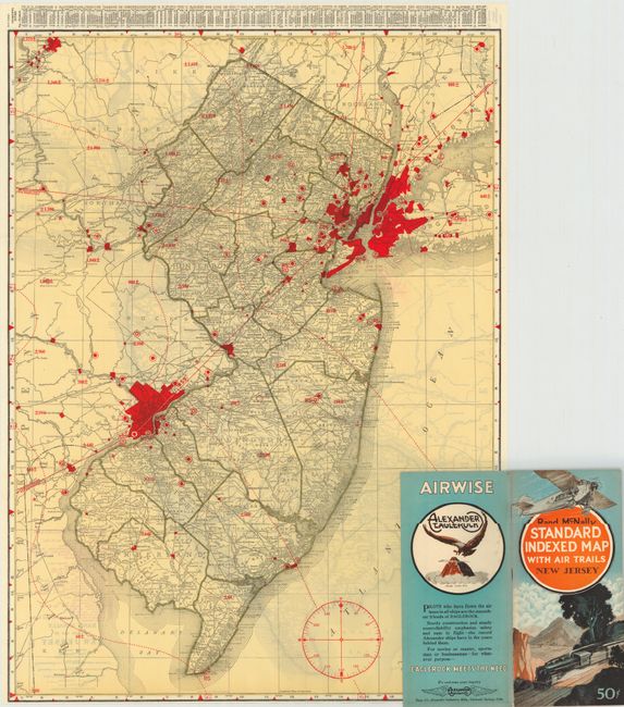
Auction 141, Lot 152
Subject: United States
Rand McNally & Co.
[Lot of 46] Rand McNally Standard Indexed Map with Air Trails, 1929-30
Size: 18.5 x 26 inches (47 x 66 cm)
Estimate: $1,200 - $1,500
Rare Rand McNally "Air Trails" Pocket Maps
Unsold
Closed on 9/5/2012
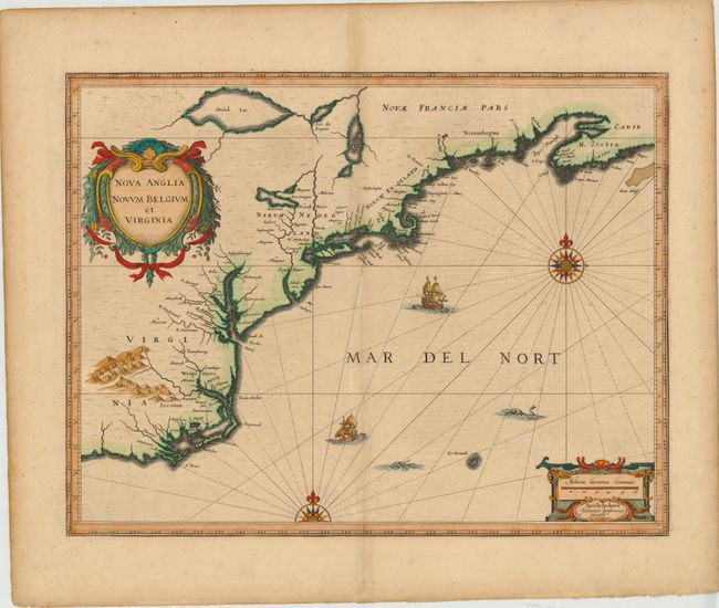
Auction 141, Lot 160
Subject: Colonial New England and Mid-Atlantic
Jansson, Jan
Nova Anglia Novum Belgium et Virginia, 1639-42
Size: 20 x 15.3 inches (50.8 x 38.9 cm)
Estimate: $2,000 - $2,300
Jansson's Influential Map of the East Coast
Unsold
Closed on 9/5/2012
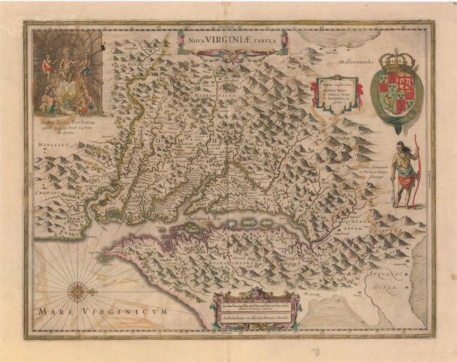
Auction 141, Lot 165
Subject: Colonial Mid-Atlantic
Hondius, Henricus
Nova Virginiae Tabula, 1647
Size: 19.5 x 15 inches (49.5 x 38.1 cm)
Estimate: $2,000 - $2,400
One of the Most Important 17th Century Maps of the Chesapeake Bay
Sold for: $1,500
Closed on 9/5/2012
Auction 141, Lot 167
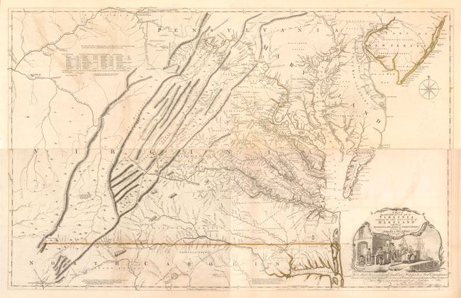
Subject: Colonial Virginia, Maryland
Fry, Joshua & Jefferson, Peter
A Map of the Most Inhabited Part of Virginia Containing the Whole Province of Maryland with Part of Pensilvania, New Jersey and North Carolina, 1775
Size: 48.5 x 31 inches (123.2 x 78.7 cm)
Estimate: $32,000 - $40,000
1775 Edition of the Landmark Fry-Jefferson Map of Virginia and Maryland
Sold for: $24,000
Closed on 9/5/2012
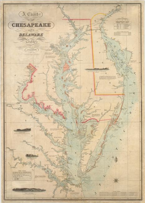
Auction 141, Lot 169
Subject: Mid-Atlantic United States, Chesapeake and Delaware Bays
Lucas, Fielding
A Chart of the Chesapeake and Delaware Bays, 1852
Size: 28.3 x 40 inches (71.9 x 101.6 cm)
Estimate: $8,000 - $10,000
Scarce Sea Chart of the Chesapeake and Delaware Bays
Unsold
Closed on 9/5/2012
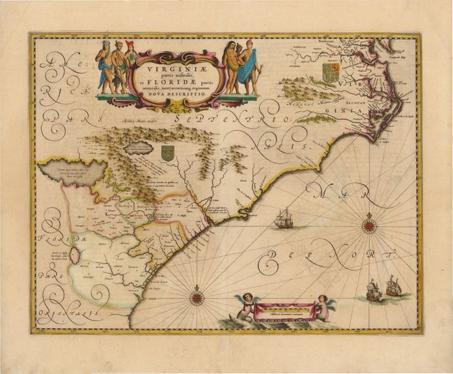
Auction 141, Lot 171
Subject: Colonial Southeast
Jansson, Jan
Virginiae Partis Australis, et Floridae Partis Orientalis, interjacentiumq Regionum Nova Descriptio, 1639
Size: 19.8 x 15.3 inches (50.3 x 38.9 cm)
Estimate: $1,600 - $1,800
Unsold
Closed on 9/5/2012
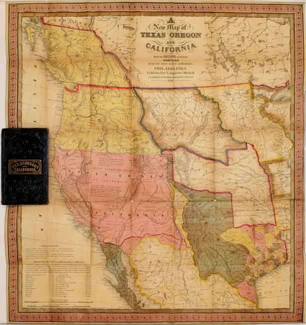
Auction 141, Lot 184
Subject: Western United States
Mitchell, Samuel Augustus
A New Map of Texas Oregon and California, 1846
Size: 19 x 21 inches (48.3 x 53.3 cm)
Estimate: $9,000 - $11,000
Mitchell's Famous Map Showing the New State of Texas
Unsold
Closed on 9/5/2012
Auction 141, Lot 213
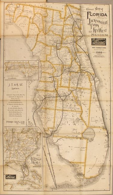
Subject: Florida
Matthews-Northrup Co
Correct Map of Florida Showing the Jacksonville Tampa and Key West System and Connections [with book] The Tarpon or "Silver King", 1889
Size: 15.5 x 27.5 inches (39.4 x 69.9 cm)
Estimate: $1,400 - $1,700
Sold for: $1,000
Closed on 9/5/2012
Auction 141, Lot 251
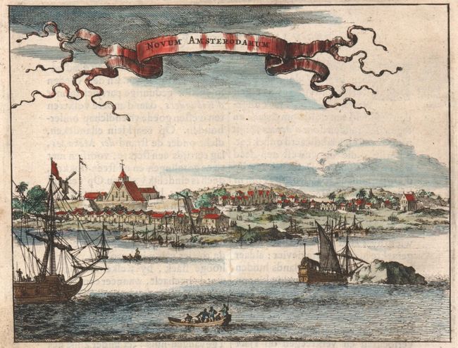
Subject: New York City, New York
Montanus, Arnoldus
Novum Amsterodamum, 1671
Size: 6.5 x 5 inches (16.5 x 12.7 cm)
Estimate: $550 - $650
One of the Earliest Views of New York City
Sold for: $600
Closed on 9/5/2012
Auction 141, Lot 252
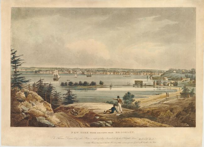
Subject: New York City, New York
New York from Heights Near Brooklyn, 1828
Size: 24.5 x 15.7 inches (62.2 x 39.9 cm)
Estimate: $2,000 - $2,500
One of the Most Beautiful Early 19th Century Views of NYC
Sold for: $1,600
Closed on 9/5/2012
Auction 141, Lot 253
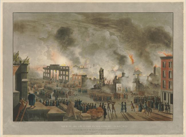
Subject: New York City, New York
[Lot of 2] View of the Great Fire in New-York, Decr. 16th. & 17th. 1835 [and] View of the Ruins After the Great Fire in New-York, Decr. 16th. & 17th. 1835, 1836
Size: 23.8 x 16.2 inches (60.5 x 41.1 cm)
Estimate: $2,750 - $3,500
Dramatic Views of the Great Fire of New York in 1835
Sold for: $1,400
Closed on 9/5/2012
Auction 141, Lot 267
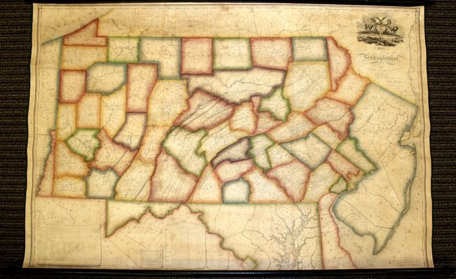
Subject: Pennsylvania
Melish, John
Map of Pennsylvania, Constructed from the County Surveys Authorized by the State; and other Original Documents...Corrected & Improved to 1826, 1826
Size: 73.5 x 42.5 inches (186.7 x 108 cm)
Estimate: $16,000 - $20,000
Melish's Greatest Published Work
Unsold
Closed on 9/5/2012
Auction 141, Lot 270
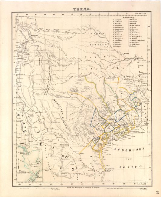
Subject: Texas
Flemming, Carl
Texas, 1845
Size: 12.6 x 15.8 inches (32 x 40.1 cm)
Estimate: $1,000 - $1,400
Scarce German Map Showing the Republic of Texas
Sold for: $700
Closed on 9/5/2012
Auction 141, Lot 288
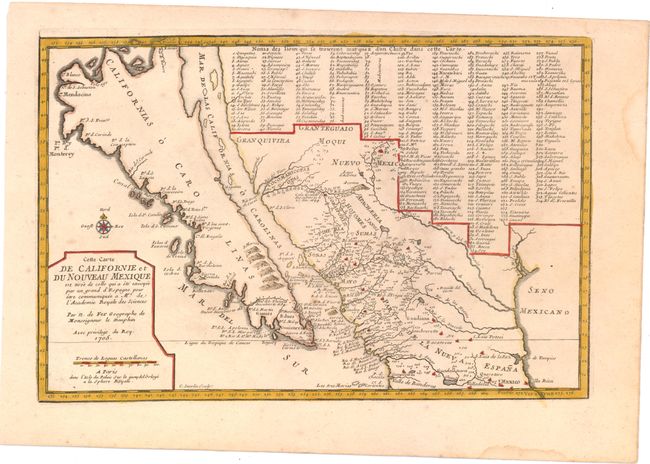
Subject: California, Southwest and Mexico
Fer, Nicolas de
Cette Carte de Californie et du Nouveau Mexique est Tiree de celle qui a ete Envoyee par un Grand d'Espagne pour etre Communiquee a Mrs. de l'Academie Royale des Sciences, 1705
Size: 13.5 x 9 inches (34.3 x 22.9 cm)
Estimate: $1,500 - $1,900
Sold for: $1,100
Closed on 9/5/2012
Auction 141, Lot 289
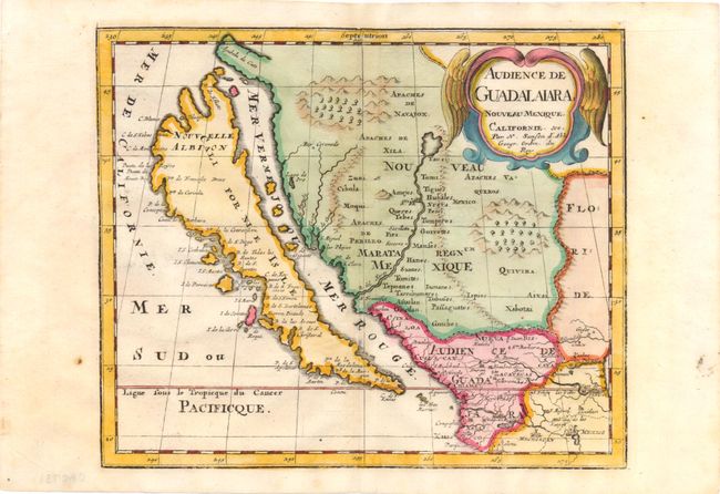
Subject: United States & Mexico, California
Sanson, Nicolas
Audience de Guadalaiara, Nouveau Mexique, Californie, &c., 1715
Size: 9.3 x 7.8 inches (23.6 x 19.8 cm)
Estimate: $950 - $1,100
Sold for: $650
Closed on 9/5/2012
16 lots


