Subject: Texas
Period: 1845 (circa)
Publication:
Color: Hand Color
Size:
12.6 x 15.8 inches
32 x 40.1 cm
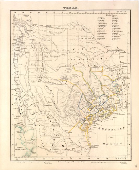
This scarce German map, a reduced version of Arrowsmith's 1841 Republic of Texas map, shows the extent of Texas's claims to the region of the upper Rio Grande, including Santa Fe, Taos and Albuquerque. The detailed map identifies many roads, rivers, towns, and forts. Thirty land districts are outlined and named in a table at the top right corner. The northern panhandle is divided into 12 sections, with the German notation (copied from Arrowsmith) that the land was well wooded and watered. There is an inset with a small map of Galveston Bay in the lower left. The outline color on this example delineates both the counties and republic boundaries. The county lines are somewhat misrepresented, with San Patricio encompassing the southern tip of the state which is consistent with 1845, but without the counties of Lamar and Bowie in northeastern Texas, which were already organized by 1841. Published in Glogau.
References:
Condition: A
A hint of toning with one tiny edge tear in bottom blank margin.