Filtered by Category:North America(Show All Categories)
Showing results for:Auction 158
Catalog Archive
9 lots
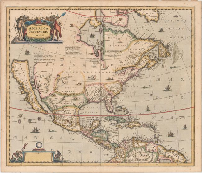
Auction 158, Lot 63
Subject: Colonial North America
Hondius, Henricus
America Septentrionalis, 1639
Size: 21.3 x 18 inches (54.1 x 45.7 cm)
Estimate: $3,000 - $3,750
Rare First State of One of the Most Important Maps Perpetuating the Myth of the Island of California
Sold for: $2,400
Closed on 6/22/2016
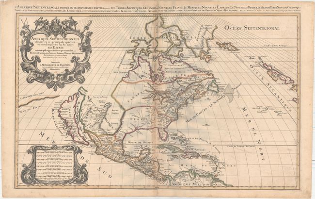
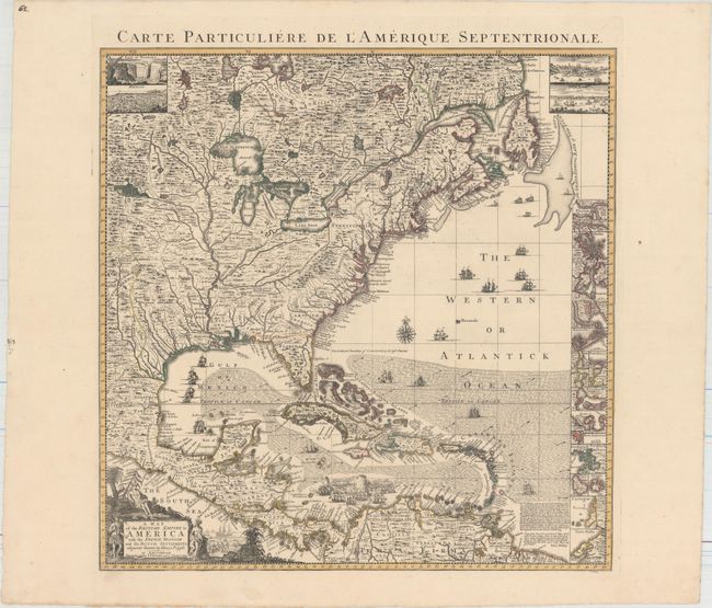
Auction 158, Lot 64
Subject: Colonial North America
Sanson/Mortier
Amerique Septentrionale Divisee en ses Principales Parties, ou sont Distingues les uns des Autres les Estats..., 1696
Size: 34.2 x 21.1 inches (86.9 x 53.6 cm)
Estimate: $2,200 - $2,500
Showing the Island of California
Unsold
Closed on 6/22/2016
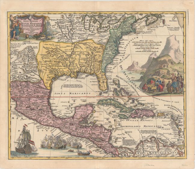
Auction 158, Lot 65
Subject: Colonial North America & Caribbean
Homann, Johann Baptist
Regni Mexicani seu Novae Hispaniae, Ludovicianae, N. Angliae, Carolinae, Virginiae et Pensylvaniae nec non Insularum Archipelagi Mexicani in America Septentrionali Accurata Tabula, 1720
Size: 22.6 x 18.8 inches (57.4 x 47.8 cm)
Estimate: $1,800 - $2,200
Gorgeous Example with Rich Embellishments
Sold for: $1,300
Closed on 6/22/2016
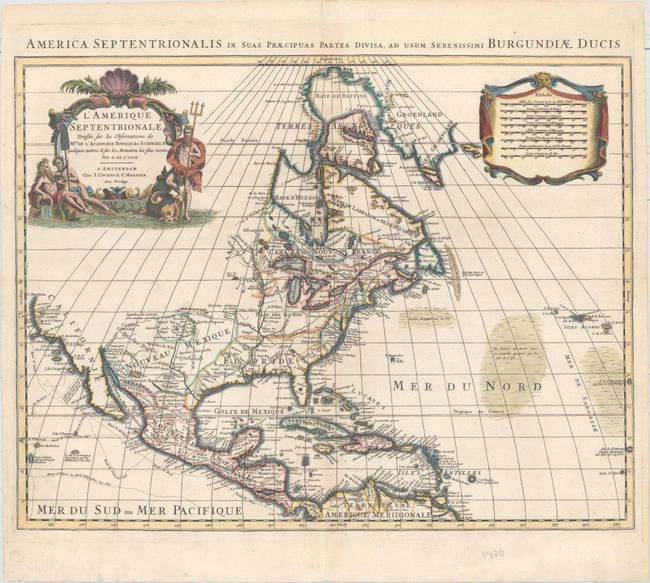
Auction 158, Lot 66
Subject: Colonial North America
Delisle/Covens & Mortier
L'Amerique Septentrionale Dressee sur les Observations de Mrs. de l'Academie Royale des Sciences ... Par G. de l'Isle …, 1730
Size: 22.5 x 17.8 inches (57.2 x 45.2 cm)
Estimate: $950 - $1,200
Unsold
Closed on 6/22/2016
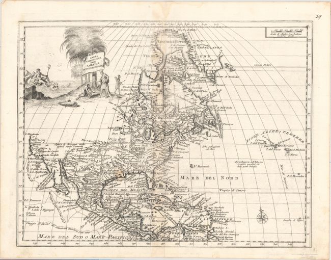
Auction 158, Lot 67
Subject: Colonial North America
Albrizzi, Girolamo
Carta Geografica dell' America Settentrionale, 1740
Size: 16.9 x 13.1 inches (42.9 x 33.3 cm)
Estimate: $600 - $750
Sold for: $280
Closed on 6/22/2016
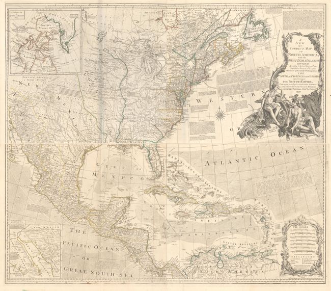
Auction 158, Lot 68
Subject: Colonial North America
Bowen & Gibson
[On 4 Sheets] A New and Correct Map of North America, with the West India Islands. Divided According to the Last Treaty of Peace..., 1777
Size: 45.8 x 20 inches (116.3 x 50.8 cm)
Estimate: $5,000 - $6,500
Bowen & Gibson's Large and Influential Map of North America
Unsold
Closed on 6/22/2016
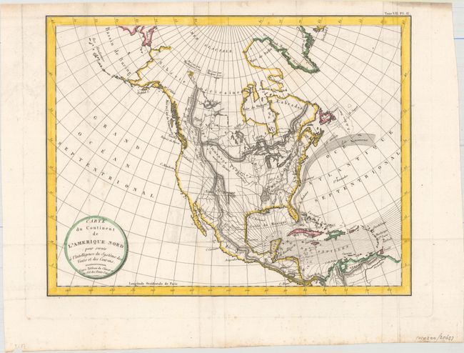
Auction 158, Lot 69
Subject: North America
Volney, C. F.
Carte du Continent de l'Amerique Nord pour Servir a l'Intelligence du Systeme des Vents et des Courans..., 1803
Size: 13 x 10 inches (33 x 25.4 cm)
Estimate: $200 - $250
Unsold
Closed on 6/22/2016
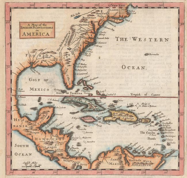
Auction 158, Lot 70
Subject: Colonial Eastern North America & West Indies
Moll, Herman
A Map of the English Plantations in America, 1701
Size: 7.3 x 7.1 inches (18.5 x 18 cm)
Estimate: $350 - $425
Sold for: $180
Closed on 6/22/2016
Auction 158, Lot 71
Subject: Colonial Eastern North America & West Indies
Popple/Covens & Mortier
A Map of the British Empire in America with the French, Spanish and the Dutch Settlements Adjacent Thereto, 1741
Size: 18.9 x 19.3 inches (48 x 49 cm)
Estimate: $2,750 - $3,500
Index Sheet of Popple's Map
Unsold
Closed on 6/22/2016
9 lots