Showing Featured Lots(remove filter)
Filtered by Category:Europe & Mediterranean(Show All Categories)
Showing results for:Auction 158
Catalog Archive
12 lots
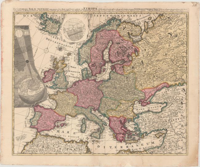
Auction 158, Lot 221
Subject: Europe, Solar Eclipse
Schenk, Pieter
Eclipseos Solis Totalis cum Mora, d. 12 Maji 1706, Horis Antem: in Europa Celebratae, Geographica Repraesentatio..., 1706
Size: 22.7 x 18.6 inches (57.7 x 47.2 cm)
Estimate: $1,400 - $1,700
Rare Map of Solar Eclipse of 1706
Sold for: $800
Closed on 6/22/2016
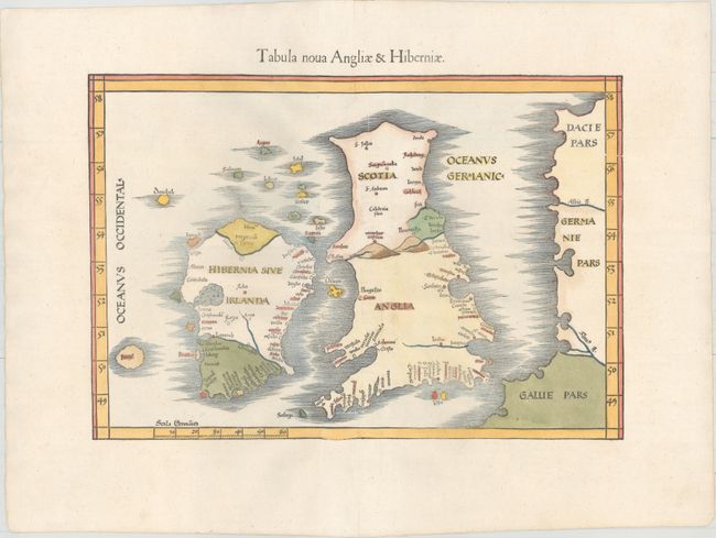
Auction 158, Lot 224
Subject: Britain
Ptolemy/Fries
Tabula Nova Angliae & Hiberniae, 1541
Size: 16 x 11.1 inches (40.6 x 28.2 cm)
Estimate: $1,900 - $2,200
"Modern" Map of the British Isles with the Island of Brazil
Sold for: $1,400
Closed on 6/22/2016
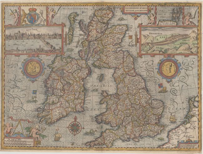
Auction 158, Lot 227
Subject: Britain
Speed, John
The Kingdome of Great Britaine and Ireland, 1665
Size: 20.1 x 15 inches (51.1 x 38.1 cm)
Estimate: $2,750 - $3,500
Speed's Famous Map of the British Isles Engraved by Hondius
Sold for: $2,000
Closed on 6/22/2016
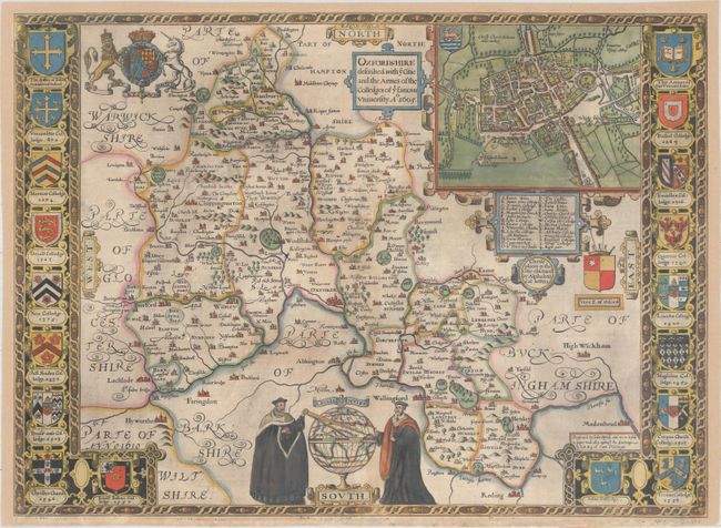
Auction 158, Lot 234
Subject: Southern England
Speed, John
Oxfordshire Described, with ye Citie and the Armes of the Colledges of yt Famous University , 1605
Size: 20.9 x 15.3 inches (53.1 x 38.9 cm)
Estimate: $1,900 - $2,200
Early Example of Speed's Resplendent Map of Oxfordshire
Sold for: $900
Closed on 6/22/2016
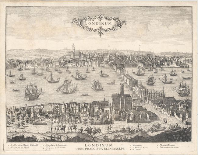
Auction 158, Lot 242
Subject: London, England
Aveline, Antonio
Londinum / Londinum Urbs Praecipua Regni Angliae, 1730
Size: 19.9 x 14.7 inches (50.5 x 37.3 cm)
Estimate: $1,400 - $1,700
Rare View of London
Sold for: $800
Closed on 6/22/2016
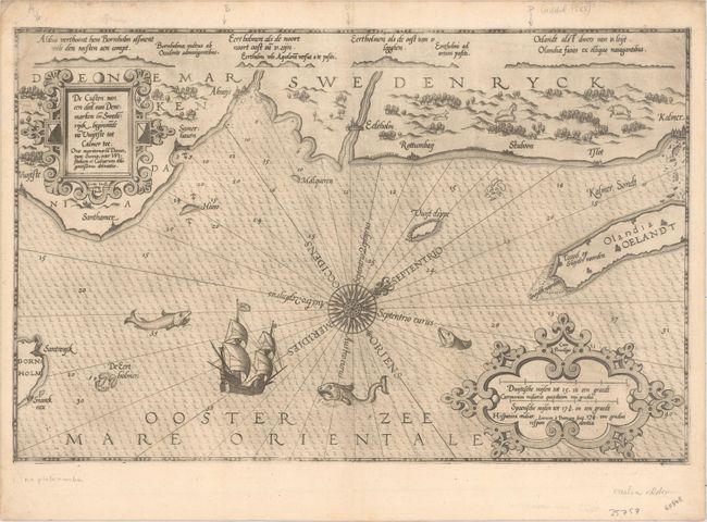
Auction 158, Lot 267
Subject: Southeastern Sweden
Waghenaer, Lucas Jansz
De Custen van een deel van Denemarken en Swederijck, Beginnede va Vuijtste to Calmer Toe..., 1585
Size: 20.3 x 13 inches (51.6 x 33 cm)
Estimate: $1,400 - $1,700
Rare and Early Sea Chart of the Southeastern Coast of Sweden
Sold for: $1,000
Closed on 6/22/2016
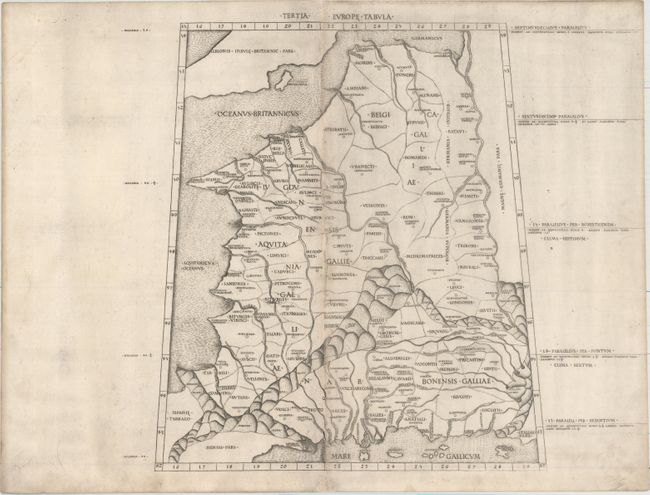
Auction 158, Lot 284
Subject: France
Ptolemy
Tertia Europe Tabula, 1478
Size: 12.6 x 14.4 inches (32 x 36.6 cm)
Estimate: $2,750 - $3,500
Rare and Important Map of France
Sold for: $2,000
Closed on 6/22/2016
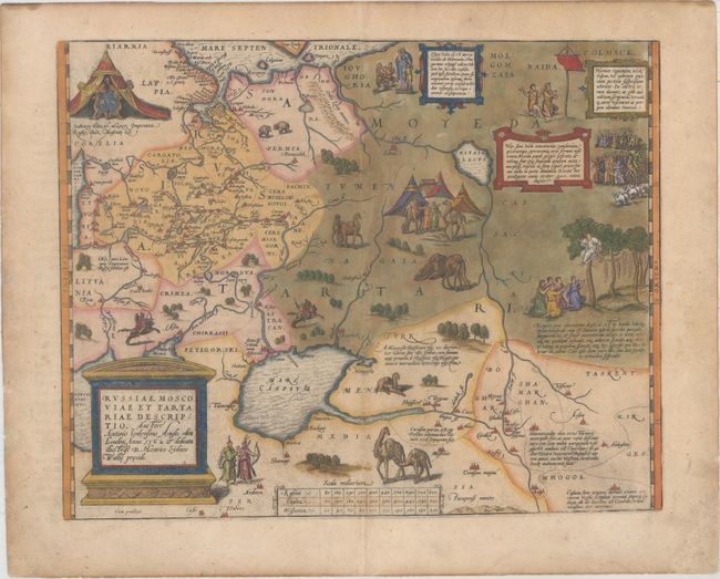
Auction 158, Lot 342
Subject: Russia, Eastern Europe & Central Asia
Ortelius, Abraham
Russiae, Moscoviae et Tartariae Descriptio. Auctore Antonio Ienkensono Anglo..., 1579
Size: 17.2 x 13.6 inches (43.7 x 34.5 cm)
Estimate: $2,000 - $2,400
Ortelius' Map of Russia with a Vignette of Ivan the Terrible
Sold for: $1,500
Closed on 6/22/2016
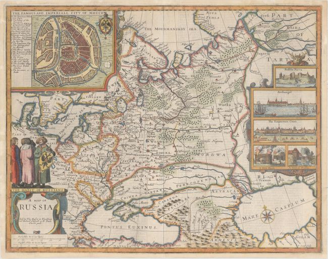
Auction 158, Lot 344
Subject: Russia in Europe
Speed/Lamb
A Map of Russia, 1676
Size: 19.9 x 15.7 inches (50.5 x 39.9 cm)
Estimate: $2,400 - $3,000
Rare Map of Russia from the Last Edition of Speed's "Prospect"
Sold for: $1,800
Closed on 6/22/2016
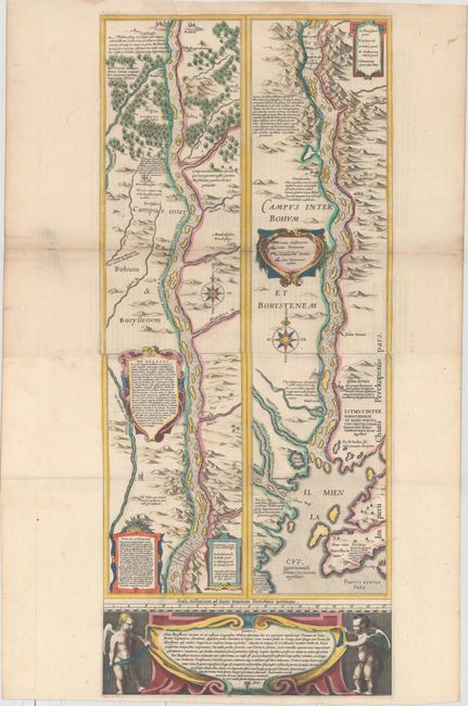
Auction 158, Lot 349
Subject: Dnieper River, Ukraine
Blaeu, (Family)
Lectori S. Hunc Borysthenis Tractum ut ad Nostrum Geographiae Tabulam…, 1635
Size: 12.5 x 29.3 inches (31.8 x 74.4 cm)
Estimate: $1,600 - $2,000
Blaeu's Strip-Map of the Dnieper River
Sold for: $1,200
Closed on 6/22/2016
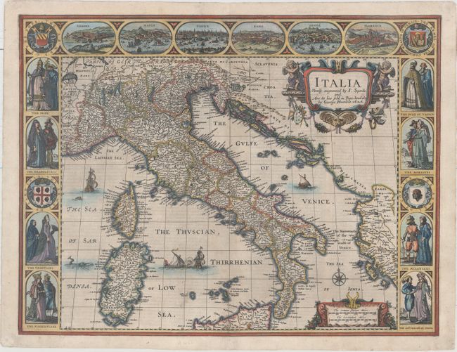
Auction 158, Lot 357
Subject: Italy
Speed, John
Italia Newly Augmented, 1626
Size: 20.1 x 15.4 inches (51.1 x 39.1 cm)
Estimate: $3,250 - $4,000
Stunning Carte-a-Figures Map of Italy
Sold for: $2,400
Closed on 6/22/2016
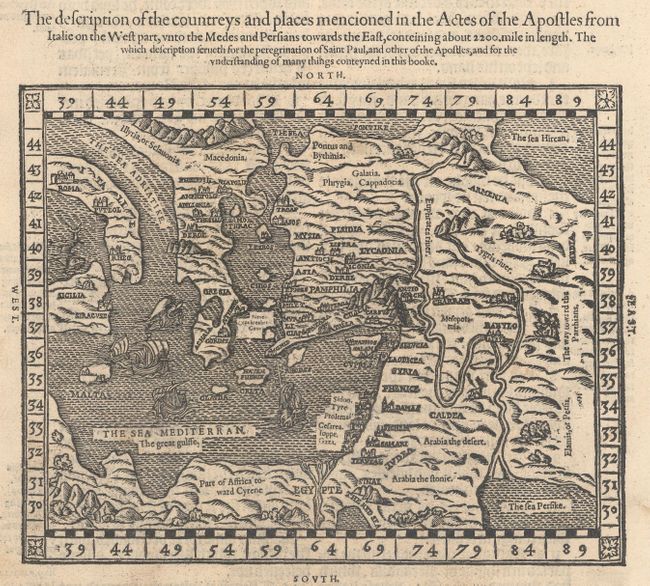
Auction 158, Lot 371
Subject: Eastern Mediterranean & Middle East
The Description of the Countreys and Places Mencioned in the Actes of the Apostles from Italie on the West Part, Unto the Medes and Persians Towards the East..., 1582
Size: 8.4 x 6.6 inches (21.3 x 16.8 cm)
Estimate: $550 - $700
Scarce Map from a Geneva Bible
Sold for: $300
Closed on 6/22/2016
12 lots