Subject: Britain
Period: 1665 (circa)
Publication: The Theatre of the Empire of Great Britaine
Color: Hand Color
Size:
20.1 x 15 inches
51.1 x 38.1 cm
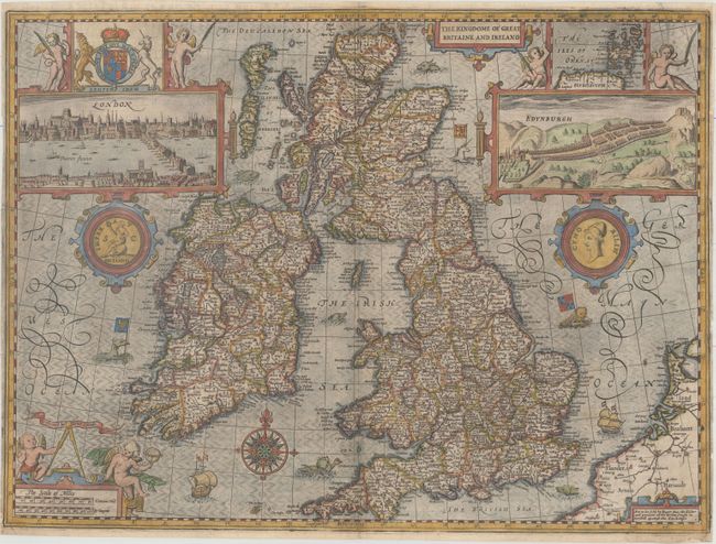
This famous map of the British Isles was engraved by Jodocus Hondius in Amsterdam. The map's outline is based on the work of Mercator, Saxton, Hondius and on the very rare 'Battles' map of 1603 compiled by Speed himself. Moreland and Bannister point out that the sea is engraved using the shot silk style. In later editions, this near 3-D effect is lost as the delicately engraved lines wore smooth. The upper part of the map is flanked by views of London and Edinburgh, and an inset map of the Orkneys. The bird's-eye view of Edinburgh appears to be based upon a manuscript map c.1588 in the Cotton collection. The London view has some elements that resemble Norden's 1600 view, but the similarities in format with part of Visscher's 1616 panorama suggest that both perspectives derive from the same, unknown, source. Embellished with coat of arms, medals or coins, putti, sea monsters, ships, a compass rose, and three cartouches. Imprint of Roger Rea, published circa 1665. English text on verso.
References: Moreland & Bannister p. 213; Shirley (BI to 1650) 316; Shirley (BL Atlases) T.SPE-1h.
Condition: B+
An attractive example with a 0.5" tear at top right and a 1" tear in Pembrokeshire that have been repaired on verso with old paper. There are a few tiny chips along the edges of the sheet that have been professionally repaired, with a minute amount of neatline replaced in facsimile at bottom right. Narrow side margins.


