Showing No Reserve Lots(remove filter)
Filtered by Category:Books, Atlases, Travel Guides, Geography & Reference Books(Show All Categories)
Showing results for:Auction 177
Catalog Archive
13 lots
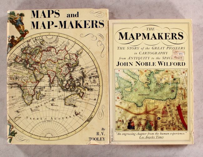
Auction 177, Lot 801
Subject: References
[Lot of 2] Maps and Map-Makers [and] The Mapmakers, 1961-81
Size: See Description
Estimate: $50 - $70
NO RESERVE
Sold for: $55
Closed on 4/29/2020
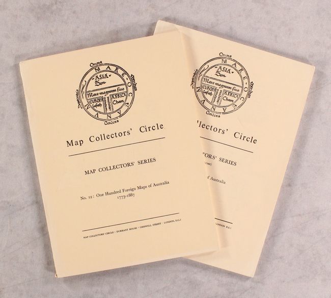
Auction 177, Lot 803
Subject: References, Australia
Tooley, R. V.
[Lot of 2] Map Collectors' Circle - No. 12: One Hundred Foreign Maps of Australia 1773-1887 [and] No. 79: Printed Maps of Australia - Part V, 1964-72
Size: 7.3 x 9.7 inches (18.5 x 24.6 cm)
Estimate: $25 - $45
NO RESERVE
Sold for: $23
Closed on 4/29/2020
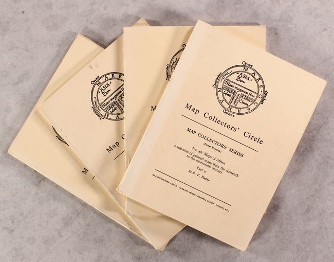
Auction 177, Lot 804
Subject: References, Africa
Tooley, R. V.
[Lot of 4] Map Collectors' Circle - Nos. 29 & 30: Printed Maps of the Continent of Africa Parts I & II. 1500-1600 [and] Nos. 47 & 48: Maps of Africa Parts I & II, 1966-68
Size: 7.3 x 9.7 inches (18.5 x 24.6 cm)
Estimate: $50 - $70
NO RESERVE
Sold for: $48
Closed on 4/29/2020
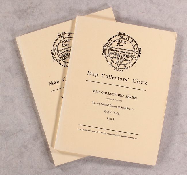
Auction 177, Lot 805
Subject: References, Scandinavia
Tooley, R. V.
[Lot of 2] Map Collectors' Circle - Nos. 70 & 71: Printed Charts of Scandinavia Parts I and II, 1971
Size: 7.3 x 9.7 inches (18.5 x 24.6 cm)
Estimate: $30 - $50
NO RESERVE
Sold for: $23
Closed on 4/29/2020
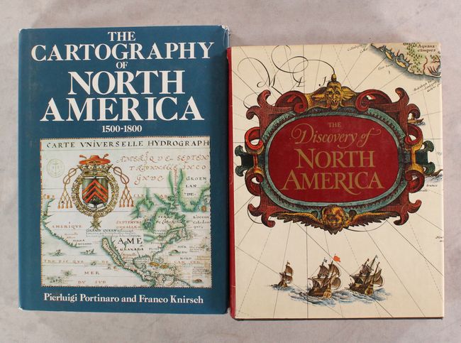
Auction 177, Lot 806
Subject: References, North America
Various
[Lot of 2] The Cartography of North America 1500-1800 [and] The Discovery of North America, 1972-87
Size: See Description
Estimate: $80 - $100
NO RESERVE
Sold for: $41
Closed on 4/29/2020
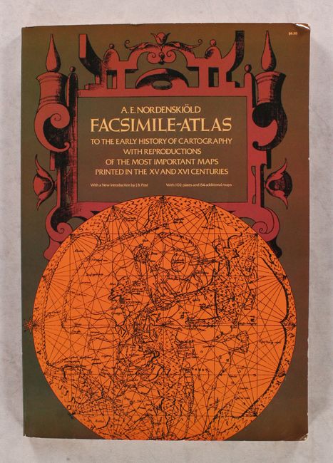
Auction 177, Lot 807
Subject: References
Nordenskiold, Nils Adolf E.
Facsimile-Atlas to the Early History of Cartography with Reproductions of the Most Important Maps Printed in the XV and XVI Centuries, 1973
Size: 11 x 15.9 inches (27.9 x 40.4 cm)
Estimate: $80 - $100
NO RESERVE
Sold for: $140
Closed on 4/29/2020
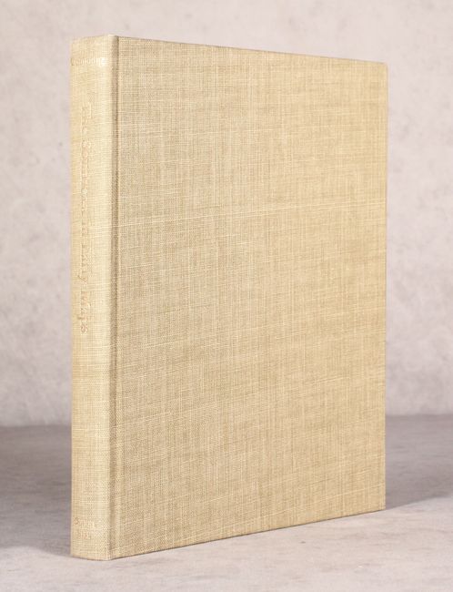
Auction 177, Lot 808
Subject: References, Southeast United States
Cumming, William P.
The Southeast in Early Maps with an Annotated Check List of Printed and Manuscript Regional and Local Maps of Southeastern North America During the Colonial Period, 1973
Size: 8.8 x 11.3 inches (22.4 x 28.7 cm)
Estimate: $120 - $150
NO RESERVE
Sold for: $37
Closed on 4/29/2020
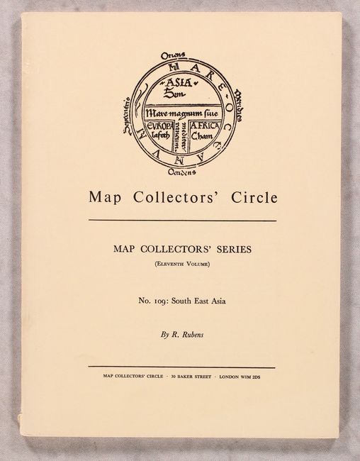
Auction 177, Lot 809
Subject: References, Southeast Asia
Tooley, R. V.
Map Collectors' Circle - No. 109: South East Asia, 1975
Size: 7.3 x 9.7 inches (18.5 x 24.6 cm)
Estimate: $20 - $40
NO RESERVE
Sold for: $24
Closed on 4/29/2020
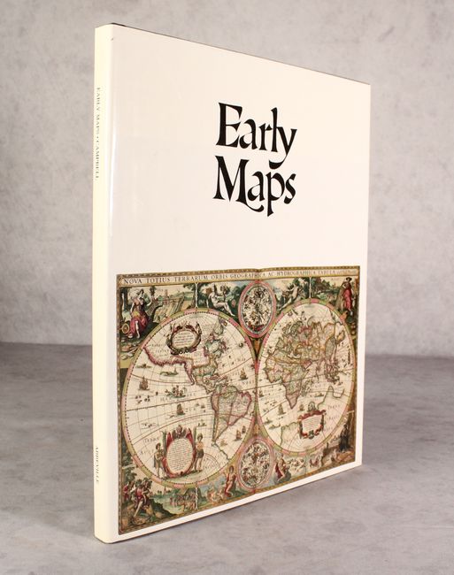
Auction 177, Lot 811
Subject: References
Campbell, Tony
Early Maps, 1981
Size: 12.3 x 15.3 inches (31.2 x 38.9 cm)
Estimate: $40 - $55
NO RESERVE
Sold for: $31
Closed on 4/29/2020
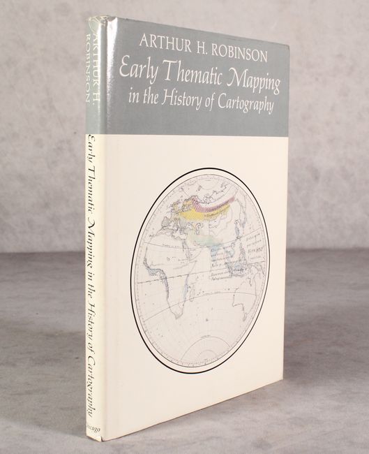
Auction 177, Lot 812
Subject: References
Early Thematic Mapping in the History of Cartography, 1982
Size: 6.9 x 9.8 inches (17.5 x 24.9 cm)
Estimate: $35 - $50
NO RESERVE
Sold for: $13
Closed on 4/29/2020
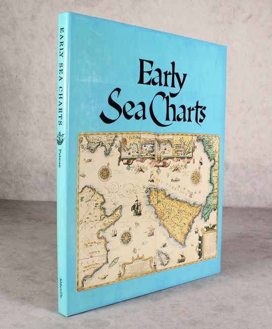
Auction 177, Lot 814
Subject: References, Sea Charts
Putman, Robert
Early Sea Charts, 1983
Size: 12 x 15.3 inches (30.5 x 38.9 cm)
Estimate: $40 - $55
NO RESERVE
Sold for: $41
Closed on 4/29/2020
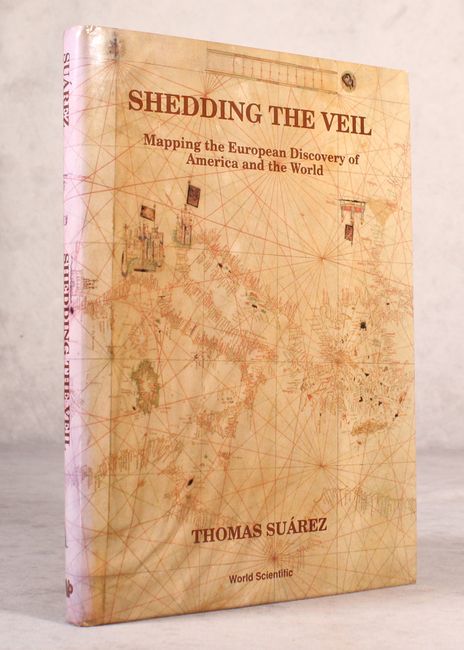
Auction 177, Lot 817
Subject: References
Suarez, Thomas
Shedding the Veil - Mapping the European Discovery of America and the World, 1992
Size: 8.7 x 11.8 inches (22.1 x 30 cm)
Estimate: $80 - $100
NO RESERVE
Sold for: $41
Closed on 4/29/2020
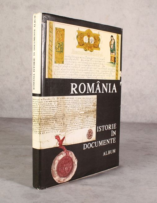
Auction 177, Lot 818
Subject: References, Romania
Romania Istorie in Documente, 1992
Size: 9.9 x 13.4 inches (25.1 x 34 cm)
Estimate: $60 - $80
NO RESERVE - Text in Romanian, French, and English
Sold for: $1
Closed on 4/29/2020
13 lots