Catalog Archive
Auction 99, Lot 502
"Carte de l'Entree de Norton, et du Detroit de Bhering ou l'on voit le Cap le plus Oriental de l'Asie, et la Pointe la plus Occidentale de l'Amerique", Cook/Benard
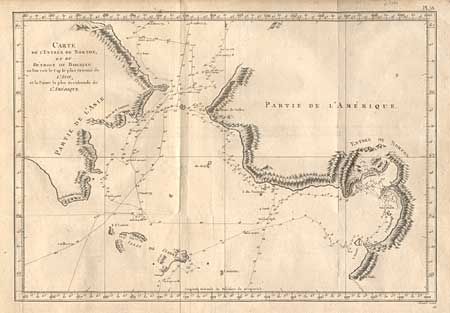
Subject: North Pacific - Alaska
Period: 1790 (circa)
Publication: Captain Cooks' Voyages (French Edition)
Color: Black & White
Size:
15.2 x 10.5 inches
38.6 x 26.7 cm
Download High Resolution Image
(or just click on image to launch the Zoom viewer)
(or just click on image to launch the Zoom viewer)