Catalog Archive
Auction 99, Lot 440

"A New Map of Great Tartary, and China, with the adjoyning Parts of Asia, taken from Mr. De Fer's Map of Asia", Wells, Edward

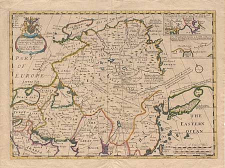
Subject: Asia - Eastern

Period: 1701 (circa)

Publication: A New Set of Maps both of Antient and Present Geography

Color: Hand Color

Size:
19.8 x 14.1 inches
50.3 x 35.8 cm
Download High Resolution Image
(or just click on image to launch the Zoom viewer)

This is a great English map covering from the Black Sea through Japan. It is filled with interesting explanatory notes including the note on the coastline above Japan that stretches eastward and off the map in the direction of America, "All this Coast, as well as that of Japon, are drawn after the Portuguese Charts, which are very different from the French S. Sansons." Two insets, both showing the region northeast of China, compiled from two different Jesuit reports. The map is decorated with a fine title cartouche with the arms of the Duke of Gloucester, to whom the map is dedicated.

References:

Condition: B

Tissue repairs along centerfold, filling in a tiny bit of loss at center, else very good.

Estimate: $275 - $325

Sold for: $200

Closed on 6/12/2002

Archived