Subject: Northern Asia
Period: 1635 (circa)
Publication: Novus Atlas
Color: Hand Color
Size:
19.3 x 14.9 inches
49 x 37.8 cm
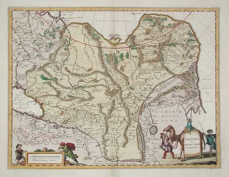
Blaeu's finely engraved map of Tartaria and northern China. Being one of the most remote regions of Asia, it was among the last to be properly explored and mapped. This map combines the knowledge obtained by the English and Dutch explorers as far as the Ob River with the balance of the map based on the reports of Marco Polo and the Greek classics. The deserts are filled with a wild assortment of devils and dragons, being held at bay from China by the Great Wall. The title is symbolically engraved onto the saddle blanket of a camel, representing the trade over the Silk Road, and explorers flank the distance scale.
References:
Condition: A
Very attractive color. Printer's crease bottom right corner. Bottom fold split in margin, closed with archival tape.