Subject: Europe
Period: 1916-44 (dated)
Publication:
Color:
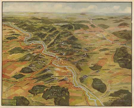
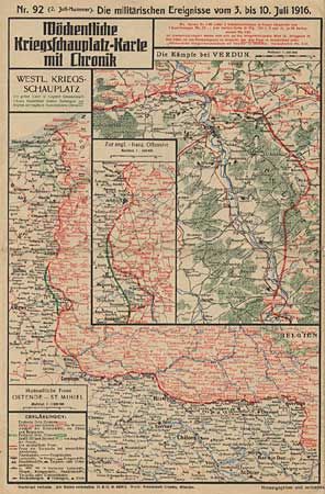
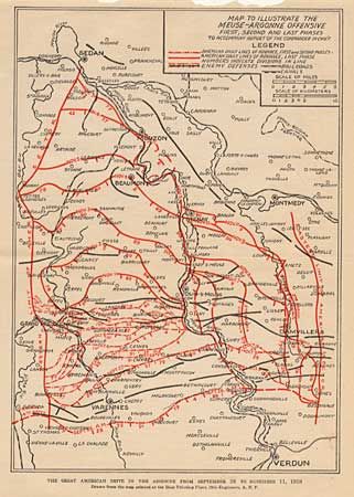
WWI maps: "Mochentliche Kriegsschauplatz-Karte mit Chronik, no. 89, 90, 92, 93, 96, 98." These maps, with text detail on verso, show military events from the German perspective between June and August, 1916 - each sheet covers seven days, 1916, PC, [all 25.3 x 25.5"]. Four untitled double sided maps of Europe with birds-eye-views of Europe, Verdun, Zone Maps, Battle Fronts, and more, circa 1919, PC, [all about 20 x 14"]. "Order of Battle on Western Front 11 A.M. Nov 11, 1918," B/W, [12.6 x 14.9"]. "Map to illustrate the Meuse-Argonne Offensive first, second and last phases to accompany Report of the Commander in Chief," 1918, [7 x 10"]. "Rand McNally War Map of the Battle Ground of Liberty of the Western Battle Fields" is a strategic map of the battleground in Belgium and France, circa 1918, PC, [13.2 x 16.7"]. WWII maps: "Afrika-Karte (Nur fur den Gebrauch innnerhalb der Wehrmacht," 1941, PC, [23.2 x 24.3"]. "Prisoner of War Camps," 1944, B/W, [9.5 x 9"]. A very interesting and historical set of 20th Century war maps.
References:
Condition: A
Maps generally in very good condition, Afrika-Karte just is only good with some splits at folds.