Catalog Archive
Auction 99, Lot 277

"The Island of Barbadoes", Moll, Herman
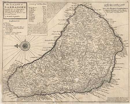
Subject: Barbados

Period: 1745 (published)

Publication: Osborne's Voyages

Color: Black & White

Size:
14.3 x 11.5 inches
36.3 x 29.2 cm
Download High Resolution Image
(or just click on image to launch the Zoom viewer)

This map of the island is filled with interesting detail and information concerning the English colony. Shows the parishes, roads, towns, churches, fortifications, plantations, sugarworks, windmills, shoals and other navigational hazards. Printed and sold by Thomas Bowles. Large compass rose decorates the chart.

References:

Condition: C

The map has been stabilized and backed with Japanese tissue. However, there are several small areas of loss including some loss of engraving. Couple of lines of ink facsimile on neatlines.

Estimate: $100 - $150

Sold for: $75

Closed on 6/12/2002

Archived