Catalog Archive
Auction 99, Lot 253

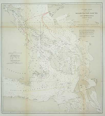
"Washington Sound and Approaches Washington Territory", U.S. Coast Survey

Subject: Washington

Period: 1866 (dated)

Publication:

Color: Printed Color

Size:
16.1 x 17.5 inches
40.9 x 44.5 cm
Download High Resolution Image
(or just click on image to launch the Zoom viewer)

The map shows the U.S. and U.K. boundary claims in the waterways between Washington Territory and Vancouver Island. It is one of several maps published in the House of Representatives documents on the Berlin Arbitration of 1873 when the Kaiser settled on the Western Line in favor of the American claim. The same map has been published without the boundary lines drawn in.

References:

Condition: B

Backed with Japanese tissue. Toned along fold lines.

Estimate: $120 - $150

Sold for: $60

Closed on 6/12/2002

Archived