Subject: Rhode Island
Period: 1822 (circa)
Publication: American Atlas
Color: Hand Color
Size:
8.2 x 11.2 inches
20.8 x 28.4 cm
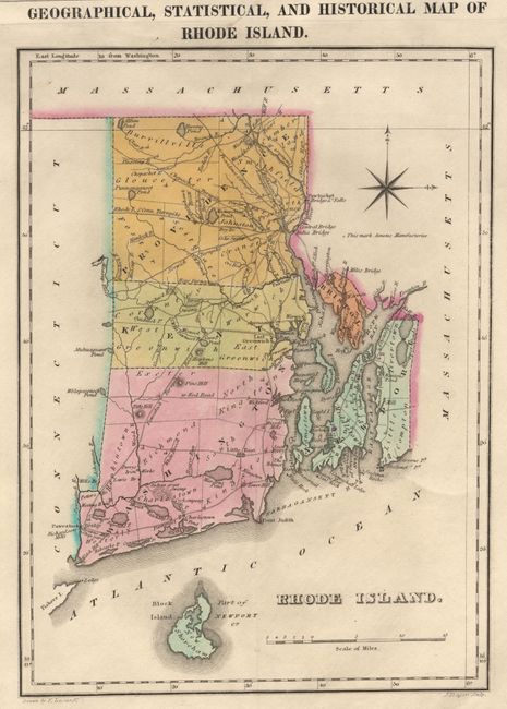
Handsome early 19th century map of the state including Block Island. The state is divided into four counties with townships noted and a good system of turnpike and common roads. The map is on a full folio sheet with surrounding text describing boundaries, rivers, bays, islands, climate, chief towns, manufacturies, religion, commerce and government. The list of governors spans from Benedict Arnold in 1663 to William C. Gibbs in 1821. The historical sketch details Rhode Island's history from Roger Williams, the founder, to a note saying Rhode Island was the last of the thirteen states to adopt the Constitution in 1790. The map was drawn by F. Lucas and engraved by J. Yeager.
References: Phillips (A) 1378-13.
Condition: A
Some minor mildew in bottom corners of text (toned with pastel). No toning along fold as is common with this map.