Catalog Archive
Auction 98, Lot 87

"Nouvelle Carte Particuliere de l'Amerique, ou sont Exactement Marquees, une Partie de la Bay d'Hudson, le Pays des Kilistonons, la Source de la Grande Riviere de Mississipi, le Pays des Illinois &c.", Popple/Covens & Mortier

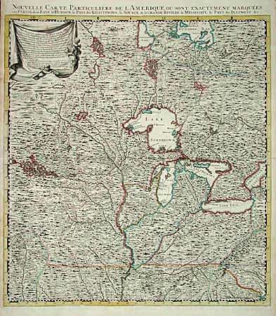
Subject: Colonial North America

Period: 1741 (circa)

Publication:

Color: Hand Color

Size:
20.5 x 22.5 inches
52.1 x 57.2 cm
Download High Resolution Image
(or just click on image to launch the Zoom viewer)

This is the northwest sheet of the Dutch, four-part, version of Henry Popple's important map of the British Empire in North America published by Covens and Mortier. It covers the Mississippi River valley from just below St. Louis, the Great Lakes, and extends to Hudson Bay. The superb detail includes forests, lakes, bogs, rivers, portages, forts, towns, and Indian villages. The Great Lakes are shown with considerable distortion and several hypothetical lakes are prominently shown. The advertising cartouche at upper left boasts of the map's accuracy and includes a recommendation by the prominent astronomer, Edmund Halley. Popple's map was the most important map that detailed the country before John Mitchell's map of 1755.

References:

Condition: A

Superb impression with archival tape repairs of minor splits on centerfold, else fine.

Estimate: $1,800 - $1,900

Sold for: $1,800

Closed on 3/6/2002

Archived