Subject: Western Hemisphere
Period: 1705 (circa)
Publication:
Color: Hand Color
Size:
22.7 x 19.5 inches
57.7 x 49.5 cm
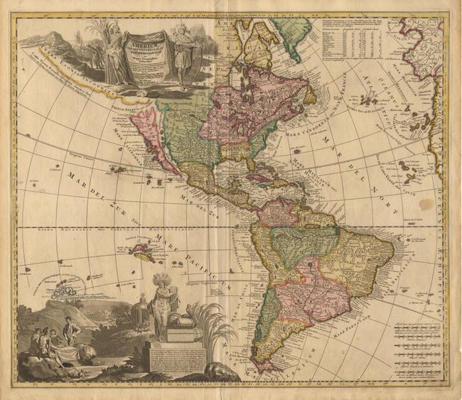
An uncommon map of the Americas with two superb pictorial (uncolored) cartouches. Engraved by A.F. Zurner and based largely on Visscher and Sanson. California is shown as an island with an indented northern coast on the Sanson model with the inclusion of three placenames in Southern California: S. Isidoro, Gigante and N S del la Guadalupe. The title cartouche, flanked by two Native Americans, conveniently hides Terra Esonis Incognita that stretches out towards Asia and the Fretum Anian separates it from California. A large vignette at bottom shows explorers seated around a table, natives worshiping in a temple, a battle, and the figure of America displaying the wealth of the hemisphere. Latin text enclosed in the cartouche discusses exploration by Columbus, Vesputius and Catholic missions. Just above this cartouche a previous owner has added the islands of Tahiti in a careful manuscript hand with a notation that they were discovered by Capt. Cook in 1769.
References: McLaughlin #166; Tooley, p.128, #67, plt #52; Wagner (NW) #490.
Condition: B
Lovely original color with uncolored cartouches. Repaired, short split at bottom centerfold and small spot in Atlantic Ocean, else very good.