Subject: Western Hemisphere
Period: 1666 (dated)
Publication:
Color: Black & White
Size:
16.7 x 13.3 inches
42.4 x 33.8 cm
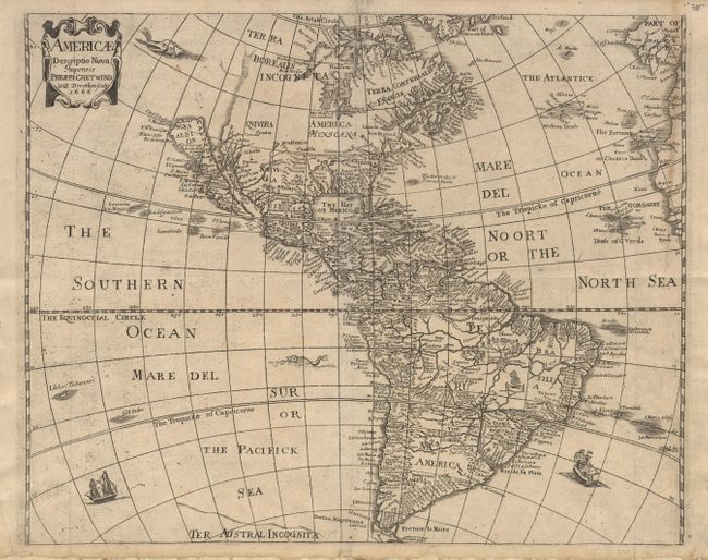
Boldly engraved map of the Americas based on the work of Abraham Goos for John Speed. It depicts California as an Island, no Great Lakes and a faint allusion to the northwest coast of North America. On the east coast Maryland, No: Belgium, and Long Ile are named. The name Carolina also appears off the coast. According to Burden this may be an accidental misspelling of the 'Carolana' of Sir Robert Heath's grant from 1629, or a possible reference to the French fort in present day Florida. The name Carolina was not used until 1660. The map is decorated with a title cartouche, sea monsters, and sailing ships. This map is the third state, issued by Philip Chetwind with his imprint replacing Seile's.
References: Burden #308; McLaughlin #13-3 & 39; Tooley (Amer) p.115, #13.
Condition: A
Very nice impression. Professionally backed with Japanese tissue to flatten folds and repair a couple of minor tears at edge. Very minor toning along one fold at right border.