Catalog Archive
Auction 98, Lot 276

"Extended Indicator Map of London Divided into Quarter Mile Squares for Measuring Distances", Smith, Charles

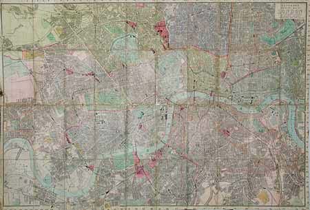
Subject: England - London

Period: 1896-97 (circa)

Publication:

Color: Hand Color

Size:
35 x 24 inches
88.9 x 61 cm
Download High Resolution Image
(or just click on image to launch the Zoom viewer)

A very unusual folding pocket map with a built-in tape measure attached at right for measuring distances throughout the city. Covers from Willesden to Victoria Park in the north and from Barnes Common to Lewisham Rail Station in the South. Sectioned and linen-backed, folding into embossed cloth covered boards with 70 pp. Visitor's Guide.

References: Hyde #230 (6).

Condition: B

Minor loss at a few fold intersections, overall good.

Estimate: $150 - $180

Sold for: $100

Closed on 3/6/2002

Archived