Subject: England
Period: 1675-98 (published)
Publication: Britannia
Color: Hand Color
Size:
17.3 x 13.2 inches
43.9 x 33.5 cm
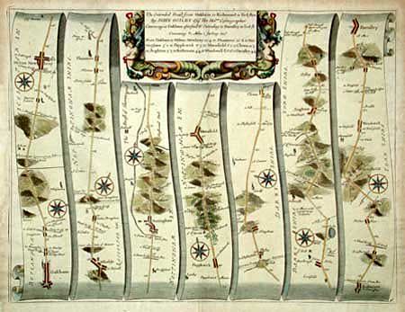
John Ogilby's 'Britannia' was published between 1675 and 1698. It is a landmark in the mapping of England and Wales. Its unique format constituted the first national road-atlas of any country in Western Europe. It was composed of maps of seventy-three major roads and cross-roads, presented in a continuous strip-form, on a uniform scale of one inch to a mile. Each beautiful map includes wonderful detail of the countryside with each strip containing a large compass rose to indicate changes in direction.
Handsome road map in the pictorial style developed by Ogilby. The map begins in Oakham and proceeds in a westerly direction, through Melton Mowbray, Nottingham (past Robin Hood's Stone), and Mansfield ending in Barnsley. Title cartouche in a strapwork and garland style.
References:
Condition: A
Professional repair of left margin.