Catalog Archive
Auction 98, Lot 266
"A Chart of Part of ye Sea Coast of England, Holland & Flanders &c. Shewing the Sands, Banks, Depth of Water, Bearing, and the Course of the Principal Tracts from the River Thames, and Harwich, &c…", Moll, Herman
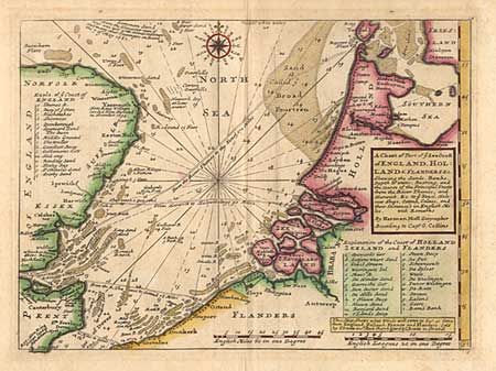
Subject: Northern Europe
Period: 1740 (circa)
Publication:
Color: Hand Color
Size:
10.7 x 7.8 inches
27.2 x 19.8 cm
Download High Resolution Image
(or just click on image to launch the Zoom viewer)
(or just click on image to launch the Zoom viewer)