Catalog Archive
Auction 98, Lot 189

"New York North Sheet [and] South Sheet", Letts & Son
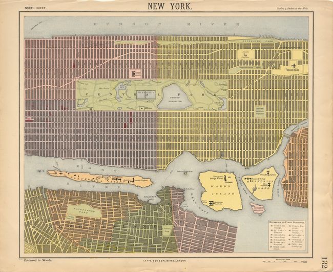
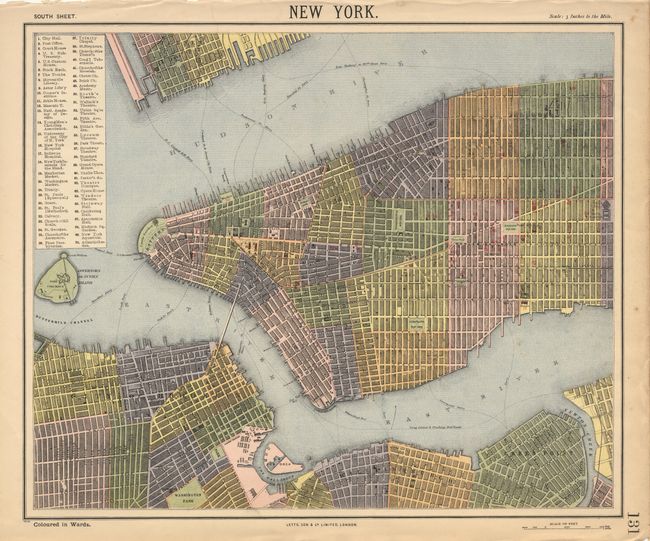
Subject: New York

Period: 1890 (circa)

Publication: Popular Atlas

Color: Printed Color

Size:
15.5 x 12.2 inches
39.4 x 31 cm
Download High Resolution Image
(or just click on image to launch the Zoom viewer)

Matched pair of large and remarkably detailed plans (4 inches/mile). Names all major streets, parks, gardens, squares, and buildings. Locates and names many ferry routes and the yet unnamed Brooklyn Bridge. Central Park is shown as are the elevated railroads. Covers from Governors Island to 138th Street. The two maps would join at 42nd Street. Legend locates 70 buildings of note.

References:

Condition: A

Crisp dark impressions with very nice color for the period. Close but adequate margin at top on both and a bit of faint foxing on south sheet.

Estimate: $120 - $150

Sold for: $120

Closed on 3/6/2002

Archived