Catalog Archive
Auction 98, Lot 186
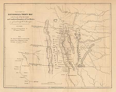
"That Part of Disturnell's Treaty Map in the Vicinity of the Rio Grande and Southern Boundary of New Mexico as referred to by U.S. Surveyor…", U.S. Government
Subject: New Mexico
Period: 1851 (dated)
Publication: Senate Ex Doc. 19, 32rd Cong., 1st Session
Color: Black & White
Size:
11 x 8.7 inches
27.9 x 22.1 cm
Download High Resolution Image
(or just click on image to launch the Zoom viewer)
(or just click on image to launch the Zoom viewer)