Catalog Archive
Auction 98, Lot 18

"Diversi Globi Terr-Aquaei Statione variante et Visu Intercedente, Per Colurus Tropicorum, per Ambos Polos et particul. Sphaerae Zenith in Planum Delineati Orthographici Prospectus", Seutter, Matthias
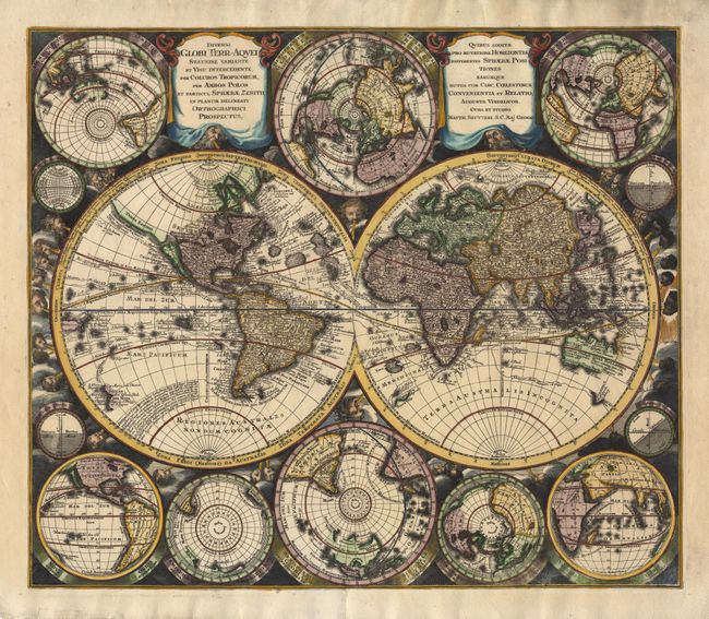
Subject: World

Period: 1730 (circa)

Publication:

Color: Hand Color

Size:
23 x 19.7 inches
58.4 x 50 cm
Download High Resolution Image
(or just click on image to launch the Zoom viewer)

This is one of the most graphic 18th century world maps. The bold engraving style follows Carel Allard's map of 1696 with the central twin hemisphere map surrounded by several smaller maps on various projections. California is an Island and is shown five times on the sheet. In Asia, Japan is shown in a bizarre shape that incorporates the fictional Terra Yedso. The map is filled with detail including the tracks of several explorers. The maps are set in a richly engraved background of clouds with numerous wind heads, lesser spheres and two cartouches.

References:

Condition: A+

Professional repair of two short tears (barely entering map at top), else extremely fine with a superb impression and lovely later color.

Estimate: $3,000 - $3,500

Sold for: $3,000

Closed on 3/6/2002

Archived