Subject: Florida
Period: 1846 (dated)
Publication:
Color: Black & White
Size:
40 x 41.5 inches
101.6 x 105.4 cm
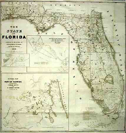
A very large and comprehensive map of Florida showing the status of Public Land Surveys, rivers, lakes, coastal islands, towns, army posts, trails etc. Inset maps: "Key West as surveyed February 1829"; "Mouths of Swanee R. and Cedar Keys showing the Western terminus of a proposed railroad"; and "A General Map of part of Florida included between Cedar Keys and St. John's River". Drawn by J. Goldsborough Bruff. This is an incredible map filled with detail and finely engraved by D. McClelland of the Topographical Engineers. A rare, large and early map of the State.
References:
Condition: A
Printed on two joined sheets, backed with Japanese tissue. Good impression, title lightly offset, a few spots, but still very good for a map of this size.