Catalog Archive
Auction 98, Lot 150

"Survey of Public Lands in the Gold Region [together with] Geological Reconnoissances in California", U.S. Government

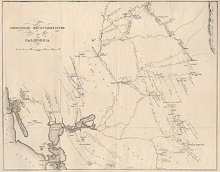
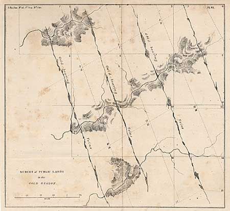
Subject: California Gold Rush

Period: 1850 (circa)

Publication: Senate Ex Doc. 47, Maps 3 & 7

Color: Black & White

Size:
See Description
Download High Resolution Image
(or just click on image to launch the Zoom viewer)

Nice pair of California Gold Rush period maps. First (8.5 x 8") shows township lines overlaid with diagonal lines indicating gold bearing veins. The second map, by Philip T. Tyson (14.8 x 11.8"), is a generalized map of the geology of central California east and north of San Francisco Bay. It extends to the Sierra Nevadas and names many gold regions: Mormon, Coloma, Spanish Bar, and many areas simply marked GOLD. Shows the Emigrant's Road to Salt Lake.

References: Map #2: Wheat (Gold) 179; Kurutz 643; Howes (US) T455.

Condition: B

Backed with Japanese tissue. Light scattered foxing, else very good.

Estimate: $250 - $300

Sold for: $190

Closed on 3/6/2002

Archived