Subject: North America
Period: 1920 (circa)
Publication: The London Geographical Institute
Color: Printed Color
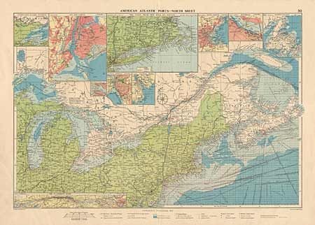
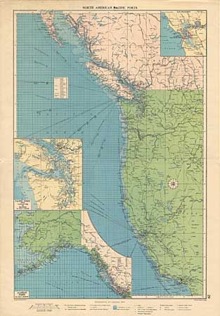
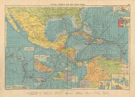
Three large folio full color lithographs. American Atlantic Ports (North Sheet), 26 x 18.7". North American Pacific Ports, 18 x 28.5". Central American and West Indies Ports, 25.7 x 18.7". These maps feature extensive detail, including a maze of ship routes. They also show a substantial portion of the land with many cities, waterways and roads. Each with numerous inset plans including Buffalo, Windward Passage, the Lesser Antilles, Willemstad (Curacao), Havana, Kingston, Halifax, Montreal, and the ones you'd expect. Legend in the bottom margin. Matched set of three large maps.
References:
Condition: A
On full sheets with fabulous detail, very nice color and full margins. A little marginal smudging and some spots along top of West Indian sheet, well away from image. Two with a short split at lower fold, not extending into the map.