Subject: North America
Period: 1770 (circa)
Publication:
Color: Hand Color
Size:
14.4 x 13.2 inches
36.6 x 33.5 cm
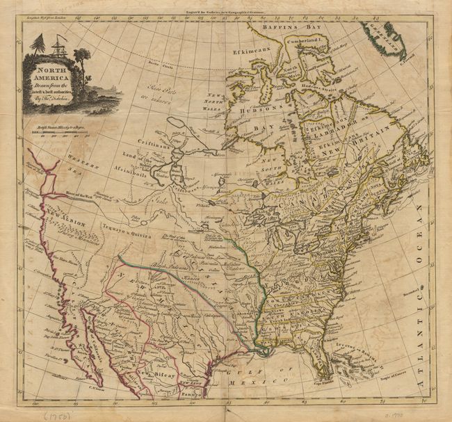
Good detail in the east with Virginia, the Carolina's and Georgia extending to the Mississippi River. Florida is comprised of East and West, with West also extending to the Mississippi. The Pacific states are labeled New Albion and the Snowy Mountains are prominently shown, but the region is mostly blank. The intermountain region is labeled Teguayo & Quivira. New Mexico is a large area that includes Texas and extends well north. The Straits of Juan de Fuca open up to a huge, but indeterminate, Western Sea, while the Columbia River, here named the River of the West, extends far into the Intermountain west to a "Pikes Lake" which extends further as the Manlons River that nearly connects with the Missouri. The Colorado is here named Martyr's River. Central Canada has a bizarre set of lakes and river systems. Locates many Indian tribes, Buffalo meadows, forts, etc. Cartouche features sailing ship with British Union Jack flying.
References:
Condition: B
Folding as issued with a short split in bottom margin just into the border, with old paper repair on back. Short marginal split also repaired. Offsetting throughout map.