Subject: Western Hemisphere
Period: 1631 (dated)
Publication: Atlas
Color: Hand Color
Size:
19.7 x 14.7 inches
50 x 37.3 cm
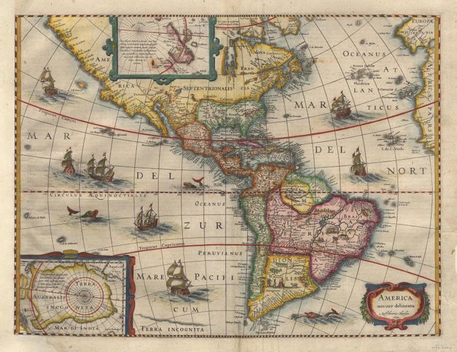
Beautiful map of the Americas derived from two earlier maps by Blaeu. Two stylized insets of the two Polar Regions. The North Pole depicts Frobisher's theory of the Northwest Passage and the South Pole shows the long-held notion of the mythical southern continent. The map is richly ornamented with a strapwork title cartouche, fleets of ships and sea monsters. North America retains the peninsular California and the East Coast is beginning to take shape, although it still lacks detail in the mid-Atlantic region. In South America, there is a large inland sea and two engraved scenes, one of which details a cannibalistic feast. State 3 with Dutch text on verso, published in 1634, retaining 1631 date in cartouche. $2,400 RESERVE
References: Burden #192; Goss #27; Tooley (America) plt. 172.
Condition: B
Minor creasing along centerfold and couple of tiny rust spots. Remargined at left with expert facsimile of a bit of the neatline and bottom corner of inset. Tiny bit of infilling at bottom centerfold. Still a nice example of this famous map