Subject: China, Korea and Japan
Period: 1640 (circa)
Publication:
Color: Hand Color
Size:
19.5 x 16.1 inches
49.5 x 40.9 cm
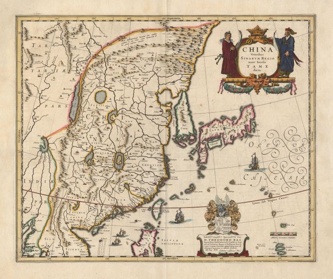
Elegant 17th century map of China and Japan. The map is closely modeled on Jansson's map of 1633. The detail includes the eastern part of China (bounded in the west by the Great Wall), Korea as a strangely shaped island, and the three main islands of Japan. The imaginary "Chiamay Lacus" is located in the southern region with numerous rivers flowing south into India and Siam. A fine title cartouche flanked by Chinese figures, a richly embellished coat of arms (dedicated to Theodore Bas, a director of the Dutch East India Company), European ships and Chinese sampans decorate the map.
References:
Condition: A
A couple of very inconspicuous spots, still very good. Fresh color.