Subject: England
Period: 1675-98 (published)
Publication: Britannia
Color: Hand Color
Size:
17.1 x 13.2 inches
43.4 x 33.5 cm
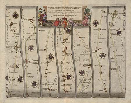
John Ogilby's 'Britannia' was published between 1675 and 1698. It is a landmark in the mapping of England and Wales. Its unique format constituted the first national road-atlas of any country in Western Europe. It was composed of maps of seventy-three major roads and cross-roads, presented in a continuous strip-form, on a uniform scale of one inch to a mile. Each beautiful map includes wonderful detail of the countryside with each strip containing a large compass rose to indicate changes in direction.
This map is a continuation of the road from London and features the section beginning at Stilton and proceeding through Peterborough, Spalding, Boston, and Sleaford to Lincoln. The pictorial cartouche features several people returning from a successful hunt.
References:
Condition: A
Lovely color.